


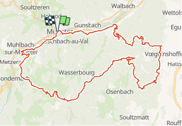
Petit Ballon - Munster

tracegps
User


5h00
Difficulty : Very difficult

FREE GPS app for hiking
 SityTrail
IGN / Geographical institutes
SityTrail Plus
The world is yours!
About
Trail Mountain bike of 57 km to be discovered at Grand Est, Haut-Rhin, Munster. This trail is proposed by tracegps.
Description
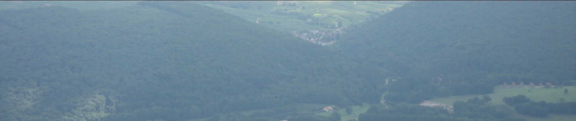
Ce circuit ne présente pas beaucoup de difficultés techniques. Par contre il offre une longue montée de 13km pour atteindre le Petit Ballon, ensuite c'est un profil descendant pendant 22km jusqu'au point de vue près de la Table des Druides. Sortie de Gueberschwihr, nouvelle ascension de 9km pour atteindre le col de Marbach. Il s’en suit une magnifique descente rapide pour finir sur une piste cyclable qui rejoint Munster.
Photos


Positioning
Comments