


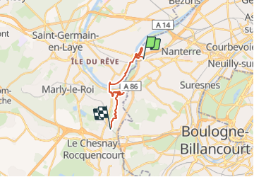


7.7 km | 10.3 km-effort


User


FREE GPS app for hiking
 SityTrail
IGN / Geographical institutes
SityTrail World
The world is yours!
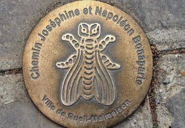
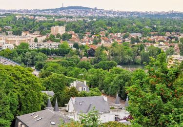
Trail Walking of 13.6 km to be discovered at Ile-de-France, Hauts-de-Seine, Rueil-Malmaison. This trail is proposed by Quarta.
RERA sortie 1, rue des 2 gares à D, 1er G, escaliers, Passer dans centre com., Place de l'Europe, Cours F De Lesseps, D louis Blériot, 3ie G Queneau, 2ième allée, entrer Jardin des impressionnistes, sortie bords de Seine aval, jusqu'au Pont de Chatou, Maison Fournaise, Gare d'eau, Pt RER vers Croisy, Quai de Seine, crochet rue de l'Abreuvoir vers M.de Grenouillère, chapelle et chateau, Berges jusqu'au Pont de Bougival, passer Seine,monter jusqu'à la maison de Berthe Morisot, prendre à G, puis 1ere D jusqu'à l'église, épingle à cheveu G,dans le P entrer Parc de la Jonchère,ligne droite 2 lacets en montée puis 2 lacets en descente (pique nique), Rebrousser chemin puis S,vers chateau d'eau, école,contourner le chateau de La Celle St Cloud,Bois de La Celle, rejoindre la Gare de La Cellesaint Cloud
Walking

Walking
On foot
Walking

Road bike
Walking
Walking
Walking
Walking