Trail Walking Lamastre - Tour de Monteil - Lamastre  (07) - Photo

Tour de Monteil - Lamastre (07)

 tracegps
tracegps

User

© OpenStreetMap contributors
Length
Length
8.4 km
Max alt
Max alt
449 m
Uphill gradient
Uphill gradient
139 m
Km-Effort
Km-Effort  
10.3 km
Min alt
Min alt
354 m
Downhill gradient
Downhill gradient
134 m
Boucle
Boucle
Yes
Creation date :
2014-12-10 00:00:00.0
Updated on :
2014-12-10 00:00:00.0

(2 Reviews)

Walking
Walking
1h45
Difficulty : Medium

Scan this QR Code to open this trail in the SityTrail application

FREE GPS app for hiking

Logo SityTrail SityTrail

IGN / Geographical institutes

Download SityTrail from the App Store Download SityTrail from Google Play

Logo SityTrail SityTrail World

The world is yours!

Download SityTrail from the App Store Download SityTrail from Google Play Download SityTrail on Huawei AppGallery

About

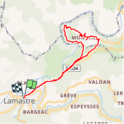
Trail Walking of 8.4 km to be discovered at Auvergne-Rhône-Alpes, Ardèche, Lamastre. This trail is proposed by tracegps.

Description

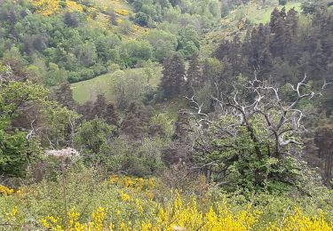
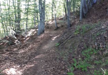
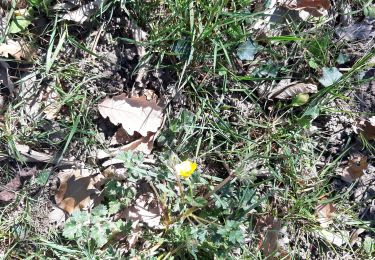
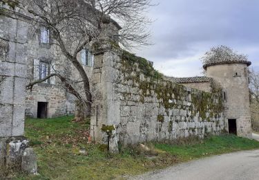
Départ de Lamastre, parking en face du temple. Rapidement on suit la voie du Chemin de fer du Vivarais ( Le Mastrou ), qui longe lui même le Doux. Ensuite montée par un ancien chemin vers le joli village de Monteil. Chapelle du Moyen-age classée. Descente du village et retour vers Lamastre. Balade assez facile. Paysages sympas.

Elevation profile

Photos

Points of interest

Point of interest Le Crestet - GITE MONTEIL - Photo
tracegps
LE CRESTET 
Point of interest Le Crestet - MAISQN MONTEIL - Photo
tracegps
LE CRESTET 
Point of interest Le Crestet - TERRAIN MONTEIL 0475582960 - Photo
tracegps

Positioning

Country:
France
Region :
Auvergne-Rhône-Alpes
Department/Province :
Ardèche
Municipality :
Lamastre
Location:
Unknown
Start:(UTM)
624793 ; 4982755 (31T) N.

Comments

Please log in to post a review or rate the element


Attention dénivelé 100 m maxi !!


Trails nearby

Trail Walking Lamastre - urbilhac  - Photo
Walking
brigitte07

Walking

Very easy
(1)
Lamastre, Auvergne-Rhône-Alpes, Ardèche, France
6.5 km | 9.6 km-effort
1h 58min
Yes
Trail Walking Nozières - Col du Buisson - Nozières - Photo
Walking
tracegps

Walking

Medium
Nozières, Auvergne-Rhône-Alpes, Ardèche, France
12 km | 18 km-effort
3h 30min
Yes
Trail Walking Lamastre - Lamastre La Rosière Combeneyre - Photo
Walking
tracegps

Walking

Medium
(1)
Lamastre, Auvergne-Rhône-Alpes, Ardèche, France
10.1 km | 14 km-effort
3h 0min
Yes
Trail Horseback riding Désaignes - SityTrail - J6 Ardèche vendredi 9 juin 2023 - Photo
Horseback riding
GUIDE
holtzv

Horseback riding

Medium
Désaignes, Auvergne-Rhône-Alpes, Ardèche, France
27 km | 40 km-effort
5h 18min
No
Trail Electric bike Lamastre - retour lamastre  - Photo
Electric bike
bernadette revoux

Electric bike

Medium
Lamastre, Auvergne-Rhône-Alpes, Ardèche, France
56 km | 65 km-effort
4h 9min
No
Trail Electric bike Lamastre - Nozieres - Photo
Electric bike
bernadette revoux

Electric bike

Medium
Lamastre, Auvergne-Rhône-Alpes, Ardèche, France
17.2 km | 25 km-effort
1h 21min
Yes
Trail Walking Nozières - Nozière col du buisson Raymonde - Photo
Walking
Martine 07

Walking

Difficult
Nozières, Auvergne-Rhône-Alpes, Ardèche, France
12.3 km | 17.9 km-effort
3h 35min
Yes
Trail Walking Lamastre - St-Barhelemy-Grozon - Photo
Walking
bernadette revoux

Walking

Medium
Lamastre, Auvergne-Rhône-Alpes, Ardèche, France
14.5 km | 20 km-effort
3h 11min
Yes
Trail Walking Lamastre - Grand tour d'Urbilhac - Photo
Walking
brigitte07

Walking

Very easy
Lamastre, Auvergne-Rhône-Alpes, Ardèche, France
7.3 km | 10.9 km-effort
2h 16min
Yes


Close
My subscriptions