Trail Mountain bike Givet - Givet - Charleville - Photo

Givet - Charleville

 tracegps
tracegps

User

© OpenStreetMap contributors
Length
Length
67 km
Max alt
Max alt
508 m
Uphill gradient
Uphill gradient
1530 m
Km-Effort
Km-Effort  
87 km
Min alt
Min alt
100 m
Downhill gradient
Downhill gradient
1483 m
Boucle
Boucle
No
Creation date :
2014-12-10 00:00:00.0
Updated on :
2014-12-10 00:00:00.0

(0 Reviews)

Mountain bike
Mountain bike
8h00
Difficulty : Difficult

Scan this QR Code to open this trail in the SityTrail application

FREE GPS app for hiking

Logo SityTrail SityTrail

IGN / Geographical institutes

Download SityTrail from the App Store Download SityTrail from Google Play

Logo SityTrail SityTrail World

The world is yours!

Download SityTrail from the App Store Download SityTrail from Google Play Download SityTrail on Huawei AppGallery

About

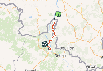
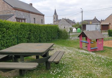
Trail Mountain bike of 67 km to be discovered at Grand Est, Ardennes, Givet. This trail is proposed by tracegps.

Description

Relier Givet à Charleville en passant par Hargnies (village typique ardennais), la Belgique (Willerzie), la Croix Scaille (point culminant des Ardennes - 504m), Monthermé (la "perle des Ardennes) .... Vue dominante sur la centrale de Chooz, les vallées de la Semoy (Roc la Tour) et de la Meuse, vue sur Nouzonville ...

Elevation profile

Points of interest

Positioning

Country:
France
Region :
Grand Est
Department/Province :
Ardennes
Municipality :
Givet
Location:
Unknown
Start:(Dec)
Start:(UTM)
629942 ; 5555766 (31U) N.

Trails nearby

Trail Walking Givet - Balade à Givet - Photo
Walking
tracegps

Walking

Medium
(3)
Givet, Grand Est, Ardennes, France
8 km | 9.4 km-effort
2h 0min
Yes
Trail Walking Givet - Promenade sur les remparts du Mont d'Haurs - Photo
Walking
tracegps

Walking

Medium
(3)
Givet, Grand Est, Ardennes, France
5.1 km | 6.7 km-effort
2h 0min
Yes
Trail Walking Hastière - Hastiere, Entre mont et vallée - Photo
Walking
pito0206

Walking

Medium
(2)
Hastière, Wallonia, Namur, Belgium
11.2 km | 14.3 km-effort
2h 5min
Yes
Trail Walking Rancennes - De Rancennes à Charnois par les Rochers du Petit Chooz - Photo
Walking
GUIDE
Desrumaux

Walking

Easy
(1)
Rancennes, Grand Est, Ardennes, France
10.6 km | 14.6 km-effort
2h 30min
Yes
Trail Walking Doische - De Gochenee vers Soulme par la vallee de l'Ermeton - Photo
Walking
GUIDE
Desrumaux

Walking

Medium
(1)
Doische, Wallonia, Namur, Belgium
18.5 km | 24 km-effort
4h 40min
Yes
Trail Walking Beauraing - Balade de Dion à Winenne - Beauraing - Photo
Walking
GUIDE
Desrumaux

Walking

Medium
(1)
Beauraing, Wallonia, Namur, Belgium
6.5 km | 8.5 km-effort
1h 55min
Yes
Trail Walking Houyet - Marche Adeps à Mesnil-Saint-Blaise - Photo
Walking
GUIDE
Desrumaux

Walking

Medium
Houyet, Wallonia, Namur, Belgium
9.8 km | 11.4 km-effort
2h 35min
Yes
Trail Walking Doische - De Gochenée à Vodelée par la vallée de l'Hermeton - Photo
Walking
GUIDE
Desrumaux

Walking

Difficult
Doische, Wallonia, Namur, Belgium
10.7 km | 12.9 km-effort
3h 46min
Yes
Trail On foot Doische - Boucle de l'hermeton Gochenée - Soulme - Photo
On foot
Yahn-Lou

On foot

Easy
(1)
Doische, Wallonia, Namur, Belgium
7.7 km | 10.2 km-effort
Unknown
Yes


Close
My subscriptions