Trail Mountain bike Belleroche - VTT à Belleroche - Rando 2010 - Photo

VTT à Belleroche - Rando 2010

 tracegps
tracegps

User

© OpenStreetMap contributors
Length
Length
43 km
Max alt
Max alt
883 m
Uphill gradient
Uphill gradient
1447 m
Km-Effort
Km-Effort  
63 km
Min alt
Min alt
458 m
Downhill gradient
Downhill gradient
1448 m
Boucle
Boucle
Yes
Creation date :
2014-12-10 00:00:00.0
Updated on :
2014-12-10 00:00:00.0

(0 Reviews)

Mountain bike
Mountain bike
4h15
Difficulty : Very difficult

Scan this QR Code to open this trail in the SityTrail application

FREE GPS app for hiking

Logo SityTrail SityTrail

IGN / Geographical institutes

Download SityTrail from the App Store Download SityTrail from Google Play

Logo SityTrail SityTrail World

The world is yours!

Download SityTrail from the App Store Download SityTrail from Google Play Download SityTrail on Huawei AppGallery

About

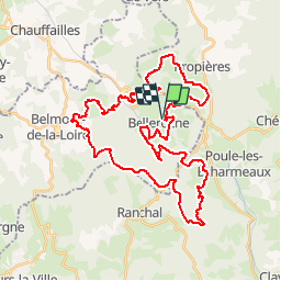
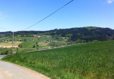
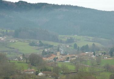
Trail Mountain bike of 43 km to be discovered at Auvergne-Rhône-Alpes, Loire, Belleroche. This trail is proposed by tracegps.

Description

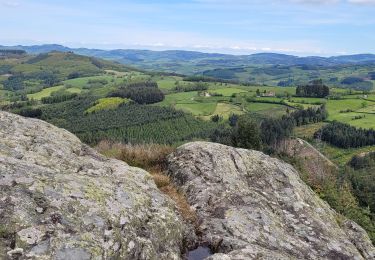
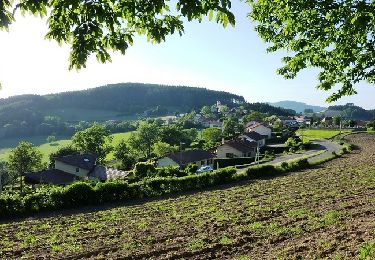
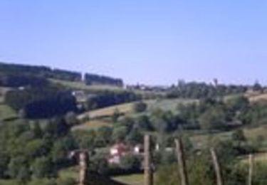
Belleroche 42670 - Parcours de la 1ère randonnée "VTT des Grands Bois" le 9 mai 2010. Départ du parking gratuit à proximité de l'église et de la mairie. Itinéraire : Belleroche, La Poute, Les Noyers, La Forêt, Col des Aillets,Château de La Ronze, Le Mont Pinay, Les Fouilloux, Le Bouis, Les Quatre Vents, Fragny, Montveneur, Lapierre, Village Garnier, Verpuits, Azolette, Plan d'eau d'Azole, Les Correux, Le Botton, Fourgerat, Belleroche. Très beau parcours très exigeant sans moment de répit en pleine nature avec peu de bitume et loin d'être ennuyé par les engins motorisés... Le tout dans un milieu rural extrème, où vous longerez des pâturages peuplés de bovins et d'ovins, où vous traverserez des sous bois de résineux tout en humant la bonne senteur des pins ! Ce parcours est réservé aux pratiquants réguliers, dingues de grimpettes et de descentes techniques avec en prime des singles tracks sympas. Du vrai VTT !

Elevation profile

Photos

Positioning

Country:
France
Region :
Auvergne-Rhône-Alpes
Department/Province :
Loire
Municipality :
Belleroche
Location:
Unknown
Start:(UTM)
609019 ; 5113750 (31T) N.

Trails nearby

Trail Walking Saint-Germain-la-Montagne - Circuit du Tourniquet - Saint Germain la Montagne - Photo
Walking
tracegps

Walking

Difficult
(1)
Saint-Germain-la-Montagne, Auvergne-Rhône-Alpes, Loire, France
15 km | 22 km-effort
4h 0min
Yes
Trail Walking Ranchal - Ranchal village vert  - Photo
Walking
tracegps

Walking

Medium
(1)
Ranchal, Auvergne-Rhône-Alpes, Rhône, France
10.2 km | 14.2 km-effort
2h 0min
Yes
Trail On foot Propières - Circuit de Propières n°3 - 15 km - Noir - Photo
On foot
PRO

On foot

Medium
Propières, Auvergne-Rhône-Alpes, Rhône, France
14.3 km | 21 km-effort
4h 46min
Yes
Trail Walking Propières - Séjour RCY journée 4 Les crêtes du Haut Beaujolais  - Photo
Walking
chessyca

Walking

Very difficult
Propières, Auvergne-Rhône-Alpes, Rhône, France
28 km | 39 km-effort
6h 48min
No
Trail Mountain bike Saint-Germain-la-Montagne - VTT sportif à travers bois - Saint Germain la Montagne - Photo
Mountain bike
tracegps

Mountain bike

Difficult
Saint-Germain-la-Montagne, Auvergne-Rhône-Alpes, Loire, France
32 km | 47 km-effort
3h 0min
Yes
Trail Walking Propières - Circuit de Propières - Photo
Walking
tracegps

Walking

Difficult
Propières, Auvergne-Rhône-Alpes, Rhône, France
14.3 km | 21 km-effort
5h 0min
Yes
Trail Mountain bike Belleroche - Marche de Belleroche - Photo
Mountain bike
balli51

Mountain bike

Difficult
Belleroche, Auvergne-Rhône-Alpes, Loire, France
33 km | 48 km-effort
2h 59min
Yes
Trail Walking Belleroche - Belleroche - Circuit du Mont Joly - Photo
Walking
tracegps

Walking

Medium
(1)
Belleroche, Auvergne-Rhône-Alpes, Loire, France
8.1 km | 11.9 km-effort
2h 30min
Yes
Trail Walking Poule-les-Écharmeaux - Poule-Les-Echarmeaux (16 km - D. 555) - Photo
Walking
Thomasdanielle

Walking

Difficult
Poule-les-Écharmeaux, Auvergne-Rhône-Alpes, Rhône, France
16.5 km | 24 km-effort
5h 37min
Yes


Close
My subscriptions