


Col de Prémol

tracegps
User
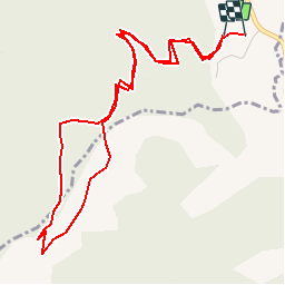

Length
5.9 km

Max alt
1215 m

Uphill gradient
236 m
Km-Effort
9 km

Min alt
972 m

Downhill gradient
241 m
Boucle
Yes
Creation date :
2014-12-10 00:00:00.0
Updated on :
2014-12-10 00:00:00.0
2h30
Difficulty : Easy

FREE GPS app for hiking
 SityTrail
IGN / Geographical institutes
SityTrail Plus
The world is yours!
About
Trail Walking of 5.9 km to be discovered at Auvergne-Rhône-Alpes, Drôme, Jonchères. This trail is proposed by tracegps.
Description
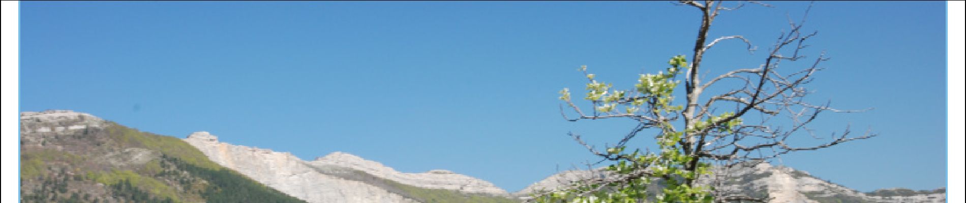
Une promenade tranquille qui permet de profiter d'un beau panorama. Au printemps le sol est couvert de Gentianes.
Photos


Positioning
Country:
France
Region :
Auvergne-Rhône-Alpes
Department/Province :
Drôme
Municipality :
Jonchères
Location:
Unknown
Start:(Dec)
Start:(UTM)
691496 ; 4935925 (31T) N.
Comments