


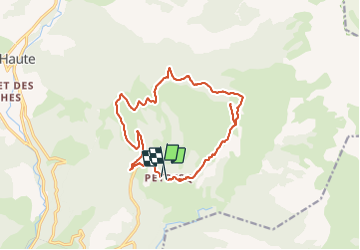

19.9 km | 37 km-effort


User


FREE GPS app for hiking
 SityTrail
IGN / Geographical institutes
SityTrail World
The world is yours!
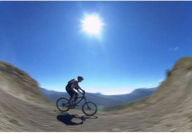
Trail Mountain bike of 17.5 km to be discovered at Provence-Alpes-Côte d'Azur, Alpes-de-Haute-Provence, Thorame-Haute. This trail is proposed by tracegps.
Petit circuit sportif extrêmement joli et varié. Un peu de chemin large mais pas vilain avant de bonnes montées sur sentier suivies d'un tout petit portage. Descente peu difficile (V3 environ en cotation VTOPO).
Walking
Walking
Walking
Walking
Walking
Cross-country skiing

Mountain bike
Snowshoes
Mountain bike