Trail Walking Mireval-Lauragais - 11_Mireval Lauragais - Photo

11_Mireval Lauragais

 jab31
jab31

User

© OpenStreetMap contributors
Length
Length
15.8 km
Max alt
Max alt
394 m
Uphill gradient
Uphill gradient
357 m
Km-Effort
Km-Effort  
21 km
Min alt
Min alt
182 m
Downhill gradient
Downhill gradient
356 m
Boucle
Boucle
Yes
Creation date :
2019-01-06 17:09:52.526
Updated on :
2019-01-06 17:09:52.526

(0 Reviews)

Walking
Walking
4h20
Difficulty : Medium

Scan this QR Code to open this trail in the SityTrail application

FREE GPS app for hiking

Logo SityTrail SityTrail

IGN / Geographical institutes

Download SityTrail from the App Store Download SityTrail from Google Play

Logo SityTrail SityTrail World

The world is yours!

Download SityTrail from the App Store Download SityTrail from Google Play Download SityTrail on Huawei AppGallery

About

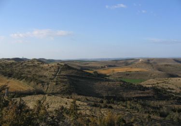
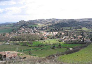
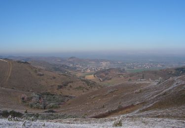
Trail Walking of 15.8 km to be discovered at Occitania, Aude, Mireval-Lauragais. This trail is proposed by jab31.

Description

chemins de crêtes, champs et garrigues
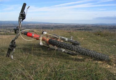
Elevation profile

Positioning

Country:
France
Region :
Occitania
Department/Province :
Aude
Municipality :
Mireval-Lauragais
Location:
Unknown
Start:(UTM)
415523 ; 4789645 (31T) N.

Trails nearby

Trail Mountain bike Villeneuve-la-Comptal - Les collines du pastel - Photo
Mountain bike
tracegps

Mountain bike

Difficult
(1)
Villeneuve-la-Comptal, Occitania, Aude, France
26 km | 33 km-effort
2h 30min
Yes
Trail Walking Laurac - Laurac Fanjeaux - Photo
Walking
tracegps

Walking

Very difficult
(1)
Laurac, Occitania, Aude, France
27 km | 37 km-effort
6h 30min
Yes
Trail Walking Villeneuve-la-Comptal - Villeneuve la Comptal 04 - Photo
Walking
tracegps

Walking

Medium
(1)
Villeneuve-la-Comptal, Occitania, Aude, France
11.2 km | 15 km-effort
2h 30min
Yes
Trail Walking Fonters-du-Razès - Boucle Saint Christol  - Photo
Walking
Mamilaure

Walking

Easy
Fonters-du-Razès, Occitania, Aude, France
12.6 km | 16.3 km-effort
2h 48min
Yes
Trail Mountain bike Laurabuc - boucle bb - Photo
Mountain bike
leroj73

Mountain bike

Easy
(1)
Laurabuc, Occitania, Aude, France
15.2 km | 19.2 km-effort
1h 15min
Yes
Trail Walking Villeneuve-la-Comptal - Villeneuve la Comptal 03 - Photo
Walking
tracegps

Walking

Medium
Villeneuve-la-Comptal, Occitania, Aude, France
14.1 km | 18.9 km-effort
3h 0min
Yes
Trail Walking Villeneuve-la-Comptal - Villeneuve la Comptal 01 - Photo
Walking
tracegps

Walking

Medium
Villeneuve-la-Comptal, Occitania, Aude, France
4.4 km | 6.1 km-effort
1h 0min
Yes
Trail Walking Laurabuc - boucle laurabuc bespllas - Photo
Walking
leroj73

Walking

Medium
Laurabuc, Occitania, Aude, France
17.9 km | 24 km-effort
5h 23min
Yes
Trail Mountain bike Villeneuve-la-Comptal - Col de Samson - Photo
Mountain bike
tracegps

Mountain bike

Difficult
Villeneuve-la-Comptal, Occitania, Aude, France
14.3 km | 18.8 km-effort
1h 45min
Yes


Close
My subscriptions