


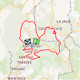

11.9 km | 16.5 km-effort


User


FREE GPS app for hiking
 SityTrail
IGN / Geographical institutes
SityTrail World
The world is yours!
Trail Walking of 17.8 km to be discovered at Occitania, Lot, Marcilhac-sur-Célé. This trail is proposed by tracegps.
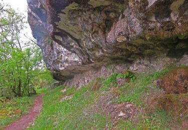
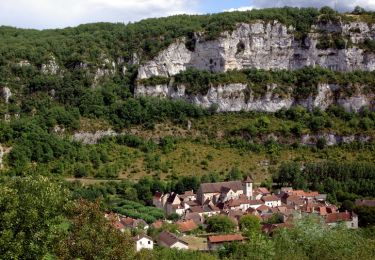
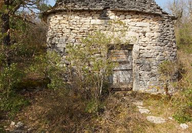
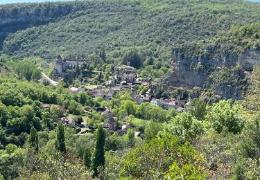
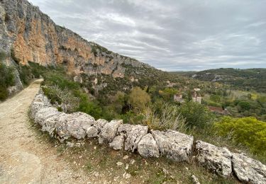
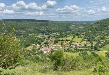
Cette très belle balade part de la rive droite du Célé et monte sur le Causse par un joli sentier qui permet d'admirer la vue sur la vallée. Puis on atteint le plateau qui chemine entre buis et chênes. Au passage on pourra admirer de magnifiques caselles. On redescend ensuite sur les bords du Célé que l'on traverse à Saint Sulpice où l'on admirera au passage les maisons accolées à la falaise. On pourra faire une pause au bord du Célé. On remonte ensuite sur le Causse où l'on chemine par de larges sentiers dans les chênes, les pins et les cèdres. Au passage un beau dolmen, un très beau point de vue du pylône et un retour un peu fastidieux par la route.
Walking
Walking

Walking

Walking
Walking

sport

Walking
Walking
Walking
Conforme au descriptif, je ne suis pas déçu. A refaire à différentes saisons. Aucune difficulté. Merci à l'éditeur.