Trail Walking Sauliac-sur-Célé - Sauliac sur céle Cabreret en boucle  - Photo

Sauliac sur céle Cabreret en boucle

© OpenStreetMap contributors
Length
Length
19.9 km
Max alt
Max alt
314 m
Uphill gradient
Uphill gradient
618 m
Km-Effort
Km-Effort  
28 km
Min alt
Min alt
134 m
Downhill gradient
Downhill gradient
621 m
Boucle
Boucle
Yes
Creation date :
2022-03-20 08:26:17.0
Updated on :
2022-03-20 14:59:45.13

(1 Reviews)

Walking
Walking
5h52
Difficulty : Easy

Scan this QR Code to open this trail in the SityTrail application

FREE GPS app for hiking

Logo SityTrail SityTrail

IGN / Geographical institutes

Download SityTrail from the App Store Download SityTrail from Google Play

Logo SityTrail SityTrail World

The world is yours!

Download SityTrail from the App Store Download SityTrail from Google Play Download SityTrail on Huawei AppGallery

About

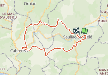
Trail Walking of 19.9 km to be discovered at Occitania, Lot, Sauliac-sur-Célé. This trail is proposed by Gaillard Isabelle.

Description

Très bien

Elevation profile

Photos

Positioning

Country:
France
Region :
Occitania
Department/Province :
Lot
Municipality :
Sauliac-sur-Célé
Location:
Unknown
Start:(UTM)
398648 ; 4930064 (31T) N.

Comments

Please log in to post a review or rate the element


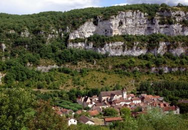
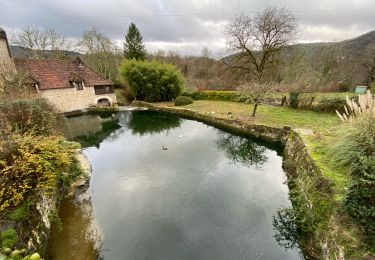
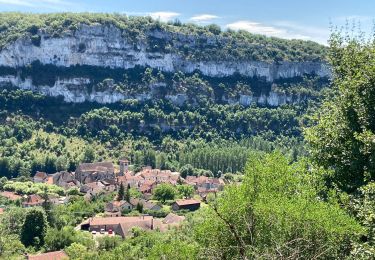
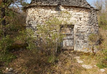
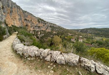
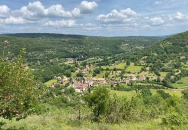
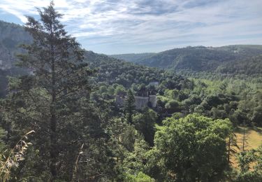
Très belle boucle, paysages variés. En bordure des falaises du Célé, sur le causse sur des chemins bordés de murets de pierres sèches pour l'aller, pistes forestières et petites routes plus banales dans la 2ème partie. Le Vieux Sauliac, c'est à voir. Passage à l'écomusée de Cuzals. Couplage possible avec le chemin des pierres levées au dessus du vieux Sauliac (+5 km).


Trails nearby

Trail Walking Marcilhac-sur-Célé - Marcilhac sur Célé - Photo
Walking
tracegps

Walking

Medium
(2)
Marcilhac-sur-Célé, Occitania, Lot, France
8.4 km | 10.8 km-effort
3h 15min
Yes
Trail Walking Marcilhac-sur-Célé - Autour de Marcilhac sur Célé - Photo
Walking
tracegps

Walking

Very difficult
(2)
Marcilhac-sur-Célé, Occitania, Lot, France
17.8 km | 25 km-effort
5h 0min
Yes
Trail Walking Larnagol - Larnagol le bout du monde  - Photo
Walking
GUIDE
antignacs

Walking

Very easy
Larnagol, Occitania, Lot, France
8.6 km | 13 km-effort
3h 9min
Yes
Trail Walking Marcilhac-sur-Célé - Marcilhac st sulpice  - Photo
Walking
GUIDE
antignacs

Walking

Medium
Marcilhac-sur-Célé, Occitania, Lot, France
20 km | 27 km-effort
5h 0min
Yes
Trail Walking Marcilhac-sur-Célé - Marcilhac-sur-Célé - Boucle - Photo
Walking
Indi34

Walking

Easy
Marcilhac-sur-Célé, Occitania, Lot, France
7.9 km | 10.8 km-effort
3h 3min
Yes
Trail Walking Marcilhac-sur-Célé - Marcilhac-sur-Célé  - Photo
Walking
thomas.o.vert

Walking

Easy
Marcilhac-sur-Célé, Occitania, Lot, France
7.4 km | 9.8 km-effort
2h 13min
Yes
Trail Walking Sauliac-sur-Célé - Sauliac Monteils Blars  - Photo
Walking
GUIDE
antignacs

Walking

Easy
Sauliac-sur-Célé, Occitania, Lot, France
17.1 km | 24 km-effort
4h 21min
Yes
Trail Walking Marcilhac-sur-Célé - Marcilhac à Espagnac - Photo
Walking
dominiq

Walking

Very difficult
Marcilhac-sur-Célé, Occitania, Lot, France
14.5 km | 22 km-effort
5h 0min
No
Trail Walking Orniac - Les Granges à Marcilhac - Photo
Walking
dominiq

Walking

Medium
Orniac, Occitania, Lot, France
14.8 km | 22 km-effort
4h 40min
No


Close
My subscriptions