Trail Mountain bike Saint-Étienne-aux-Clos - St Etienne au Clos - Photo
 tracegps
tracegps

User

© OpenStreetMap contributors
Length
Length
31 km
Max alt
Max alt
798 m
Uphill gradient
Uphill gradient
779 m
Km-Effort
Km-Effort  
41 km
Min alt
Min alt
589 m
Downhill gradient
Downhill gradient
776 m
Boucle
Boucle
No
Creation date :
2014-12-10 00:00:00.0
Updated on :
2014-12-10 00:00:00.0

(0 Reviews)

Mountain bike
Mountain bike
3h30
Difficulty : Difficult

Scan this QR Code to open this trail in the SityTrail application

FREE GPS app for hiking

Logo SityTrail SityTrail

IGN / Geographical institutes

Download SityTrail from the App Store Download SityTrail from Google Play

Logo SityTrail SityTrail World

The world is yours!

Download SityTrail from the App Store Download SityTrail from Google Play Download SityTrail on Huawei AppGallery

About

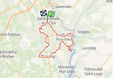
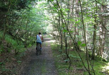
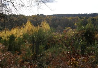
Trail Mountain bike of 31 km to be discovered at New Aquitaine, Corrèze, Saint-Étienne-aux-Clos. This trail is proposed by tracegps.

Description

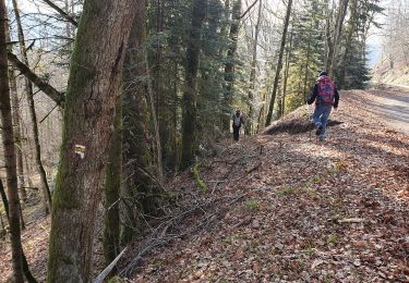
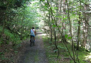
Balade difficile mais agréable car parcours vallonné, demande de la technicité. Vue sur une partie du Lac de Vassivière, sur les anciens tunnels ferroviaires, creusés et battis à la main. Très beau site, je vous le recommande.

Elevation profile

Positioning

Country:
France
Region :
New Aquitaine
Department/Province :
Corrèze
Municipality :
Saint-Étienne-aux-Clos
Location:
Unknown
Start:(UTM)
457668 ; 5046112 (31T) N.

Trails nearby

Trail Walking Confolent-Port-Dieu - Confolent et Monestier - Photo
Walking
viam19

Walking

Difficult
Confolent-Port-Dieu, New Aquitaine, Corrèze, France
13 km | 20 km-effort
6h 22min
No
Trail On foot Savennes - Saint-Jean-du-Desert - Photo
On foot
PRO

On foot

Medium
Savennes, Auvergne-Rhône-Alpes, Puy-de-Dôme, France
16.2 km | 22 km-effort
4h 59min
Yes
Trail Walking Saint-Étienne-aux-Clos - entre Limousin et Auvergne  - Photo
Walking
viam19

Walking

Medium
Saint-Étienne-aux-Clos, New Aquitaine, Corrèze, France
15 km | 20 km-effort
4h 43min
Yes
Trail Mountain bike Merlines - Lémovices ou Arvernes - Gare de Savennes 13 km - Pays de Haute Corrèze - Photo
Mountain bike
tracegps

Mountain bike

Difficult
Merlines, New Aquitaine, Corrèze, France
13.6 km | 18.3 km-effort
1h 30min
Yes
Trail Walking Merlines - Lémovices ou Arvernes - Gare de Savennes 13 km - Pays de Haute Corrèze - Photo
Walking
tracegps

Walking

Difficult
Merlines, New Aquitaine, Corrèze, France
13.6 km | 18.3 km-effort
4h 0min
Yes
Trail Mountain bike Saint-Étienne-aux-Clos - Lémovices ou Arvernes - Saint Etienne aux Clos 8 km - Pays de Haute Corrèze - Photo
Mountain bike
tracegps

Mountain bike

Medium
Saint-Étienne-aux-Clos, New Aquitaine, Corrèze, France
8.1 km | 11.4 km-effort
45min
Yes
Trail Walking Saint-Étienne-aux-Clos - Lémovices ou Arvernes - Saint Etienne aux Clos 8 km - Pays de Haute Corrèze - Photo
Walking
tracegps

Walking

Medium
Saint-Étienne-aux-Clos, New Aquitaine, Corrèze, France
8.1 km | 11.4 km-effort
2h 0min
Yes
Trail Mountain bike Saint-Étienne-aux-Clos - Lémovices ou Arvernes - Saint Etienne aux Clos 12,7 km- Pays de Haute Corrèze - Photo
Mountain bike
tracegps

Mountain bike

Difficult
Saint-Étienne-aux-Clos, New Aquitaine, Corrèze, France
12.7 km | 17.5 km-effort
1h 40min
Yes
Trail Walking Saint-Étienne-aux-Clos - Lémovices ou Arvernes - Saint Etienne aux Clos 12,7 km- Pays de Haute Corrèze - Photo
Walking
tracegps

Walking

Difficult
Saint-Étienne-aux-Clos, New Aquitaine, Corrèze, France
12.7 km | 17.5 km-effort
4h 0min
Yes


Close
My subscriptions