


Bouillouses Carlit

JeanPierreNancy
User
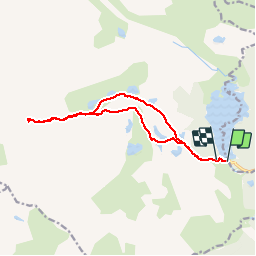

Length
14.6 km

Max alt
2885 m

Uphill gradient
909 m
Km-Effort
27 km

Min alt
2009 m

Downhill gradient
878 m
Boucle
No
Creation date :
2019-01-15 17:33:05.349
Updated on :
2019-01-15 17:33:05.349
8h46
Difficulty : Unknown

FREE GPS app for hiking
 SityTrail
IGN / Geographical institutes
SityTrail Plus
The world is yours!
About
Trail Walking of 14.6 km to be discovered at Occitania, Pyrénées-Orientales, Angoustrine-Villeneuve-des-Escaldes. This trail is proposed by JeanPierreNancy.
Positioning
Country:
France
Region :
Occitania
Department/Province :
Pyrénées-Orientales
Municipality :
Angoustrine-Villeneuve-des-Escaldes
Location:
Unknown
Start:(Dec)
Start:(UTM)
417929 ; 4712409 (31T) N.
Comments