Trail Walking Saint-Jean-Saint-Maurice-sur-Loire - Balade à Saint-Jean - Saint-Maurice-sur-Loire - Photo

Balade à Saint-Jean - Saint-Maurice-sur-Loire

 tracegps
tracegps

User

© OpenStreetMap contributors
Length
Length
4.3 km
Max alt
Max alt
405 m
Uphill gradient
Uphill gradient
115 m
Km-Effort
Km-Effort  
5.9 km
Min alt
Min alt
320 m
Downhill gradient
Downhill gradient
115 m
Boucle
Boucle
Yes
Creation date :
2014-12-10 00:00:00.0
Updated on :
2014-12-10 00:00:00.0

(1 Reviews)

Walking
Walking
1h30
Difficulty : Medium

Scan this QR Code to open this trail in the SityTrail application

FREE GPS app for hiking

Logo SityTrail SityTrail

IGN / Geographical institutes

Download SityTrail from the App Store Download SityTrail from Google Play

Logo SityTrail SityTrail World

The world is yours!

Download SityTrail from the App Store Download SityTrail from Google Play Download SityTrail on Huawei AppGallery

About

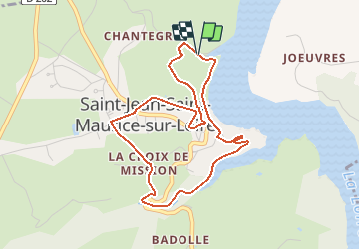
Trail Walking of 4.3 km to be discovered at Auvergne-Rhône-Alpes, Loire, Saint-Jean-Saint-Maurice-sur-Loire. This trail is proposed by tracegps.

Description

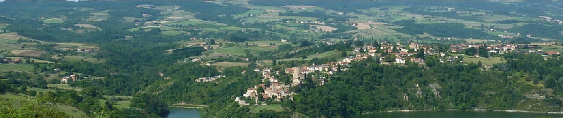
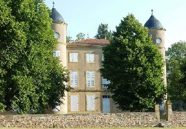
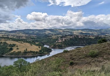
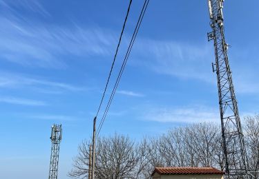
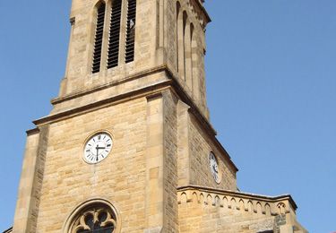
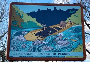
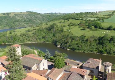
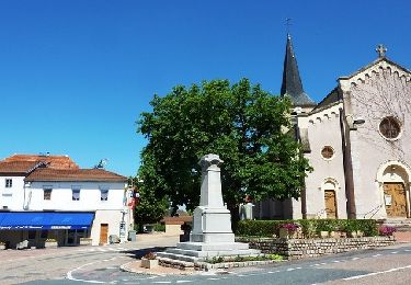
Parking gratuit : port de la Caille (au bord de la route). Départ : du parking du port de la Caille. Ce village en balcon sur "La Loire" possède un riche passé, les monuments que vous découvrirez en témoignent. Le Moyen-Age et la Renaissance ont apporté leurs pierres à ce patrimoine : donjon du XIIème S. dans les ruines du château, porte de ville et remparts, maisons anciennes dans le village. Il existe un circuit du patrimoine de 3 km afin de découvrir les monuments dans le village, (balisage blanc et jaune avec un H en forme de tour fortifiée). Ne pas quitter les lieux sans être monté au sommet de "La Tour" pour admirer les gorges de La Loire et un somptueux panorama à 360° !!! Topoguide : Rando Guide "A Travers l'Ouest Roannais" (Balisage jaune CCOR)... disponible dans les mairies de la Communauté de Commune de l'Ouest Roannais (CCOR) Lentigny, Ouches et Saint Léger sur Roanne(siège de la CCOR).

Elevation profile

Photos

Positioning

Country:
France
Region :
Auvergne-Rhône-Alpes
Department/Province :
Loire
Municipality :
Saint-Jean-Saint-Maurice-sur-Loire
Location:
Unknown
Start:(UTM)
578102 ; 5091173 (31T) N.

Comments

Please log in to post a review or rate the element


Trails nearby

Trail Mountain bike Commelle-Vernay - VTT dans le bois de Terrenoire et au bord du Rhins - Commelle Vernay - Photo
Mountain bike
tracegps

Mountain bike

Medium
(3)
Commelle-Vernay, Auvergne-Rhône-Alpes, Loire, France
35 km | 43 km-effort
3h 0min
Yes
Trail Walking Saint-Jean-Saint-Maurice-sur-Loire - Autour des Gorges de la Loire - PR N° 9 : Sur le pas des pèlerins - Saint-Jean-Saint-Maurice-sur-Loire - Photo
Walking
tracegps

Walking

Very difficult
(1)
Saint-Jean-Saint-Maurice-sur-Loire, Auvergne-Rhône-Alpes, Loire, France
14.2 km | 19.8 km-effort
4h 30min
Yes
Trail sport Saint-Jean-Saint-Maurice-sur-Loire - Retour bis - Photo
sport
ophness

sport

Very easy
(1)
Saint-Jean-Saint-Maurice-sur-Loire, Auvergne-Rhône-Alpes, Loire, France
12.6 km | 16.2 km-effort
Unknown
No
Trail Walking Cordelle - boucle rilly-9.7 km - Photo
Walking
famillerudent

Walking

Difficult
Cordelle, Auvergne-Rhône-Alpes, Loire, France
9.7 km | 13.4 km-effort
2h 44min
Yes
Trail Walking Villemontais - Villemontais : Chérier et Haut Ste-Agathe - Photo
Walking
Jgar

Walking

Difficult
Villemontais, Auvergne-Rhône-Alpes, Loire, France
15.1 km | 23 km-effort
4h 22min
Yes
Trail Walking Cordelle - Cordelle : Terrenoire et versant sud - Photo
Walking
Jgar

Walking

Medium
Cordelle, Auvergne-Rhône-Alpes, Loire, France
12.1 km | 15.4 km-effort
3h 43min
Yes
Trail On foot Commelle-Vernay - Commelle-Vernay : petit train touristique - Photo
On foot
Jgar

On foot

Easy
Commelle-Vernay, Auvergne-Rhône-Alpes, Loire, France
7.3 km | 9.2 km-effort
2h 15min
Yes
Trail Walking Saint-Jean-Saint-Maurice-sur-Loire - St Jean-St Maurice 18km - Photo
Walking
GUIDE
thonyc

Walking

Difficult
Saint-Jean-Saint-Maurice-sur-Loire, Auvergne-Rhône-Alpes, Loire, France
18.3 km | 25 km-effort
5h 55min
Yes
Trail Mountain bike Lentigny - Escapade dans les Gouttes de la Loire - Lentigny - Photo
Mountain bike
tracegps

Mountain bike

Difficult
Lentigny, Auvergne-Rhône-Alpes, Loire, France
31 km | 40 km-effort
3h 0min
Yes


Close
My subscriptions