Trail Walking Boisbreteau - Le circuit des cervidés - Boisbreteau - Photo

Le circuit des cervidés - Boisbreteau

 tracegps
tracegps

User

© OpenStreetMap contributors
Length
Length
6.9 km
Max alt
Max alt
152 m
Uphill gradient
Uphill gradient
97 m
Km-Effort
Km-Effort  
8.2 km
Min alt
Min alt
93 m
Downhill gradient
Downhill gradient
97 m
Boucle
Boucle
Yes
Creation date :
2014-12-10 00:00:00.0
Updated on :
2014-12-10 00:00:00.0

(1 Reviews)

Walking
Walking
1h45
Difficulty : Easy

Scan this QR Code to open this trail in the SityTrail application

FREE GPS app for hiking

Logo SityTrail SityTrail

IGN / Geographical institutes

Download SityTrail from the App Store Download SityTrail from Google Play

Logo SityTrail SityTrail World

The world is yours!

Download SityTrail from the App Store Download SityTrail from Google Play Download SityTrail on Huawei AppGallery

About

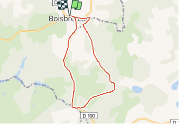
Trail Walking of 6.9 km to be discovered at New Aquitaine, Charente, Boisbreteau. This trail is proposed by tracegps.

Description

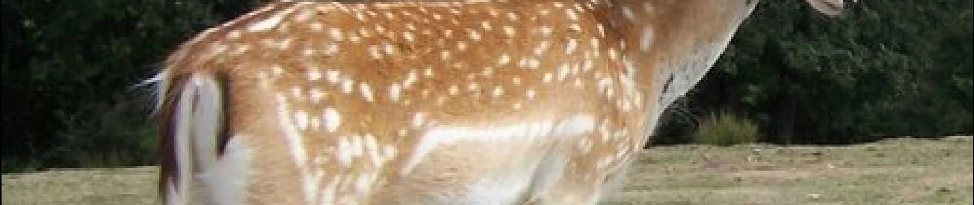
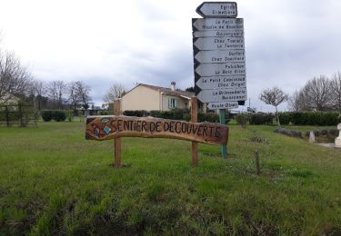
Circuit aménagé, entretenu et proposé par la commune de Boisbreteau et le Groupe de Randonnée nature de Boisbreteau. Départ de l’église de Boisbreteau. Le circuit des cervidés emprunte un circuit ombragé et une zone humide avant de revenir par la route. Il longe un parc animalier, le « SAFARI Parc » de Haute Saintonge, dans sa partie Est et passe à proximité d’un grand étang habité par les cistudes. Avec un minimum de patience et de discrétion, vous observerez une faune aquatique très variée mais aussi de nombreux mouflons, des daims, des cerfs axis, des cerfs de Virginie et peut être le grand cerf rouge. Retrouvez le circuit dans le topoguide 2006.

Elevation profile

Photos

Positioning

Country:
France
Region :
New Aquitaine
Department/Province :
Charente
Municipality :
Boisbreteau
Location:
Unknown
Start:(UTM)
723222 ; 5022844 (30T) N.

Comments

Please log in to post a review or rate the element


Randonnée devenue impossible un propriétaire a barré l’accès dès le début du parcours.


Trails nearby

Trail Walking Guizengeard - guizengeard 03 avril 2018 - Photo
Walking
bert16

Walking

Easy
Guizengeard, New Aquitaine, Charente, France
7.5 km | 9.3 km-effort
2h 1min
Yes
Trail Walking Guizengeard - guizengeard - Photo
Walking
autantmichaud

Walking

Easy
Guizengeard, New Aquitaine, Charente, France
6.7 km | 8.1 km-effort
2h 10min
Yes
Trail Walking Guizengeard - ballade aux lacs bleus - Photo
Walking
roro17800

Walking

Very easy
Guizengeard, New Aquitaine, Charente, France
4.4 km | 5.4 km-effort
2h 19min
Yes
Trail Walking Boresse-et-Martron - Boresse  11km - Photo
Walking
JACQUOU

Walking

Medium
Boresse-et-Martron, New Aquitaine, Charente-Maritime, France
10.9 km | 13.2 km-effort
3h 0min
Yes
Trail Walking Guizengeard - lac bleu guizengeard - Photo
Walking
Florence Normand

Walking

Easy
Guizengeard, New Aquitaine, Charente, France
3.7 km | 4.6 km-effort
1h 15min
Yes
Trail Walking Boresse-et-Martron - Boresse - Photo
Walking
JACQUOU

Walking

Easy
Boresse-et-Martron, New Aquitaine, Charente-Maritime, France
12.8 km | 15.6 km-effort
3h 1min
Yes
Trail Walking Guizengeard - Guizengard - Photo
Walking
JACQUOU

Walking

Easy
Guizengeard, New Aquitaine, Charente, France
14.3 km | 17.4 km-effort
3h 27min
Yes
Trail Walking Guizengeard - Carrière de kaolin  - Photo
Walking
Onillon

Walking

Guizengeard, New Aquitaine, Charente, France
17.9 km | 21 km-effort
1h 13min
No


Close
My subscriptions