Trail Mountain bike Saint-Lô - Les Roches du Ham - Saint Lo - Photo

Les Roches du Ham - Saint Lo

 tracegps
tracegps

User

© OpenStreetMap contributors
Length
Length
31 km
Max alt
Max alt
109 m
Uphill gradient
Uphill gradient
510 m
Km-Effort
Km-Effort  
37 km
Min alt
Min alt
20 m
Downhill gradient
Downhill gradient
514 m
Boucle
Boucle
Yes
Creation date :
2014-12-10 00:00:00.0
Updated on :
2014-12-10 00:00:00.0

(0 Reviews)

Mountain bike
Mountain bike
2h00
Difficulty : Difficult

Scan this QR Code to open this trail in the SityTrail application

FREE GPS app for hiking

Logo SityTrail SityTrail

IGN / Geographical institutes

Download SityTrail from the App Store Download SityTrail from Google Play

Logo SityTrail SityTrail World

The world is yours!

Download SityTrail from the App Store Download SityTrail from Google Play Download SityTrail on Huawei AppGallery

About

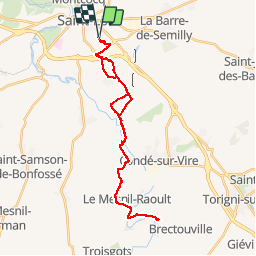
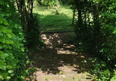
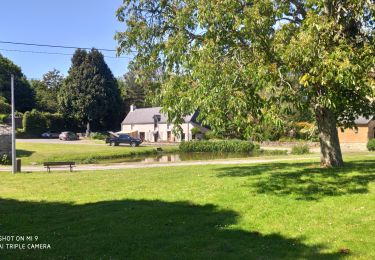
Trail Mountain bike of 31 km to be discovered at Normandy, Manche, Saint-Lô. This trail is proposed by tracegps.

Description

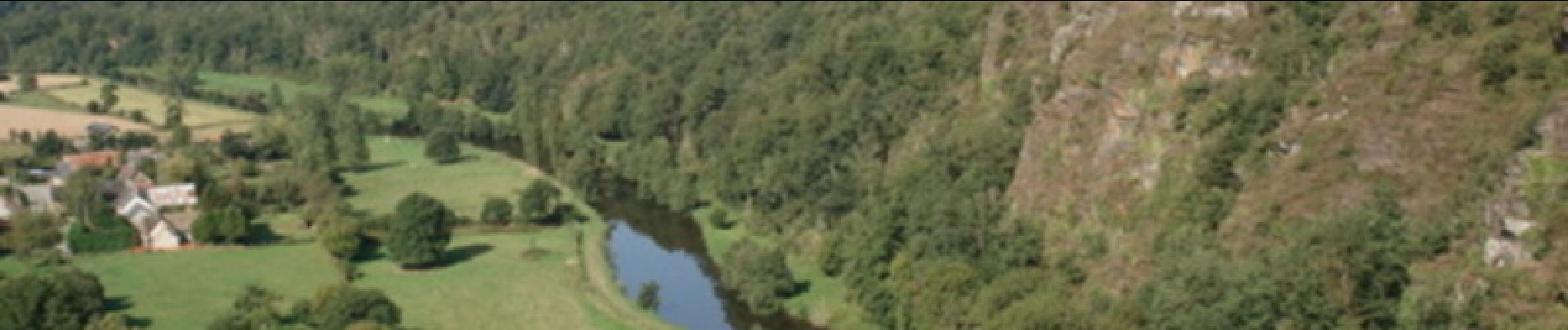
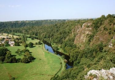
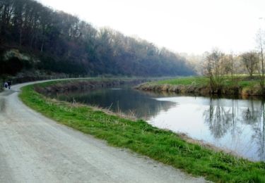
Un beau parcours qui amène sur le point de vue des roches du Ham... Source Wikipedia: Les roches de Ham (également appelées, surtout localement, roches du Ham constituent un site naturel situé au sud de Saint-Lô, au cœur du bocage normand, avec ses haies vives encadrant les parcelles de prés. Il s'agit d'une falaise de schiste, culminant à 105 m, présentant un aplomb vertigineux au-dessus du fleuve la Vire. De son sommet se dévoile un superbe panorama, une vraie leçon de géographie physique et humaine. Le site est équipé pour l'escalade, mais est aussi idéal pour les randonnées pédestres et équestres.

Elevation profile

Photos

Positioning

Country:
France
Region :
Normandy
Department/Province :
Manche
Municipality :
Saint-Lô
Location:
Unknown
Start:(UTM)
640213 ; 5441215 (30U) N.

Trails nearby

Trail Mountain bike Agneaux - L'Agnelaise 2014 - Agneaux - Photo
Mountain bike
tracegps

Mountain bike

Difficult
Agneaux, Normandy, Manche, France
44 km | 52 km-effort
3h 0min
Yes
Trail Walking Saint-Lô - Saint-Lô - La Vire et le Falaise - Photo
Walking
PatRando

Walking

Easy
Saint-Lô, Normandy, Manche, France
5.4 km | 6.6 km-effort
1h 20min
Yes
Trail Walking Saint-Lô - BALLADE 2 JUIN - Photo
Walking
PatRando

Walking

Very easy
Saint-Lô, Normandy, Manche, France
3.1 km | 3.7 km-effort
51min
Yes
Trail Walking Saint-Lô - Ballade 2 juin 2020 - Photo
Walking
PatRando

Walking

Very easy
Saint-Lô, Normandy, Manche, France
3.6 km | 4.2 km-effort
1h 2min
Yes
Trail Walking Saint-Lô - Ballade - Photo
Walking
PatRando

Walking

Very easy
Saint-Lô, Normandy, Manche, France
814 m | 940 m-effort
22min
Yes
Trail Walking Saint-Lô - Le Hutrel 27 ai 2020 - Photo
Walking
PatRando

Walking

Very easy
Saint-Lô, Normandy, Manche, France
2.3 km | 2.9 km-effort
48min
Yes
Trail Equestrian Bourgvallées - La vallée de la Vire : 3 boucles pour cavaliers - Photo
Equestrian
tracegps

Equestrian

Difficult
Bourgvallées, Normandy, Manche, France
44 km | 53 km-effort
9h 0min
Yes
Trail Mountain bike Saint-Lô - Au pied des remparts de Saint-Lô - Photo
Mountain bike
tracegps

Mountain bike

Medium
Saint-Lô, Normandy, Manche, France
18.2 km | 23 km-effort
2h 0min
Yes
Trail Walking Saint-Lô - 1er - Photo
Walking
Raymond Demeestere

Walking

Medium
Saint-Lô, Normandy, Manche, France
6.6 km | 8.3 km-effort
1h 47min
Yes


Close
My subscriptions