Trail Mountain bike La Hague - Les sentiers de La Hague 2011 - 45 kms - Photo

Les sentiers de La Hague 2011 - 45 kms

 tracegps
tracegps

User

© OpenStreetMap contributors
Length
Length
45 km
Max alt
Max alt
174 m
Uphill gradient
Uphill gradient
1058 m
Km-Effort
Km-Effort  
59 km
Min alt
Min alt
15 m
Downhill gradient
Downhill gradient
1059 m
Boucle
Boucle
Yes
Creation date :
2014-12-10 00:00:00.0
Updated on :
2014-12-10 00:00:00.0

(0 Reviews)

Mountain bike
Mountain bike
3h30
Difficulty : Difficult

Scan this QR Code to open this trail in the SityTrail application

FREE GPS app for hiking

Logo SityTrail SityTrail

IGN / Geographical institutes

Download SityTrail from the App Store Download SityTrail from Google Play

Logo SityTrail SityTrail World

The world is yours!

Download SityTrail from the App Store Download SityTrail from Google Play Download SityTrail on Huawei AppGallery

About

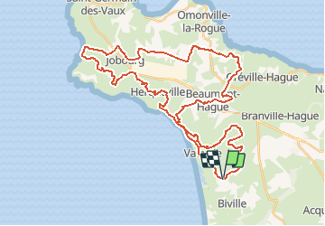
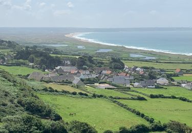
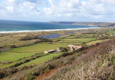
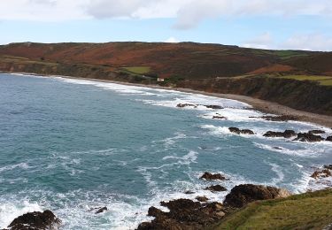
Trail Mountain bike of 45 km to be discovered at Normandy, Manche, La Hague. This trail is proposed by tracegps.

Description

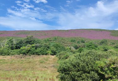
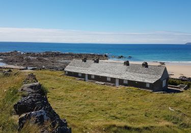
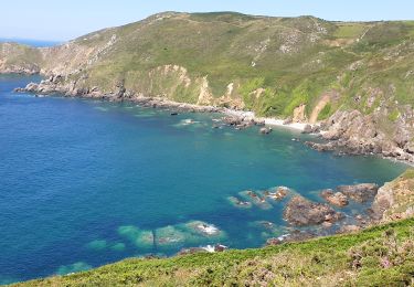
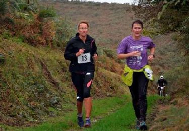
Parcours concocté par la joyeuse équipe des Haguards qui vous fera découvrir de somptueux paysages de bord de mer. Cette boucle traverse des landes, des chemins un peu boueux, des bois, de quoi se régaler en fait.... Les randonneurs de cette édition étaient ravis de leur expédition... Dédicace à toutes les personnes ayant contribué à cette édition 2011 sans qui ce rendez-vous incontournable du nord cotentin ne serait possible. LES HAGUARDS vous donnent rendez-vous tous les dimanches si, comme nous, vous appréciez les randos dans une ambiance conviviale. LES HAGUARDS ne sont pas sectaires et apprécient aussi de pratiquer d'autres activités sportives tel que les raids multisports, trails, triathlons etc..... Et ils n'hésitent pas à se déplacer ensembles sur des évènements incontournables comme la GAMELLE TROPHY, LA JEAN RACINE, LES SENTIERS DE LA HAGUE etc.... Pour plus d'info: LESHAGUARDS.COM - facebook : VTT LES HAGUARDS.

Elevation profile

Photos

Positioning

Country:
France
Region :
Normandy
Department/Province :
Manche
Municipality :
La Hague
Location:
Vauville
Start:(UTM)
584523 ; 5497552 (30U) N.

Trails nearby

Trail Walking La Hague - ioupi biville 01 - Photo
Walking
black2boy

Walking

Easy
(1)
La Hague, Normandy, Manche, France
9.5 km | 11.3 km-effort
2h 11min
Yes
Trail Walking La Hague - Vauville - Photo
Walking
PatRando

Walking

Easy
La Hague, Normandy, Manche, France
7 km | 8 km-effort
1h 48min
Yes
Trail Walking Héauville - Béquille - blockhaus-plage Dielette port et retour - Photo
Walking
FOUBERT

Walking

Easy
Héauville, Normandy, Manche, France
11.8 km | 13.5 km-effort
3h 10min
No
Trail Walking La Hague - Vauville - Côte Soufflée A/R  - Photo
Walking
PascalN

Walking

Very difficult
La Hague, Normandy, Manche, France
22 km | 33 km-effort
4h 32min
Yes
Trail Walking La Hague - Gag - Photo
Walking
adamfv

Walking

Medium
La Hague, Normandy, Manche, France
5.4 km | 8.4 km-effort
1h 46min
No
Trail Walking La Hague - Vauville,  dunes de Biville Héauville - Photo
Walking
PascalN

Walking

Easy
La Hague, Normandy, Manche, France
21 km | 25 km-effort
4h 13min
Yes
Trail Walking La Hague - Herquemoulin-Cap de la Hague  - Photo
Walking
PascalN

Walking

Difficult
La Hague, Normandy, Manche, France
16.9 km | 26 km-effort
4h 9min
Yes
Trail Running La Hague - Run and Bike Haguard 2013 - Sainte Croix Hague - Photo
Running
tracegps

Running

Difficult
La Hague, Normandy, Manche, France
21 km | 27 km-effort
2h 30min
Yes
Trail Mountain bike La Hague - Run and Bike Haguard 2013 - Sainte Croix Hague - Photo
Mountain bike
tracegps

Mountain bike

Medium
La Hague, Normandy, Manche, France
21 km | 27 km-effort
1h 30min
Yes


Close
My subscriptions