Trail Mountain bike Puycapel - Dans les bois de Calvinet - La Roubine - Photo

Dans les bois de Calvinet - La Roubine

 tracegps
tracegps

User

© OpenStreetMap contributors
Length
Length
24 km
Max alt
Max alt
791 m
Uphill gradient
Uphill gradient
588 m
Km-Effort
Km-Effort  
32 km
Min alt
Min alt
503 m
Downhill gradient
Downhill gradient
588 m
Boucle
Boucle
Yes
Creation date :
2014-12-10 00:00:00.0
Updated on :
2014-12-10 00:00:00.0

(1 Reviews)

Mountain bike
Mountain bike
2h30
Difficulty : Medium

Scan this QR Code to open this trail in the SityTrail application

FREE GPS app for hiking

Logo SityTrail SityTrail

IGN / Geographical institutes

Download SityTrail from the App Store Download SityTrail from Google Play

Logo SityTrail SityTrail World

The world is yours!

Download SityTrail from the App Store Download SityTrail from Google Play Download SityTrail on Huawei AppGallery

About

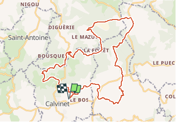
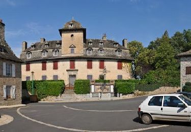
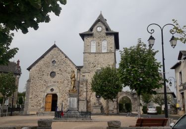
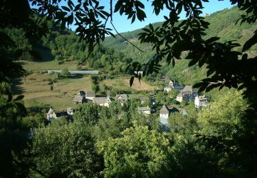
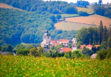
Trail Mountain bike of 24 km to be discovered at Auvergne-Rhône-Alpes, Cantal, Puycapel. This trail is proposed by tracegps.

Description

Joli petit circuit avec peu de route. Quelque beaux points de vue.

Elevation profile

Positioning

Country:
France
Region :
Auvergne-Rhône-Alpes
Department/Province :
Cantal
Municipality :
Puycapel
Location:
Calvinet
Start:(UTM)
449808 ; 4951960 (31T) N.

Comments

Please log in to post a review or rate the element


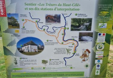
Très beau parcours varie avec beaucoup de sous bois agréables. Seul bémol, nous avons mis 3 h 30 au lieu des 2 h 30 prévue. Il faut une bonne forme pour 2 h 30 car il y a beaucoup de dénivelé !


Trails nearby

Trail Walking Sénezergues - promenade de la noix à Senezergues - Photo
Walking
alainlissac

Walking

Medium
(2)
Sénezergues, Auvergne-Rhône-Alpes, Cantal, France
10.9 km | 15.2 km-effort
3h 27min
Yes
Trail Running Puycapel - Mourjou Châtaigne 2013  - Photo
Running
tracegps

Running

Difficult
Puycapel, Auvergne-Rhône-Alpes, Cantal, France
11.6 km | 18 km-effort
2h 0min
Yes
Trail Walking Puycapel - Mourjou Châtaigne 2013  - Photo
Walking
tracegps

Walking

Medium
Puycapel, Auvergne-Rhône-Alpes, Cantal, France
11.6 km | 18 km-effort
2h 10min
Yes
Trail Walking Cassaniouze - cassaniouze st projet  - Photo
Walking
Sandrine 15

Walking

Very difficult
Cassaniouze, Auvergne-Rhône-Alpes, Cantal, France
13.6 km | 22 km-effort
2h 39min
Yes
Trail Walking Cassaniouze - cassaniouze st projet - Photo
Walking
yves12

Walking

Medium
Cassaniouze, Auvergne-Rhône-Alpes, Cantal, France
15.2 km | 24 km-effort
3h 52min
Yes
Trail Walking Cassaniouze - Cassaniouze - St Projet - Le chateau de Roquemaurel - Photo
Walking
tracegps

Walking

Difficult
Cassaniouze, Auvergne-Rhône-Alpes, Cantal, France
15.6 km | 26 km-effort
4h 0min
Yes
Trail Running Puycapel - Autour de Mourjou - Photo
Running
tracegps

Running

Medium
Puycapel, Auvergne-Rhône-Alpes, Cantal, France
19.5 km | 27 km-effort
2h 0min
No
Trail Walking Puycapel - Mourjou en Châtaigneraie  - Photo
Walking
topophil

Walking

Easy
Puycapel, Auvergne-Rhône-Alpes, Cantal, France
4.8 km | 6 km-effort
2h 12min
Yes
Trail Walking Puycapel - Mourjou - Photo
Walking
Midego

Walking

Easy
Puycapel, Auvergne-Rhône-Alpes, Cantal, France
3.5 km | 4.9 km-effort
1h 59min
Yes


Close
My subscriptions