Trail Equestrian Lobsann - Lobsann et alentours - Photo

Lobsann et alentours

 anniston
anniston

User

© OpenStreetMap contributors
Length
Length
22 km
Max alt
Max alt
353 m
Uphill gradient
Uphill gradient
424 m
Km-Effort
Km-Effort  
27 km
Min alt
Min alt
156 m
Downhill gradient
Downhill gradient
424 m
Boucle
Boucle
Yes
Creation date :
2019-01-15 18:37:42.303
Updated on :
2019-01-15 18:37:42.303

(0 Reviews)

Equestrian
Equestrian
3h24
Difficulty : Easy

Scan this QR Code to open this trail in the SityTrail application

FREE GPS app for hiking

Logo SityTrail SityTrail

IGN / Geographical institutes

Download SityTrail from the App Store Download SityTrail from Google Play

Logo SityTrail SityTrail World

The world is yours!

Download SityTrail from the App Store Download SityTrail from Google Play Download SityTrail on Huawei AppGallery

About

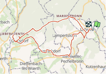
Trail Equestrian of 22 km to be discovered at Grand Est, Bas-Rhin, Lobsann. This trail is proposed by anniston.

Description

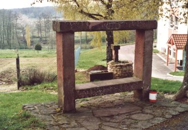
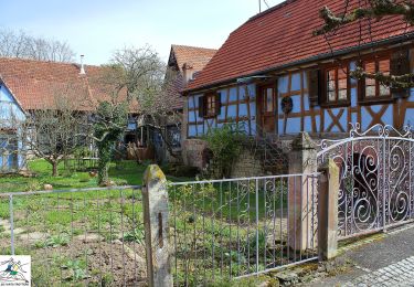
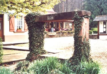
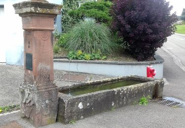
Balade accessible aux attelages (écartement 1,25m max en raison de la présence d'une chicane). Départ du parking du cimetierre de Lobsann. Pause de midi au restaurant le Palais Gourmand à Goersdorf ou pique-nique à la halte équestre de notre dame du chêne. Pas mal de macadam (tracé pour attelages) mais découverte de charmants villages.

Elevation profile

Points of interest

Point of interest Gœrsdorf - Chicane - Photo
anniston
GŒRSDORF 

Positioning

Country:
France
Region :
Grand Est
Department/Province :
Bas-Rhin
Municipality :
Lobsann
Location:
Unknown
Start:(UTM)
415879 ; 5423783 (32U) N.

Trails nearby

Trail Mountain bike Cleebourg - Petite sortie VTT sympa secteur Wissembourg - Photo
Mountain bike
tracegps

Mountain bike

Medium
(1)
Cleebourg, Grand Est, Bas-Rhin, France
23 km | 32 km-effort
2h 30min
Yes
Trail On foot Lembach - Anneau vert - Photo
On foot
PRO

On foot

Easy
Lembach, Grand Est, Bas-Rhin, France
3.8 km | 5.2 km-effort
1h 10min
Yes
Trail On foot Climbach - Triangle vert - Photo
On foot
PRO

On foot

Easy
Climbach, Grand Est, Bas-Rhin, France
10.3 km | 15 km-effort
3h 24min
No
Trail On foot Cleebourg - Disque jaune - Photo
On foot
PRO

On foot

Medium
Cleebourg, Grand Est, Bas-Rhin, France
20 km | 27 km-effort
6h 13min
No
Trail On foot Merkwiller-Pechelbronn - Croix bleue - Photo
On foot
PRO

On foot

Easy
Merkwiller-Pechelbronn, Grand Est, Bas-Rhin, France
9 km | 11.9 km-effort
2h 42min
No
Trail On foot Soultz-sous-Forêts - Triangle bleu - Photo
On foot
PRO

On foot

Easy
Soultz-sous-Forêts, Grand Est, Bas-Rhin, France
6.1 km | 7.2 km-effort
1h 38min
No
Trail On foot Lembach - Rectangle bleu barré de blanc - Photo
On foot
PRO

On foot

Easy
Lembach, Grand Est, Bas-Rhin, France
4 km | 6 km-effort
1h 21min
No
Trail On foot Soultz-sous-Forêts - Anneau jaune - Photo
On foot
PRO

On foot

Easy
Soultz-sous-Forêts, Grand Est, Bas-Rhin, France
5.4 km | 7.8 km-effort
1h 45min
Yes
Trail On foot Lembach - Rectangle jaune barré de blanc - Photo
On foot
PRO

On foot

Easy
Lembach, Grand Est, Bas-Rhin, France
11.8 km | 18.6 km-effort
4h 14min
No


Close
My subscriptions