Trail Mountain bike Berre-l'Étang - Berre - Cornillon - Photo
 tracegps
tracegps

User

© OpenStreetMap contributors
Length
Length
13.9 km
Max alt
Max alt
110 m
Uphill gradient
Uphill gradient
219 m
Km-Effort
Km-Effort  
16.7 km
Min alt
Min alt
9 m
Downhill gradient
Downhill gradient
161 m
Boucle
Boucle
No
Creation date :
2014-12-10 00:00:00.0
Updated on :
2014-12-10 00:00:00.0

(0 Reviews)

Mountain bike
Mountain bike
1h00
Difficulty : Difficult

Scan this QR Code to open this trail in the SityTrail application

FREE GPS app for hiking

Logo SityTrail SityTrail

IGN / Geographical institutes

Download SityTrail from the App Store Download SityTrail from Google Play

Logo SityTrail SityTrail World

The world is yours!

Download SityTrail from the App Store Download SityTrail from Google Play Download SityTrail on Huawei AppGallery

About

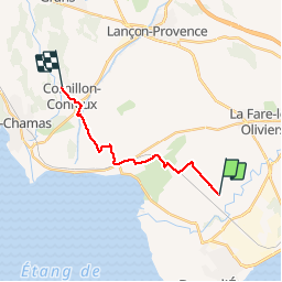
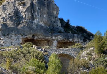
Trail Mountain bike of 13.9 km to be discovered at Provence-Alpes-Côte d'Azur, Bouches-du-Rhône, Berre-l'Étang. This trail is proposed by tracegps.

Description

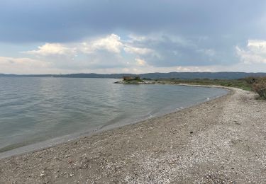
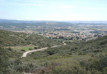
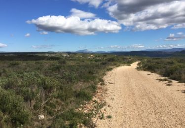
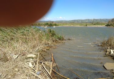
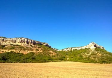
Le parcours part des Gravons, ensuite on attaque sur les chemins de Calissane, où plusieurs chemins se présentent, mais ça monte dur. Arrivé en haut on a un magnifique panorama sur l'étang de Berre et sur Salon .

Elevation profile

Photos

Positioning

Country:
France
Region :
Provence-Alpes-Côte d'Azur
Department/Province :
Bouches-du-Rhône
Municipality :
Berre-l'Étang
Location:
Unknown
Start:(Dec)
Start:(UTM)
675022 ; 4820518 (31T) N.

Trails nearby

Trail Walking La Fare-les-Oliviers - Castelas Bories - Photo
Walking
sereton

Walking

Easy
La Fare-les-Oliviers, Provence-Alpes-Côte d'Azur, Bouches-du-Rhône, France
10.2 km | 12.9 km-effort
2h 55min
No
Trail Walking La Fare-les-Oliviers - PF-La Fare-les-Oliviers - R - Variante - Photo
Walking
MicDul

Walking

La Fare-les-Oliviers, Provence-Alpes-Côte d'Azur, Bouches-du-Rhône, France
6.6 km | 8.8 km-effort
1h 50min
Yes
Trail Walking Berre-l'Étang - PF--Berre-l'Etang - La Randonnée des Amis - La petite Camargue berroise - Photo
Walking
MicDul

Walking

Easy
Berre-l'Étang, Provence-Alpes-Côte d'Azur, Bouches-du-Rhône, France
8.8 km | 9.2 km-effort
2h 30min
Yes
Trail Walking La Fare-les-Oliviers - PF-La Fare-les-Oliviers - J - Photo
Walking
MicDul

Walking

Easy
La Fare-les-Oliviers, Provence-Alpes-Côte d'Azur, Bouches-du-Rhône, France
9.5 km | 12.1 km-effort
2h 44min
Yes
Trail Walking Lançon-Provence - Ruine de Constantine - Chateau Virant - Photo
Walking
morthy25

Walking

Easy
Lançon-Provence, Provence-Alpes-Côte d'Azur, Bouches-du-Rhône, France
5.8 km | 8.2 km-effort
2h 15min
Yes
Trail Walking La Fare-les-Oliviers - PF-La-Fare-les-Oliviers - J - Variante 3 - Photo
Walking
MicDul

Walking

Easy
La Fare-les-Oliviers, Provence-Alpes-Côte d'Azur, Bouches-du-Rhône, France
8.9 km | 11.2 km-effort
1h 59min
Yes
Trail Walking Berre-l'Étang - berre - Photo
Walking
jo-ba

Walking

Very easy
Berre-l'Étang, Provence-Alpes-Côte d'Azur, Bouches-du-Rhône, France
9.4 km | 9.8 km-effort
4h 8min
Yes
Trail Mountain bike Rognac - VTT au plateau de Vitrolles - Photo
Mountain bike
tracegps

Mountain bike

Very difficult
Rognac, Provence-Alpes-Côte d'Azur, Bouches-du-Rhône, France
28 km | 33 km-effort
1h 40min
Yes
Trail Walking Berre-l'Étang - Berre la merveille emb de lArc - Photo
Walking
ego

Walking

Medium
Berre-l'Étang, Provence-Alpes-Côte d'Azur, Bouches-du-Rhône, France
9.2 km | 9.4 km-effort
2h 27min
Yes


Close
My subscriptions