Trail Walking Aydat - Fohet - Photo
 tracegps
tracegps

User

© OpenStreetMap contributors
Length
Length
17.7 km
Max alt
Max alt
1079 m
Uphill gradient
Uphill gradient
416 m
Km-Effort
Km-Effort  
23 km
Min alt
Min alt
836 m
Downhill gradient
Downhill gradient
417 m
Boucle
Boucle
Yes
Creation date :
2014-12-10 00:00:00.0
Updated on :
2014-12-10 00:00:00.0

(0 Reviews)

Walking
Walking
4h40
Difficulty : Medium

Scan this QR Code to open this trail in the SityTrail application

FREE GPS app for hiking

Logo SityTrail SityTrail

IGN / Geographical institutes

Download SityTrail from the App Store Download SityTrail from Google Play

Logo SityTrail SityTrail World

The world is yours!

Download SityTrail from the App Store Download SityTrail from Google Play Download SityTrail on Huawei AppGallery

About

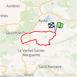
Trail Walking of 17.7 km to be discovered at Auvergne-Rhône-Alpes, Puy-de-Dôme, Aydat. This trail is proposed by tracegps.

Description

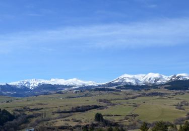
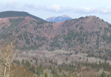
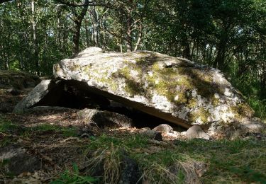
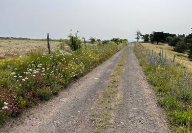
Départ à Fohet, commune d'Aydat, parking près de l'église. Le parcours entre 900 et 1100 mètres d'altitude traverse les hameaux ou villages de Prades, Fontmarcel, Monne, Mareuge et Zanières. Très très peu de goudron sur cet itinéraire varié, vallonné avec de multiples vues sur la chaîne des Puys.

Elevation profile

Photos

Points of interest

Point of interest Aydat - départ - Photo
tracegps
AYDAT 

Positioning

Country:
France
Region :
Auvergne-Rhône-Alpes
Department/Province :
Puy-de-Dôme
Municipality :
Aydat
Location:
Unknown
Start:(Dec)
Start:(UTM)
500300 ; 5054306 (31T) N.

Trails nearby

Trail Walking Le Vernet-Sainte-Marguerite - Vernet_Puy_Alou - Photo
Walking
GUIDE
jagarnier

Walking

Medium
(1)
Le Vernet-Sainte-Marguerite, Auvergne-Rhône-Alpes, Puy-de-Dôme, France
9.9 km | 13.1 km-effort
2h 50min
Yes
Trail Walking Aydat - LacAydatVeyreras_T - Photo
Walking
force

Walking

Very easy
(1)
Aydat, Auvergne-Rhône-Alpes, Puy-de-Dôme, France
11.1 km | 14.2 km-effort
3h 6min
Yes
Trail Walking Aydat - puy de Vichatel - Photo
Walking
bernardeau

Walking

Very easy
(1)
Aydat, Auvergne-Rhône-Alpes, Puy-de-Dôme, France
3.8 km | 5.8 km-effort
1h 13min
Yes
Trail On foot Le Vernet-Sainte-Marguerite - Le Puy d'Alou - Photo
On foot
PRO

On foot

Easy
Le Vernet-Sainte-Marguerite, Auvergne-Rhône-Alpes, Puy-de-Dôme, France
9.3 km | 12 km-effort
2h 43min
Yes
Trail On foot Aydat - Le Lac de la Cassière - Photo
On foot
PRO

On foot

Easy
Aydat, Auvergne-Rhône-Alpes, Puy-de-Dôme, France
3.2 km | 4 km-effort
54min
Yes
Trail Walking Aydat - Fohet_Landes - Photo
Walking
GUIDE
jagarnier

Walking

Medium
(1)
Aydat, Auvergne-Rhône-Alpes, Puy-de-Dôme, France
13.1 km | 16.8 km-effort
4h 0min
Yes
Trail Walking Le Vernet-Sainte-Marguerite - Autour du Puy d’Alou - Photo
Walking
Dalma Chuck

Walking

Medium
Le Vernet-Sainte-Marguerite, Auvergne-Rhône-Alpes, Puy-de-Dôme, France
5.6 km | 7 km-effort
1h 11min
Yes
Trail Walking Le Vernet-Sainte-Marguerite - Le Puy d’Alou - Photo
Walking
Dalma Chuck

Walking

Medium
Le Vernet-Sainte-Marguerite, Auvergne-Rhône-Alpes, Puy-de-Dôme, France
6.1 km | 8 km-effort
1h 15min
Yes
Trail On foot Aydat - Mont Redon - Photo
On foot
PRO

On foot

Easy
Aydat, Auvergne-Rhône-Alpes, Puy-de-Dôme, France
6.9 km | 9.9 km-effort
2h 14min
Yes


Close
My subscriptions