Trail Walking Vallées-en-Champagne - Fables et Champagne 2 - Photo
 tracegps
tracegps

User

© OpenStreetMap contributors
Length
Length
15.2 km
Max alt
Max alt
238 m
Uphill gradient
Uphill gradient
347 m
Km-Effort
Km-Effort  
19.8 km
Min alt
Min alt
86 m
Downhill gradient
Downhill gradient
343 m
Boucle
Boucle
No
Creation date :
2014-12-10 00:00:00.0
Updated on :
2014-12-10 00:00:00.0

(0 Reviews)

Walking
Walking
4h30
Difficulty : Very difficult

Scan this QR Code to open this trail in the SityTrail application

FREE GPS app for hiking

Logo SityTrail SityTrail

IGN / Geographical institutes

Download SityTrail from the App Store Download SityTrail from Google Play

Logo SityTrail SityTrail World

The world is yours!

Download SityTrail from the App Store Download SityTrail from Google Play Download SityTrail on Huawei AppGallery

About

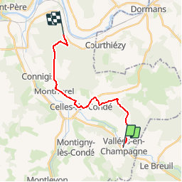
Trail Walking of 15.2 km to be discovered at Hauts-de-France, Aisne, Vallées-en-Champagne. This trail is proposed by tracegps.

Description

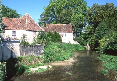
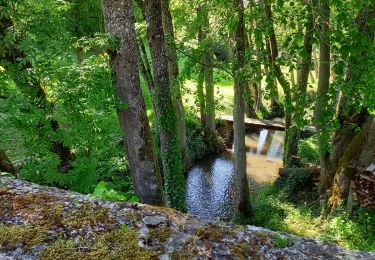
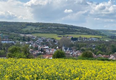
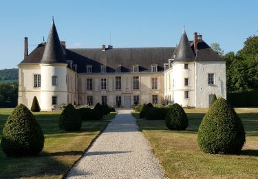
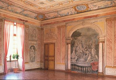
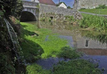
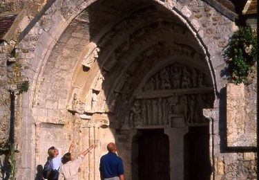
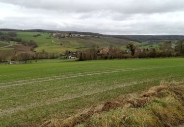
Un itinéraire d'eaux ruisselantes et de vins pétillants sur les traces de Jean de La Fontaine. Ce dernier était bon marcheur et de tempérament spirituel. On peut deviner qu'il trouva dans les pas bucoliques de sa charge forestière l'inspiration de bon nombre de ses vers. Jalonné de villages bien conservés (habitat en pierre meulière, églises, fontaines, lavoirs) et de caves à champagne, ce circuit peut être saisi d'un seul regard depuis le mémorial américain de la cote 204. En trois jours, on remonte les vallées viticoles de la Marne et du Surmelin, bénéficiant de larges vues sur les effets de relief du paysage. Toutes les infos sont ICI

Elevation profile

Positioning

Country:
France
Region :
Hauts-de-France
Department/Province :
Aisne
Municipality :
Vallées-en-Champagne
Location:
Unknown
Start:(UTM)
544918 ; 5426125 (31U) N.

Trails nearby

Trail Walking Condé-en-Brie - Le domaine des princes de Condé - Photo
Walking
tracegps

Walking

Very difficult
(1)
Condé-en-Brie, Hauts-de-France, Aisne, France
14.5 km | 19.1 km-effort
3h 30min
Yes
Trail Walking Pargny-la-Dhuys - Pargnys la Dhuys  - Photo
Walking
TURLUPIN2010

Walking

Medium
Pargny-la-Dhuys, Hauts-de-France, Aisne, France
12.4 km | 15.3 km-effort
4h 0min
No
Trail Walking Condé-en-Brie - Pargny la Dhuys - Photo
Walking
Tournan

Walking

Very easy
(1)
Condé-en-Brie, Hauts-de-France, Aisne, France
23 km | 30 km-effort
6h 20min
Yes
Trail Walking Condé-en-Brie - Boucle Condé en Brie  - Photo
Walking
NANE51

Walking

Medium
Condé-en-Brie, Hauts-de-France, Aisne, France
8.5 km | 10.9 km-effort
1h 47min
Yes
Trail Walking Condé-en-Brie - La vallée du Surmelin - Photo
Walking
fitz2014

Walking

Easy
Condé-en-Brie, Hauts-de-France, Aisne, France
10.6 km | 12.5 km-effort
2h 21min
Yes
Trail Mountain bike Condé-en-Brie - La vallée du Surmelin - Photo
Mountain bike
tracegps

Mountain bike

Very easy
Condé-en-Brie, Hauts-de-France, Aisne, France
26 km | 35 km-effort
4h 30min
Yes
Trail Walking Pargny-la-Dhuys - Le vallon de la verdonnelle - Photo
Walking
tracegps

Walking

Very difficult
Pargny-la-Dhuys, Hauts-de-France, Aisne, France
12.9 km | 16.1 km-effort
4h 0min
Yes
Trail Walking Monthurel - Les portes du paradis - Photo
Walking
tracegps

Walking

Very difficult
Monthurel, Hauts-de-France, Aisne, France
14.5 km | 18.6 km-effort
4h 15min
Yes
Trail Walking Vallées-en-Champagne - La Chapelle-Monthodon du 14-12-2023 - Photo
Walking
VANDERPUTTENMi

Walking

Difficult
Vallées-en-Champagne, Hauts-de-France, Aisne, France
9.3 km | 12 km-effort
2h 7min
Yes


Close
My subscriptions