Trail Walking Vailly-sur-Aisne - Les roches de l'Abondin - Photo

Les roches de l'Abondin

 tracegps
tracegps

User

© OpenStreetMap contributors
Length
Length
9.8 km
Max alt
Max alt
182 m
Uphill gradient
Uphill gradient
256 m
Km-Effort
Km-Effort  
13.2 km
Min alt
Min alt
52 m
Downhill gradient
Downhill gradient
259 m
Boucle
Boucle
Yes
Creation date :
2014-12-10 00:00:00.0
Updated on :
2014-12-10 00:00:00.0

(1 Reviews)

Walking
Walking
3h00
Difficulty : Very difficult

Scan this QR Code to open this trail in the SityTrail application

FREE GPS app for hiking

Logo SityTrail SityTrail

IGN / Geographical institutes

Download SityTrail from the App Store Download SityTrail from Google Play

Logo SityTrail SityTrail World

The world is yours!

Download SityTrail from the App Store Download SityTrail from Google Play Download SityTrail on Huawei AppGallery

About

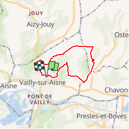
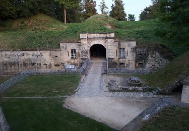
Trail Walking of 9.8 km to be discovered at Hauts-de-France, Aisne, Vailly-sur-Aisne. This trail is proposed by tracegps.

Description

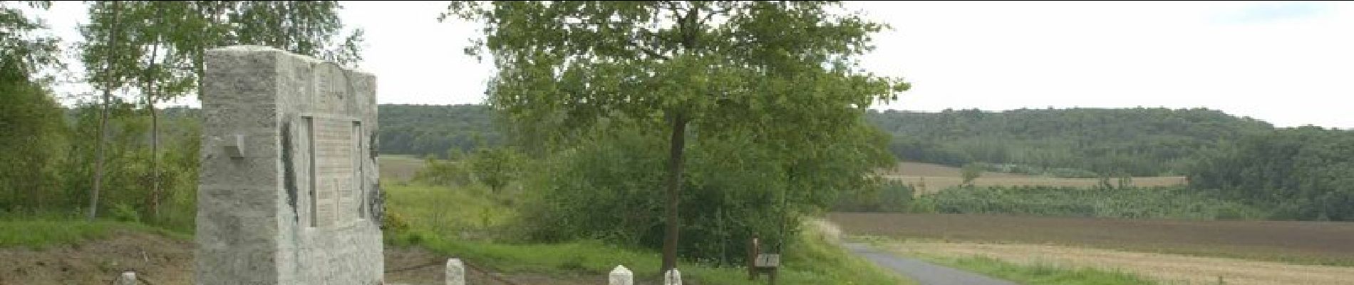
Une balade pour décourvrir la richesse du paysage qui environne Vailly-sur-Aisne, son quartier de Saint-Précord, avec son lavoir et son calvaire, et le monument des aviateurs à Ostel. Toutes les infos sont ICI

Elevation profile

Photos

Positioning

Country:
France
Region :
Hauts-de-France
Department/Province :
Aisne
Municipality :
Vailly-sur-Aisne
Location:
Unknown
Start:(UTM)
537673 ; 5473245 (31U) N.

Comments

Please log in to post a review or rate the element


Trails nearby

Trail Walking Chivres-Val - Fort de condé - chivres - Photo
Walking
fitz2014

Walking

Very difficult
(1)
Chivres-Val, Hauts-de-France, Aisne, France
18 km | 22 km-effort
4h 48min
Yes
Trail Walking Aizy-Jouy - grand tour dans la foret derruere chez nous - Photo
Walking
Angele02

Walking

Medium
Aizy-Jouy, Hauts-de-France, Aisne, France
4.6 km | 6.1 km-effort
1h 44min
Yes
Trail Walking Aizy-Jouy - l assaut du chemin des dames - Photo
Walking
hm

Walking

Medium
Aizy-Jouy, Hauts-de-France, Aisne, France
12.4 km | 15.7 km-effort
2h 53min
Yes
Trail Walking Chivres-Val - 11 la fontaine St ouen - Photo
Walking
fitz2014

Walking

Medium
Chivres-Val, Hauts-de-France, Aisne, France
14.1 km | 17.5 km-effort
3h 53min
Yes
Trail Walking Chivres-Val - Autour du fort de Condé - Photo
Walking

Walking

Very easy
Chivres-Val, Hauts-de-France, Aisne, France
939 m | 999 m-effort
Unknown
Yes
Trail Walking Chivres-Val - Chivres Val - La Fontaine de St Ouen - Photo
Walking
tracegps

Walking

Medium
Chivres-Val, Hauts-de-France, Aisne, France
12 km | 15.1 km-effort
4h 0min
No
Trail Walking Chassemy - Chassemy - Le temps perdu - Photo
Walking
tracegps

Walking

Medium
Chassemy, Hauts-de-France, Aisne, France
14.3 km | 17.5 km-effort
3h 45min
Yes
Trail Walking Aizy-Jouy - A l'assaut du chemin des Dames - Photo
Walking
tracegps

Walking

Difficult
Aizy-Jouy, Hauts-de-France, Aisne, France
12.1 km | 15.4 km-effort
4h 0min
Yes
Trail Walking Chivres-Val - la fontaine de Saint - Ouen . - Photo
Walking
José800

Walking

Difficult
Chivres-Val, Hauts-de-France, Aisne, France
12.6 km | 15.7 km-effort
3h 33min
Yes


Close
My subscriptions