Trail Walking Étreux - Le Canal - variante - Photo

Le Canal - variante

 tracegps
tracegps

User

© OpenStreetMap contributors
Length
Length
10.2 km
Max alt
Max alt
159 m
Uphill gradient
Uphill gradient
77 m
Km-Effort
Km-Effort  
11.2 km
Min alt
Min alt
122 m
Downhill gradient
Downhill gradient
77 m
Boucle
Boucle
Yes
Creation date :
2014-12-10 00:00:00.0
Updated on :
2014-12-10 00:00:00.0

(0 Reviews)

Walking
Walking
2h30
Difficulty : Medium

Scan this QR Code to open this trail in the SityTrail application

FREE GPS app for hiking

Logo SityTrail SityTrail

IGN / Geographical institutes

Download SityTrail from the App Store Download SityTrail from Google Play

Logo SityTrail SityTrail World

The world is yours!

Download SityTrail from the App Store Download SityTrail from Google Play Download SityTrail on Huawei AppGallery

About

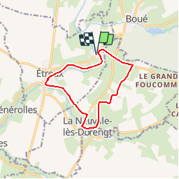
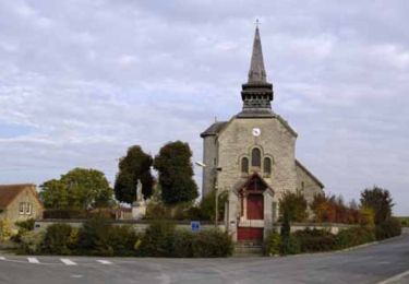
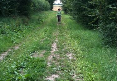
Trail Walking of 10.2 km to be discovered at Hauts-de-France, Aisne, Étreux. This trail is proposed by tracegps.

Description

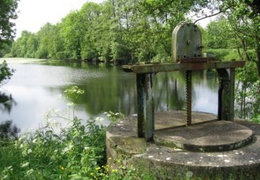
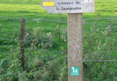
Au départ de la halte nautique du Gard, cette balade musarde le long de la partie amont du canal de la Sambre à l'Oise, ponctuée par neuf écluses : autant de possiblités d'observer les bateaux de marchandises et de plaisance. Toutes les infos sont ICI

Elevation profile

Positioning

Country:
France
Region :
Hauts-de-France
Department/Province :
Aisne
Municipality :
Étreux
Location:
Unknown
Start:(UTM)
548777 ; 5538932 (31U) N.

Trails nearby

Trail Walking Rejet-de-Beaulieu - Circuit du canal de la Sambre à l'Oise. (Rejet-de-Beaulieu) - Photo
Walking
tracegps

Walking

Easy
Rejet-de-Beaulieu, Hauts-de-France, Nord, France
6.4 km | 7 km-effort
1h 40min
Yes
Trail Walking Étreux - Le Canal - Photo
Walking
tracegps

Walking

Medium
(1)
Étreux, Hauts-de-France, Aisne, France
12.5 km | 13.8 km-effort
3h 15min
Yes
Trail Walking Rejet-de-Beaulieu - rejet de Beaulieu - Photo
Walking
julienfayeulle

Walking

Very easy
Rejet-de-Beaulieu, Hauts-de-France, Nord, France
3.9 km | 4.3 km-effort
Unknown
Yes
Trail Walking Boué - Le sentier de Bo-we - Photo
Walking

Walking

Very easy
Boué, Hauts-de-France, Aisne, France
971 m | 1.1 km-effort
Unknown
No
Trail Walking Rejet-de-Beaulieu - Sentier du ruisseau de Gourgouche  (Rejet-de-Beaulieu) - Photo
Walking
tracegps

Walking

Easy
Rejet-de-Beaulieu, Hauts-de-France, Nord, France
2.7 km | 3 km-effort
45min
Yes
Trail Walking Fesmy-le-Sart - fesmy_le _sars - Photo
Walking
Michel Zante

Walking

Very easy
(1)
Fesmy-le-Sart, Hauts-de-France, Aisne, France
10.5 km | 11.5 km-effort
2h 27min
Yes
Trail Walking La Neuville-lès-Dorengt - boué ballade le long du cana - Photo
Walking
aspriet

Walking

Very easy
La Neuville-lès-Dorengt, Hauts-de-France, Aisne, France
11.7 km | 12.9 km-effort
2h 41min
No
Trail Running Boué - boué  - Photo
Running
aspriet

Running

Very easy
Boué, Hauts-de-France, Aisne, France
10.8 km | 12.4 km-effort
1h 14min
Yes


Close
My subscriptions