Trail Walking Conques-en-Rouergue - Noailhac - Livinhac le Haut - Chemin de St-Jacques de Compostelle - Photo

Noailhac - Livinhac le Haut - Chemin de St-Jacques de Compostelle

 tracegps
tracegps

User

© OpenStreetMap contributors
Length
Length
16.8 km
Max alt
Max alt
639 m
Uphill gradient
Uphill gradient
384 m
Km-Effort
Km-Effort  
23 km
Min alt
Min alt
177 m
Downhill gradient
Downhill gradient
687 m
Boucle
Boucle
No
Creation date :
2014-12-10 00:00:00.0
Updated on :
2014-12-10 00:00:00.0

(1 Reviews)

Walking
Walking
3h00
Difficulty : Difficult

Scan this QR Code to open this trail in the SityTrail application

FREE GPS app for hiking

Logo SityTrail SityTrail

IGN / Geographical institutes

Download SityTrail from the App Store Download SityTrail from Google Play

Logo SityTrail SityTrail World

The world is yours!

Download SityTrail from the App Store Download SityTrail from Google Play Download SityTrail on Huawei AppGallery

About

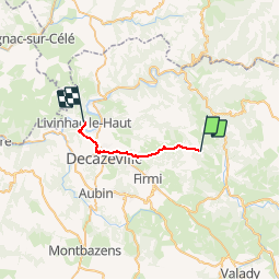
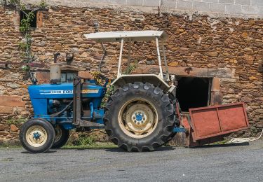
Trail Walking of 16.8 km to be discovered at Occitania, Aveyron, Conques-en-Rouergue. This trail is proposed by tracegps.

Description

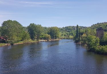
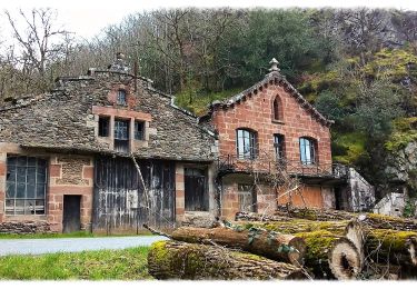
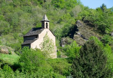
Onzième étape sur notre Chemin de Compostelle qui nous mène de Noailhac à Livinhac le Haut. (Km 213,883 à Km 230,75) D’autres informations et photos sur le Chemin de Compostelle sont disponibles ICI Balade proposée par « Les Balades et Randonnées de Fred »

Elevation profile

Photos

Positioning

Country:
France
Region :
Occitania
Department/Province :
Aveyron
Municipality :
Conques-en-Rouergue
Location:
Unknown
Start:(UTM)
450441 ; 4934855 (31T) N.

Comments

Please log in to post a review or rate the element


Trails nearby

Trail On foot Conques-en-Rouergue - TerraTrail 7 - Photo
On foot
PRO

On foot

Easy
Conques-en-Rouergue, Occitania, Aveyron, France
9.4 km | 15.8 km-effort
3h 36min
Yes
Trail On foot Conques-en-Rouergue - Terra Trail 4 - Photo
On foot
PRO

On foot

Easy
Conques-en-Rouergue, Occitania, Aveyron, France
10.3 km | 16 km-effort
3h 38min
Yes
Trail On foot Conques-en-Rouergue - Terra Trail 13 - Photo
On foot
PRO

On foot

Medium
Conques-en-Rouergue, Occitania, Aveyron, France
18 km | 27 km-effort
6h 11min
Yes
Trail Walking Conques-en-Rouergue - Conques Levinhac le Haut Avril 2018 - Photo
Walking
GUIDE
Kargil

Walking

Difficult
Conques-en-Rouergue, Occitania, Aveyron, France
25 km | 36 km-effort
7h 4min
No
Trail Walking Conques-en-Rouergue - Conques  - Photo
Walking
GUIDE
antignacs

Walking

Very easy
Conques-en-Rouergue, Occitania, Aveyron, France
10.9 km | 16.3 km-effort
3h 2min
Yes
Trail On foot Conques-en-Rouergue - Le Chemin de l'Oiseau - Photo
On foot
PRO

On foot

Easy
Conques-en-Rouergue, Occitania, Aveyron, France
5 km | 7.9 km-effort
1h 47min
Yes
Trail On foot Conques-en-Rouergue - Sentier Conques - Grand-Vabre - Photo
On foot
PRO

On foot

Easy
Conques-en-Rouergue, Occitania, Aveyron, France
4.9 km | 6.4 km-effort
1h 27min
No
Trail On foot Conques-en-Rouergue - Le Sentier de Saint-Roch - Photo
On foot
PRO

On foot

Easy
Conques-en-Rouergue, Occitania, Aveyron, France
7.5 km | 11.3 km-effort
2h 33min
No
Trail On foot Conques-en-Rouergue - Chapelle Sainte-Foy - Photo
On foot
PRO

On foot

Easy
Conques-en-Rouergue, Occitania, Aveyron, France
5.8 km | 10.4 km-effort
2h 22min
No


Close
My subscriptions