Trail Walking Cobrieux - Circuit de la Commanderie à Cobrieux - Photo

Circuit de la Commanderie à Cobrieux

 tracegps
tracegps

User

© OpenStreetMap contributors
Length
Length
11.8 km
Max alt
Max alt
67 m
Uphill gradient
Uphill gradient
84 m
Km-Effort
Km-Effort  
12.9 km
Min alt
Min alt
31 m
Downhill gradient
Downhill gradient
85 m
Boucle
Boucle
Yes
Creation date :
2014-12-10 00:00:00.0
Updated on :
2014-12-10 00:00:00.0

(1 Reviews)

Walking
Walking
3h00
Difficulty : Medium

Scan this QR Code to open this trail in the SityTrail application

FREE GPS app for hiking

Logo SityTrail SityTrail

IGN / Geographical institutes

Download SityTrail from the App Store Download SityTrail from Google Play

Logo SityTrail SityTrail World

The world is yours!

Download SityTrail from the App Store Download SityTrail from Google Play Download SityTrail on Huawei AppGallery

About

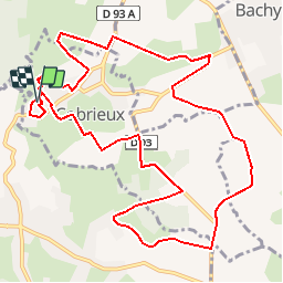
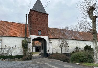
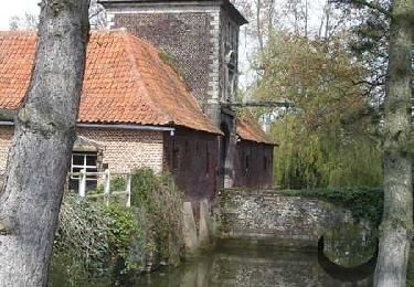
Trail Walking of 11.8 km to be discovered at Hauts-de-France, Nord, Cobrieux. This trail is proposed by tracegps.

Description

Départ de la salle communale (prés de l’église). Vous pouvez trouver le descriptif et le plan du circuit sur le site de la communauté de communes du pays de Pévèle. Ce circuit a été numérisé par les randonneurs du CODEPEM.

Elevation profile

Photos

Positioning

Country:
France
Region :
Hauts-de-France
Department/Province :
Nord
Municipality :
Cobrieux
Location:
Unknown
Start:(UTM)
515970 ; 5599041 (31U) N.

Comments

Please log in to post a review or rate the element


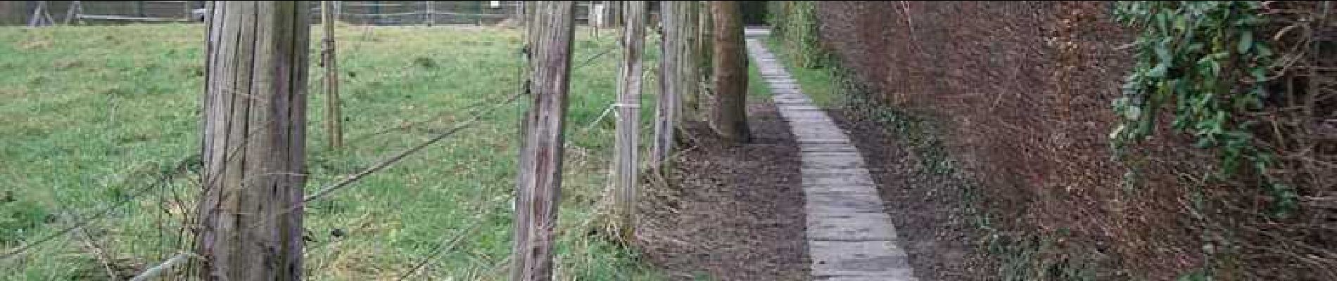
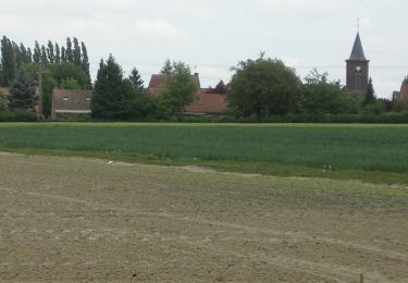
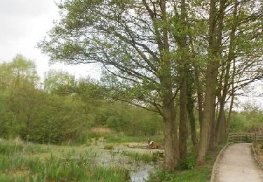
Agréable randonnée. Faire attentions aux parties sur la départementale. La partie qui traverse les bois est boueux par fortes pluies. Attention au balisage qui n'est pas toujours le même que cette carte, surtout au cimetière où il faut tourner à gauche.


Trails nearby

Trail Mountain bike Bachy - De Bachy à Gruson   - Photo
Mountain bike
tracegps

Mountain bike

Medium
(1)
Bachy, Hauts-de-France, Nord, France
21 km | 23 km-effort
1h 30min
Yes
Trail Equestrian Cappelle-en-Pévèle - Boucle des Pavés - Capelle en Pévèle  - Photo
Equestrian
tracegps

Equestrian

Medium
(1)
Cappelle-en-Pévèle, Hauts-de-France, Nord, France
17.7 km | 18.7 km-effort
2h 45min
Yes
Trail Walking Péronne-en-Mélantois - Péronne en Mélantois et ses marais - Photo
Walking
tracegps

Walking

Medium
(1)
Péronne-en-Mélantois, Hauts-de-France, Nord, France
13.1 km | 14 km-effort
3h 15min
Yes
Trail Walking Fretin - Mélantois - La Marque - Photo
Walking
Greg813

Walking

Easy
(1)
Fretin, Hauts-de-France, Nord, France
13.9 km | 14.9 km-effort
3h 10min
Yes
Trail Walking Cobrieux - cobrieux - Photo
Walking
Templeuveenmarche

Walking

Very easy
(1)
Cobrieux, Hauts-de-France, Nord, France
9.5 km | 10.4 km-effort
56min
Yes
Trail Walking Bachy - sur les pas de Monique, version officielle - Photo
Walking
papiou

Walking

Medium
Bachy, Hauts-de-France, Nord, France
11 km | 11.8 km-effort
2h 30min
Yes
Trail Walking Bouvines - Bouvines 16,2 km - Photo
Walking
GUIDE
rvapeldo

Walking

Easy
Bouvines, Hauts-de-France, Nord, France
16.2 km | 17.3 km-effort
4h 26min
Yes
Trail Cycle Bouvines - Sur les traces des batailles de Bouvines et Mons-en-Pévèle - Photo
Cycle
tracegps

Cycle

Medium
Bouvines, Hauts-de-France, Nord, France
43 km | 46 km-effort
4h 0min
Yes
Trail Walking Péronne-en-Mélantois - Circuit du Marais - Péronne en Mélantois - Photo
Walking
tracegps

Walking

Easy
Péronne-en-Mélantois, Hauts-de-France, Nord, France
7.1 km | 7.5 km-effort
2h 0min
Yes


Close
My subscriptions