Trail Walking Beauquesne - Le Tortillard (variante courte) - Photo

Le Tortillard (variante courte)

 tracegps
tracegps

User

© OpenStreetMap contributors
Length
Length
8.7 km
Max alt
Max alt
145 m
Uphill gradient
Uphill gradient
75 m
Km-Effort
Km-Effort  
9.7 km
Min alt
Min alt
95 m
Downhill gradient
Downhill gradient
75 m
Boucle
Boucle
Yes
Creation date :
2014-12-10 00:00:00.0
Updated on :
2014-12-10 00:00:00.0

(0 Reviews)

Walking
Walking
2h30
Difficulty : Medium

Scan this QR Code to open this trail in the SityTrail application

FREE GPS app for hiking

Logo SityTrail SityTrail

IGN / Geographical institutes

Download SityTrail from the App Store Download SityTrail from Google Play

Logo SityTrail SityTrail World

The world is yours!

Download SityTrail from the App Store Download SityTrail from Google Play Download SityTrail on Huawei AppGallery

About

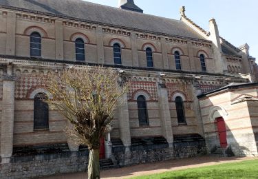
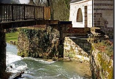
Trail Walking of 8.7 km to be discovered at Hauts-de-France, Somme, Beauquesne. This trail is proposed by tracegps.

Description

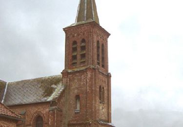
Si les chênes ayant inspiré le nom de ce village y poussent toujours, le train qui y passait naguère a disparu. Pour télécharger la fiche du circuit en format pdf.

Elevation profile

Photos

Positioning

Country:
France
Region :
Hauts-de-France
Department/Province :
Somme
Municipality :
Beauquesne
Location:
Unknown
Start:(UTM)
456781 ; 5549101 (31U) N.

Trails nearby

Trail On foot Beauval - Le Tortillard - Photo
On foot
PRO

On foot

Easy
Beauval, Hauts-de-France, Somme, France
10.5 km | 11.9 km-effort
2h 42min
Yes
Trail Walking Thièvres - Sentier de la montagne - Thièvres - Photo
Walking
tracegps

Walking

Medium
Thièvres, Hauts-de-France, Somme, France
8.7 km | 10.1 km-effort
2h 10min
Yes
Trail Walking Thièvres - Sentier du Fay - Grand-Rullecourt - Photo
Walking
tracegps

Walking

Very difficult
Thièvres, Hauts-de-France, Somme, France
8.7 km | 10.1 km-effort
4h 25min
Yes
Trail Walking Thièvres - THIEVRES - Circuit de l'arbre de Cocagne - Photo
Walking
temmichel

Walking

Medium
Thièvres, Hauts-de-France, Pas-de-Calais, France
8.8 km | 10.6 km-effort
2h 24min
Yes
Trail Walking Puchevillers - PUCHEVILLERS (80) - CVCircuit de la Montagne Bergère - Photo
Walking
temmichel

Walking

Difficult
Puchevillers, Hauts-de-France, Somme, France
11.6 km | 14 km-effort
3h 11min
Yes
Trail On foot Raincheval - Circuit du Château de Raincheval - Photo
On foot
PRO

On foot

Easy
Raincheval, Hauts-de-France, Somme, France
5.9 km | 7 km-effort
1h 35min
Yes
Trail Walking Beauquesne - Le Tortillard - Photo
Walking
tracegps

Walking

Medium
Beauquesne, Hauts-de-France, Somme, France
11.7 km | 13.2 km-effort
4h 0min
Yes
Trail Walking Thièvres - kjv - Photo
Walking
a.catteau

Walking

Very easy
Thièvres, Hauts-de-France, Somme, France
9 km | 10.4 km-effort
2h 39min
Yes


Close
My subscriptions