


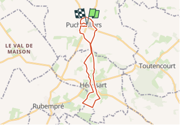

11.7 km | 14.1 km-effort


User


FREE GPS app for hiking
 SityTrail
IGN / Geographical institutes
SityTrail World
The world is yours!
Trail Walking of 11.6 km to be discovered at Hauts-de-France, Somme, Puchevillers. This trail is proposed by temmichel.
Randonnées au pays du coquelicot haut lieu des batailles de la somme durant la première guerre mondiale
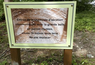
 - CVCircuit de la Montagne Bergère - Photo 1")
On foot

On foot
On foot

On foot

Walking

Walking

On foot

Mountain bike
