Trail Walking Ennevelin - Circuit d'Aigremont - Photo

Circuit d'Aigremont

 tracegps
tracegps

User

© OpenStreetMap contributors
Length
Length
11.1 km
Max alt
Max alt
36 m
Uphill gradient
Uphill gradient
55 m
Km-Effort
Km-Effort  
11.8 km
Min alt
Min alt
26 m
Downhill gradient
Downhill gradient
54 m
Boucle
Boucle
Yes
Creation date :
2014-12-10 00:00:00.0
Updated on :
2014-12-10 00:00:00.0

(1 Reviews)

Walking
Walking
2h45
Difficulty : Medium

Scan this QR Code to open this trail in the SityTrail application

FREE GPS app for hiking

Logo SityTrail SityTrail

IGN / Geographical institutes

Download SityTrail from the App Store Download SityTrail from Google Play

Logo SityTrail SityTrail World

The world is yours!

Download SityTrail from the App Store Download SityTrail from Google Play Download SityTrail on Huawei AppGallery

About

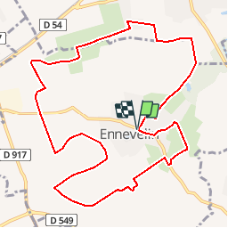
Trail Walking of 11.1 km to be discovered at Hauts-de-France, Nord, Ennevelin. This trail is proposed by tracegps.

Description

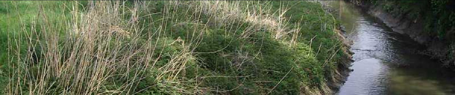
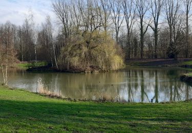
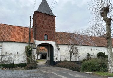
Départ du parking du centre ville d’Ennevelin. Circuit sans difficulté qui traverse les champs et zones humides du val de Marque. Vous pourrez voir la ferme d’Aigremont, avec le porche en forme de tour-pigeonnier. Retrouvez ce circuit sur le site du Comité Départemental du Tourisme du Nord. Ce circuit a été numérisé par les randonneurs du CODEPEM.

Elevation profile

Photos

Positioning

Country:
France
Region :
Hauts-de-France
Department/Province :
Nord
Municipality :
Ennevelin
Location:
Unknown
Start:(UTM)
509039 ; 5598713 (31U) N.

Comments

Please log in to post a review or rate the element


Trails nearby

Trail Equestrian Cappelle-en-Pévèle - Boucle des Pavés - Capelle en Pévèle  - Photo
Equestrian
tracegps

Equestrian

Medium
(1)
Cappelle-en-Pévèle, Hauts-de-France, Nord, France
17.7 km | 18.7 km-effort
2h 45min
Yes
Trail Walking Péronne-en-Mélantois - Péronne en Mélantois et ses marais - Photo
Walking
tracegps

Walking

Medium
(1)
Péronne-en-Mélantois, Hauts-de-France, Nord, France
13.1 km | 14 km-effort
3h 15min
Yes
Trail Walking Fretin - Mélantois - La Marque - Photo
Walking
Greg813

Walking

Easy
(1)
Fretin, Hauts-de-France, Nord, France
13.9 km | 14.9 km-effort
3h 10min
Yes
Trail Walking Fretin - Sur les traces de Philippe II Auguste - Photo
Walking

Walking

Easy
(1)
Fretin, Hauts-de-France, Nord, France
26 km | 28 km-effort
5h 12min
Yes
Trail Walking Fretin - fretin et ses marais - Photo
Walking
dehemjacques

Walking

Easy
(2)
Fretin, Hauts-de-France, Nord, France
12 km | 12.7 km-effort
2h 31min
Yes
Trail Walking Bouvines - Bouvines 16,2 km - Photo
Walking
GUIDE
rvapeldo

Walking

Easy
Bouvines, Hauts-de-France, Nord, France
16.2 km | 17.3 km-effort
4h 26min
Yes
Trail Walking Avelin - circuit des chicons - Photo
Walking
dehemjacques

Walking

Easy
Avelin, Hauts-de-France, Nord, France
11.7 km | 12.5 km-effort
2h 21min
Yes
Trail On foot Fretin - Fretin - Seclin par le GR121B (option Phalempin) - Photo
On foot

On foot

Medium
Fretin, Hauts-de-France, Nord, France
23 km | 25 km-effort
5h 41min
No
Trail Walking Fretin - Trajet simple FRETIN -121b - MARCQ - Photo
Walking

Walking

Medium
Fretin, Hauts-de-France, Nord, France
31 km | 34 km-effort
6h 0min
No


Close
My subscriptions