Trail Walking Ercé - Les Ecureuils autour de Cominac - Photo

Les Ecureuils autour de Cominac

 tracegps
tracegps

User

© OpenStreetMap contributors
Length
Length
8.5 km
Max alt
Max alt
1067 m
Uphill gradient
Uphill gradient
329 m
Km-Effort
Km-Effort  
12.9 km
Min alt
Min alt
734 m
Downhill gradient
Downhill gradient
339 m
Boucle
Boucle
Yes
Creation date :
2014-12-10 00:00:00.0
Updated on :
2014-12-10 00:00:00.0

(0 Reviews)

Walking
Walking
2h30
Difficulty : Medium

Scan this QR Code to open this trail in the SityTrail application

FREE GPS app for hiking

Logo SityTrail SityTrail

IGN / Geographical institutes

Download SityTrail from the App Store Download SityTrail from Google Play

Logo SityTrail SityTrail World

The world is yours!

Download SityTrail from the App Store Download SityTrail from Google Play Download SityTrail on Huawei AppGallery

About

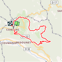
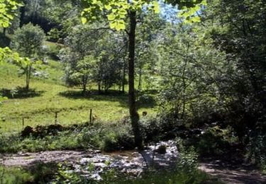
Trail Walking of 8.5 km to be discovered at Occitania, Ariège, Ercé. This trail is proposed by tracegps.

Description

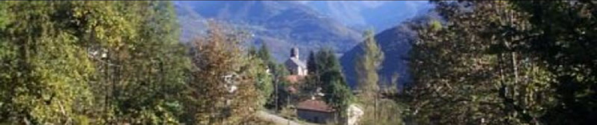
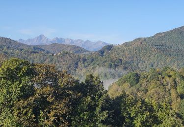
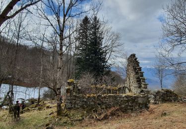
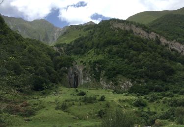
Grand comme trois fois la ville de Paris, le Haut-Couserans se situe au coeur des Pyrénées Ariègeoises à 1h30 de Toulouse. Son environnement naturel et bâtit exceptionnellement préservé, variant de 463m à 2865m, est à découvrir. Les Ecureuils autour de Cominac. Un site architectural classé, un panorama exceptionnel sur les hauts sommets. Découverte du plateau pastoral de Cominac. D’Oust, prendre la route d’Aulus sur 500m. Tourner à gauche à la 1ère intersection, direction Col de Saraillé. A l’entrée du hameau de Cominac continuer à gauche vers le col. Départ 200m après la cabine téléphonique. Parking au village.

Elevation profile

Photos

Positioning

Country:
France
Region :
Occitania
Department/Province :
Ariège
Municipality :
Ercé
Location:
Unknown
Start:(UTM)
358144 ; 4747481 (31T) N.

Trails nearby

Trail Walking Biert - Boucle de Ouert (n°14) - Photo
Walking
chrisgps

Walking

Very easy
Biert, Occitania, Ariège, France
12 km | 20 km-effort
5h 54min
Yes
Trail Walking Ercé - Tuc de la Coume en boucle (2ème) - Photo
Walking
chrisgps

Walking

Medium
Ercé, Occitania, Ariège, France
10.4 km | 21 km-effort
6h 12min
Yes
Trail Walking Oust - Estour et Artigue - Photo
Walking
altaya

Walking

Medium
Oust, Occitania, Ariège, France
27 km | 49 km-effort
6h 37min
No
Trail Mountain bike Soueix-Rogalle - La Vallée de Laspieng - Photo
Mountain bike
tracegps

Mountain bike

Medium
Soueix-Rogalle, Occitania, Ariège, France
10.3 km | 16.6 km-effort
1h 49min
Yes
Trail Walking Soueix-Rogalle - La Vallée de Laspieng - Photo
Walking
tracegps

Walking

Difficult
Soueix-Rogalle, Occitania, Ariège, France
10.3 km | 16.6 km-effort
3h 49min
Yes
Trail Mountain bike Ercé - Les Estives d'Ercé - Photo
Mountain bike
tracegps

Mountain bike

Medium
Ercé, Occitania, Ariège, France
10.9 km | 18.9 km-effort
2h 0min
Yes
Trail Walking Ercé - Les Estives d'Ercé - Photo
Walking
tracegps

Walking

Medium
Ercé, Occitania, Ariège, France
10.9 km | 18.9 km-effort
4h 0min
Yes
Trail Walking Ercé - Le tour du Régudé - Photo
Walking
tracegps

Walking

Difficult
Ercé, Occitania, Ariège, France
14.7 km | 22 km-effort
4h 49min
Yes
Trail Mountain bike Ercé - La Pastorale - Photo
Mountain bike
tracegps

Mountain bike

Medium
Ercé, Occitania, Ariège, France
8.2 km | 13.6 km-effort
1h 30min
Yes


Close
My subscriptions