


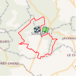

8.1 km | 10.5 km-effort


User


FREE GPS app for hiking
 SityTrail
IGN / Geographical institutes
SityTrail World
The world is yours!
Trail Walking of 14.4 km to be discovered at Grand Est, Aube, Sommeval. This trail is proposed by tracegps.
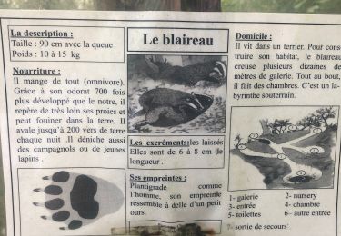
Les Randonnées Thématiques du Comité Régional du Tourisme de Champagne-Ardenne Le sentier du Loup en pays d’Othe Ce circuit, au départ de Sommeval, vous emmènera dans les sous bois du pays d’Othe, sur les chemins empruntés jadis par de nombreuses meutes de loups. Découvrez ainsi les légendes locales qu’ils ont fait naître, comme celle des « Voirloups ».


Walking
Walking

Walking
Walking
Walking
Walking
Walking

Walking
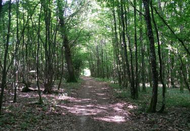
sentier très agréable, très bien balisé et sans difficulté particulière ; le faire par temps de grosse chaleur est un réel plaisir, car il est la plupart du temps très ombragé