Trail Walking Cauterets - Le Pic de Monné de Cauterets 2724m - Photo

Le Pic de Monné de Cauterets 2724m

 tracegps
tracegps

User

© OpenStreetMap contributors
Length
Length
15.1 km
Max alt
Max alt
2684 m
Uphill gradient
Uphill gradient
1444 m
Km-Effort
Km-Effort  
34 km
Min alt
Min alt
1255 m
Downhill gradient
Downhill gradient
1444 m
Boucle
Boucle
Yes
Creation date :
2014-12-10 00:00:00.0
Updated on :
2014-12-10 00:00:00.0

(0 Reviews)

Walking
Walking
7h00
Difficulty : Difficult

Scan this QR Code to open this trail in the SityTrail application

FREE GPS app for hiking

Logo SityTrail SityTrail

IGN / Geographical institutes

Download SityTrail from the App Store Download SityTrail from Google Play

Logo SityTrail SityTrail World

The world is yours!

Download SityTrail from the App Store Download SityTrail from Google Play Download SityTrail on Huawei AppGallery

About

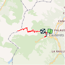
Trail Walking of 15.1 km to be discovered at Occitania, Hautespyrenees, Cauterets. This trail is proposed by tracegps.

Description

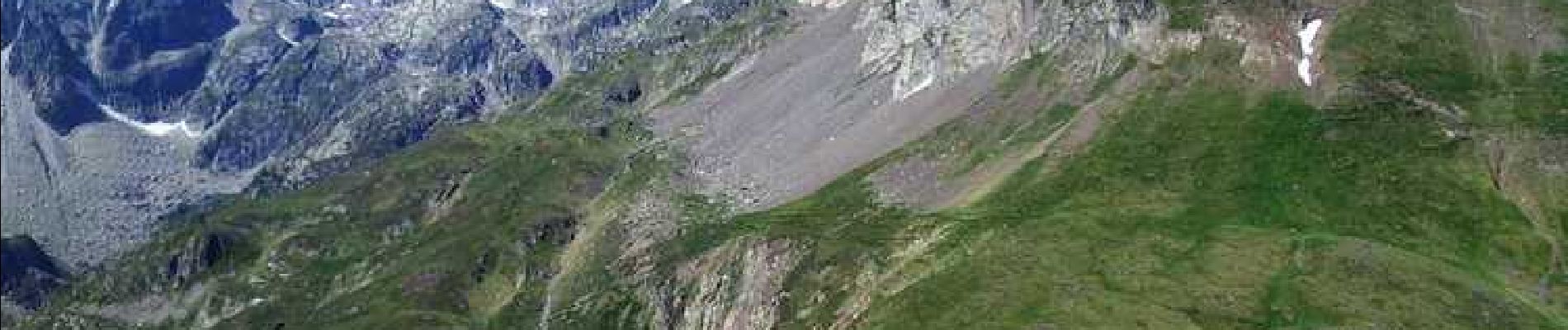
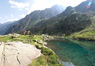
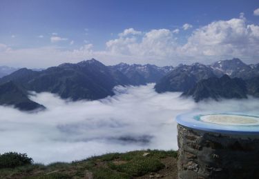
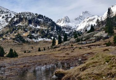
Le Pic de Monné 2724m de Cauterets Ce remarquable belvédère mérite d'être gravi au moins une fois dans la vie d'un pyrénéiste: le fantastique panorama vous fera oublier une montée importante (1500m) et peu enthousiasmante, sur un sentier aussi herbeux que soporifique dans sa moitié inférieure. Difficulté: Le dernier quart d'heure demande un peu d'attention. D’autres indications, photos et panoramiques sur le site « Les Pyrénées vues par Mariano ».

Elevation profile

Photos

Positioning

Country:
France
Region :
Occitania
Department/Province :
Hautespyrenees
Municipality :
Cauterets
Location:
Unknown
Start:(UTM)
734505 ; 4752329 (30T) N.

Trails nearby

Trail Walking Cauterets - Lac d'Estom - Photo
Walking
Philindy26

Walking

Medium
(1)
Cauterets, Occitania, Hautespyrenees, France
11.4 km | 17.5 km-effort
3h 30min
Yes
Trail Walking Cauterets - contrefort de Cauterets - Photo
Walking
christian33

Walking

Medium
(1)
Cauterets, Occitania, Hautespyrenees, France
13.7 km | 21 km-effort
4h 21min
Yes
Trail Walking Cauterets - Le Cabaliros - Photo
Walking
tracegps

Walking

Difficult
(1)
Cauterets, Occitania, Hautespyrenees, France
14.5 km | 29 km-effort
5h 0min
Yes
Trail Walking Cauterets - promenade Russell - Photo
Walking
pffrench

Walking

Very easy
(1)
Cauterets, Occitania, Hautespyrenees, France
11.9 km | 21 km-effort
5h 46min
Yes
Trail Walking Cauterets - Chemin des cascades - Photo
Walking
herve.feurprier

Walking

Easy
(1)
Cauterets, Occitania, Hautespyrenees, France
8 km | 12.6 km-effort
2h 30min
No
Trail Walking Estaing - Les Viellettes - Estaing - Photo
Walking
tracegps

Walking

Difficult
(1)
Estaing, Occitania, Hautespyrenees, France
13.1 km | 24 km-effort
4h 0min
Yes
Trail Walking Cauterets - 2022-12-31 Marche Refuge du Clot vers Refuge Wallon - Photo
Walking
GUIDE
holtzv

Walking

Difficult
Cauterets, Occitania, Hautespyrenees, France
17.3 km | 34 km-effort
7h 46min
No
Trail Walking Cauterets - CAUTERETS Le chemin des pères G3 le 14/10/2022
Walking
GUIDE
marmotte65

Walking

Medium
Cauterets, Occitania, Hautespyrenees, France
9.4 km | 15.3 km-effort
3h 5min
Yes
Trail Walking Cauterets - Pic d'Estibe Aute - Photo
Walking
tracegps

Walking

Very difficult
(1)
Cauterets, Occitania, Hautespyrenees, France
17.2 km | 36 km-effort
7h 0min
Yes


Close
My subscriptions