Trail Walking Laruns - Le Pic d'Er 2205m - Photo
 tracegps
tracegps

User

© OpenStreetMap contributors
Length
Length
10.4 km
Max alt
Max alt
2169 m
Uphill gradient
Uphill gradient
1217 m
Km-Effort
Km-Effort  
27 km
Min alt
Min alt
985 m
Downhill gradient
Downhill gradient
1217 m
Boucle
Boucle
Yes
Creation date :
2014-12-10 00:00:00.0
Updated on :
2014-12-10 00:00:00.0

(0 Reviews)

Walking
Walking
5h45
Difficulty : Difficult

Scan this QR Code to open this trail in the SityTrail application

FREE GPS app for hiking

Logo SityTrail SityTrail

IGN / Geographical institutes

Download SityTrail from the App Store Download SityTrail from Google Play

Logo SityTrail SityTrail World

The world is yours!

Download SityTrail from the App Store Download SityTrail from Google Play Download SityTrail on Huawei AppGallery

About

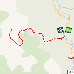
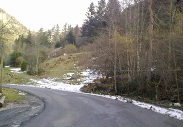
Trail Walking of 10.4 km to be discovered at New Aquitaine, Pyrénées-Atlantiques, Laruns. This trail is proposed by tracegps.

Description

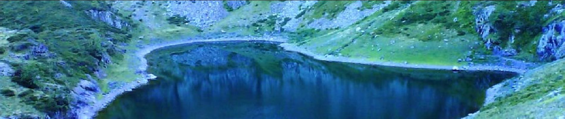
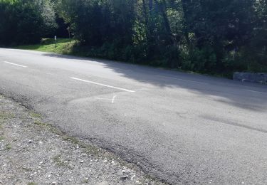
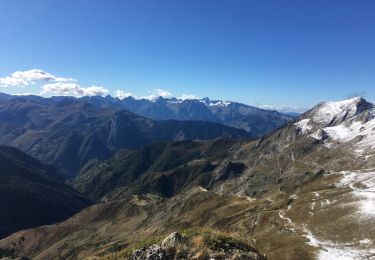
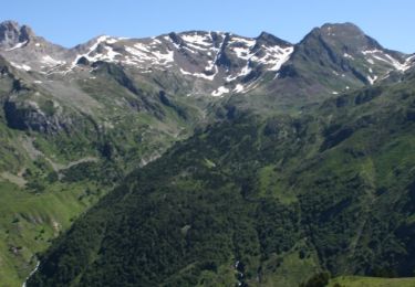
Le Pic d'Er 2205m depuis proximité Gabas (975m) A travers une splendide forêt, un énergique sentier propulse pêcheurs et marcheurs au lac d'Er, niché dans un site sauvage. Les Randonneurs poursuivront l'ascension jusqu'au pic d'Er, bien peu fréquenté malgré son panorama fort intéressant. Horaires: 800m de dénivelé et 4h00 aller/retour pour le Lac, pour le Pic: 1250m et 5h45mn. D’autres indications, photos et panoramiques sur le site « Les Pyrénées vues par Mariano ».

Elevation profile

Photos

Positioning

Country:
France
Region :
New Aquitaine
Department/Province :
Pyrénées-Atlantiques
Municipality :
Laruns
Location:
Unknown
Start:(UTM)
709568 ; 4752789 (30T) N.

Trails nearby

Trail Walking Laruns - Tour des Lacs d'Ayous en boucle depuis Bious-Artigues - Photo
Walking
tracegps

Walking

Medium
(4)
Laruns, New Aquitaine, Pyrénées-Atlantiques, France
14.1 km | 24 km-effort
5h 30min
Yes
Trail Walking Laruns - Tour des Lacs d'Ayous + Pic des Moines (2349m) - Photo
Walking
tracegps

Walking

Difficult
(1)
Laruns, New Aquitaine, Pyrénées-Atlantiques, France
15 km | 27 km-effort
5h 30min
Yes
Trail Walking Laruns - chemin des fenetres - Photo
Walking
mongo

Walking

Easy
(1)
Laruns, New Aquitaine, Pyrénées-Atlantiques, France
8 km | 14.1 km-effort
3h 0min
No
Trail Walking Laruns - COLLECTE GR108
Walking
GUIDE
marmotte65

Walking

Medium
Laruns, New Aquitaine, Pyrénées-Atlantiques, France
6.6 km | 11 km-effort
2h 29min
No
Trail Walking Laruns - Lac d’Aule et Col du Turin Garié - Photo
Walking
Bearn64230

Walking

Difficult
Laruns, New Aquitaine, Pyrénées-Atlantiques, France
11.7 km | 25 km-effort
5h 37min
Yes
Trail On foot Laruns - Voie d'OssauB - Photo
On foot
PRO

On foot

Medium
Laruns, New Aquitaine, Pyrénées-Atlantiques, France
14.1 km | 24 km-effort
5h 32min
No
Trail On foot Laruns - Vallon du Soussouéou - Photo
On foot
PRO

On foot

Medium
Laruns, New Aquitaine, Pyrénées-Atlantiques, France
13.7 km | 26 km-effort
5h 51min
Yes
Trail Walking Laruns - GR 10 - 16ème étape : les Cabanes de Cézy - col de l’Hourquette D’Arre - Gourette - Photo
Walking
LEGUE

Walking

Very difficult
Laruns, New Aquitaine, Pyrénées-Atlantiques, France
15 km | 28 km-effort
3h 59min
No
Trail Walking Laruns - GR 10 - U - Photo
Walking
LouisROGER

Walking

Very difficult
(1)
Laruns, New Aquitaine, Pyrénées-Atlantiques, France
12.9 km | 26 km-effort
5h 1min
No


Close
My subscriptions