Trail Walking Tendon - Les deux cascades de Tendon - Photo

Les deux cascades de Tendon

 tracegps
tracegps

User

© OpenStreetMap contributors
Length
Length
6.3 km
Max alt
Max alt
699 m
Uphill gradient
Uphill gradient
223 m
Km-Effort
Km-Effort  
9.2 km
Min alt
Min alt
505 m
Downhill gradient
Downhill gradient
222 m
Boucle
Boucle
Yes
Creation date :
2014-12-10 00:00:00.0
Updated on :
2014-12-10 00:00:00.0

(2 Reviews)

Walking
Walking
2h30
Difficulty : Medium

Scan this QR Code to open this trail in the SityTrail application

FREE GPS app for hiking

Logo SityTrail SityTrail

IGN / Geographical institutes

Download SityTrail from the App Store Download SityTrail from Google Play

Logo SityTrail SityTrail World

The world is yours!

Download SityTrail from the App Store Download SityTrail from Google Play Download SityTrail on Huawei AppGallery

About

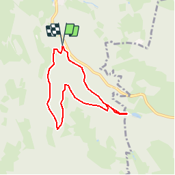
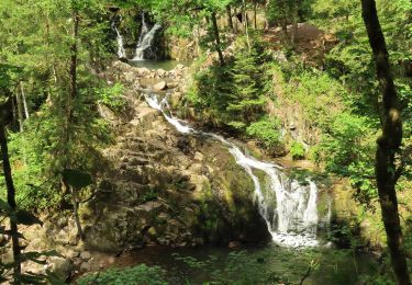
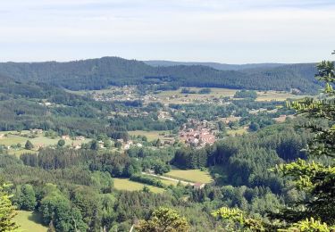
Trail Walking of 6.3 km to be discovered at Grand Est, Vosges, Tendon. This trail is proposed by tracegps.

Description

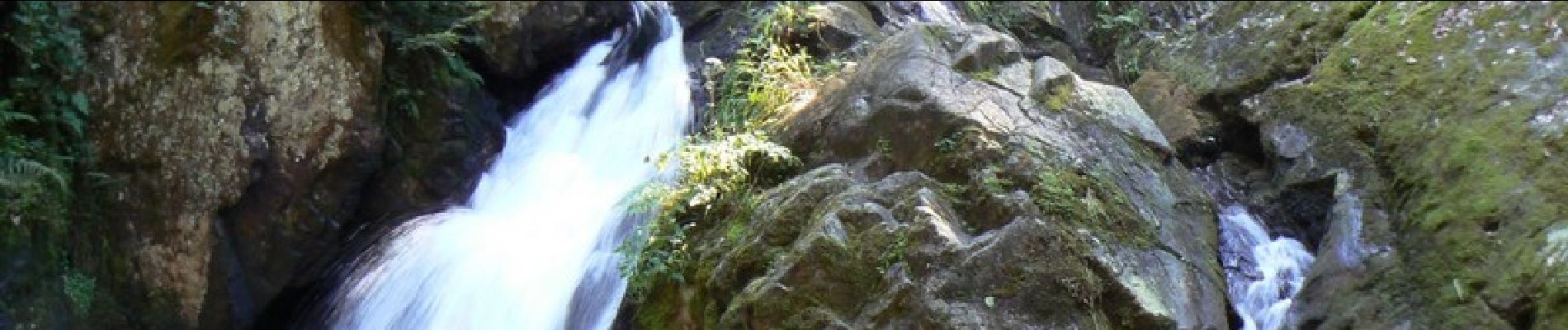
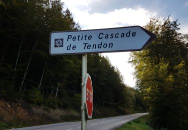
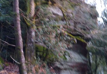
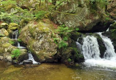
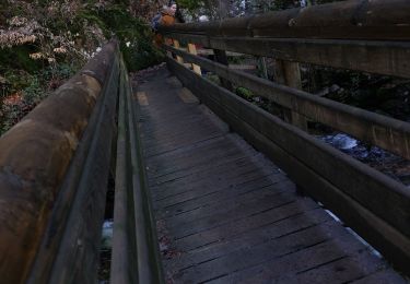
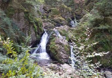
Promenades des deux cascades de Tendon. Entre Tendon et Gérardmer aller au parking de la petite cascade et descendre vers celle-ci pour traverser le pont afin de commencer la petite randonnée proposée, le balisage commence à être refait mais il faut suivre les "petits chaperons rouges" pour rejoindre la grande cascade, on peut grimper tout en haut de celle-ci qui est magnifique. Le retour se fait par un sentier forestier sans difficulté. D’autres informations et photos sur le site des Balades de Stéphane.

Elevation profile

Photos

Positioning

Country:
France
Region :
Grand Est
Department/Province :
Vosges
Municipality :
Tendon
Location:
Unknown
Start:(UTM)
327453 ; 5331271 (32U) N.

Comments

Please log in to post a review or rate the element


Faire la petite Cascade avant la grande et prenez la grande boucle le paysage de sous bois et magnifique et reposant


Trails nearby

Trail Walking Tendon - Cascades de Tendon - Trou de l'Enfer - Roches de la Moulure - Photo
Walking
Bart2015

Walking

Medium
(3)
Tendon, Grand Est, Vosges, France
20 km | 28 km-effort
5h 33min
Yes
Trail Walking Éloyes - eloyes champ dolant - Photo
Walking
lacote

Walking

Medium
(2)
Éloyes, Grand Est, Vosges, France
8.2 km | 12.4 km-effort
2h 26min
Yes
Trail Horseback riding Le Tholy - 2022-06-03 Rando CVA Le Tholy Gerbamont - Photo
Horseback riding
GUIDE
holtzv

Horseback riding

Very difficult
Le Tholy, Grand Est, Vosges, France
28 km | 41 km-effort
6h 25min
No
Trail Horseback riding Le Tholy - 2022-06-02 Rando CVA Le Tholy Tête des Cuveaux - Photo
Horseback riding
GUIDE
holtzv

Horseback riding

Difficult
Le Tholy, Grand Est, Vosges, France
28 km | 40 km-effort
5h 19min
Yes
Trail Horseback riding Le Tholy - 2022-06-01 Rando CVA Le Tholy Boucle Cascades du Tendon - Photo
Horseback riding
GUIDE
holtzv

Horseback riding

Difficult
Le Tholy, Grand Est, Vosges, France
24 km | 34 km-effort
5h 16min
Yes
Trail Walking Le Tholy - tendon  - Photo
Walking
michelelfn

Walking

Easy
(4)
Le Tholy, Grand Est, Vosges, France
9.1 km | 12.9 km-effort
3h 1min
Yes
Trail Walking Tendon - cascade  - Photo
Walking
aubr

Walking

Very difficult
Tendon, Grand Est, Vosges, France
20 km | 25 km-effort
1h 51min
No
Trail Walking Tendon - cascade du tendon - Photo
Walking
ghislaine61

Walking

Difficult
Tendon, Grand Est, Vosges, France
8.6 km | 12.2 km-effort
2h 44min
Yes
Trail Walking Saint-Étienne-lès-Remiremont - Les cuveaux à Eloyes - Photo
Walking
regish54

Walking

Easy
Saint-Étienne-lès-Remiremont, Grand Est, Vosges, France
4.5 km | 5.6 km-effort
1h 23min
No


Close
My subscriptions