Trail Cycle Nesle - Canal du Nord et de la Somme - Photo

Canal du Nord et de la Somme

 tracegps
tracegps

User

© OpenStreetMap contributors
Length
Length
41 km
Max alt
Max alt
85 m
Uphill gradient
Uphill gradient
309 m
Km-Effort
Km-Effort  
45 km
Min alt
Min alt
48 m
Downhill gradient
Downhill gradient
308 m
Boucle
Boucle
Yes
Creation date :
2014-12-10 00:00:00.0
Updated on :
2014-12-10 00:00:00.0

(1 Reviews)

Cycle
Cycle
2h30
Difficulty : Medium

Scan this QR Code to open this trail in the SityTrail application

FREE GPS app for hiking

Logo SityTrail SityTrail

IGN / Geographical institutes

Download SityTrail from the App Store Download SityTrail from Google Play

Logo SityTrail SityTrail World

The world is yours!

Download SityTrail from the App Store Download SityTrail from Google Play Download SityTrail on Huawei AppGallery

About

Trail Cycle of 41 km to be discovered at Hauts-de-France, Somme, Nesle. This trail is proposed by tracegps.

Description

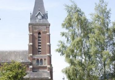
Canal du nord et de la Somme Au départ de Nesle, partez à la découverte des deux principaux canaux du département. Cet itinéraire s’ouvre sur de vastes étangs propices à la pratique de la pêche. Départ : Nesle, parking du faubourg St Marcoult. À voir : Hombleux : Atelier Rémi Damiens (sculpture et tournage sur bois). Falvy : Eglise Sainte Benoite. Villecourt : source de la Saint-Barthélémy. Saint-Christ-Briost : Le Vivier d’Omignon (site de pêche et de loisirs).

Elevation profile

Photos

Positioning

Country:
France
Region :
Hauts-de-France
Department/Province :
Somme
Municipality :
Nesle
Location:
Unknown
Start:(UTM)
493788 ; 5511714 (31U) N.

Comments

Please log in to post a review or rate the element


beau circuit mais pas de repère sur le terrain


Trails nearby

Trail Walking Potte - Circuit des Calvaires - Autour du Pré Lacroix - Potte - Photo
Walking
tracegps

Walking

Medium
Potte, Hauts-de-France, Somme, France
9.3 km | 9.8 km-effort
3h 0min
Yes
Trail Walking Curchy - Circuit de l'Ingon - Curchy - Photo
Walking
tracegps

Walking

Medium
Curchy, Hauts-de-France, Somme, France
9.7 km | 10.7 km-effort
2h 30min
Yes
Trail Walking Nesle - Circuit de la fontaine Saint Quentin - Nesle - Photo
Walking
tracegps

Walking

Medium
Nesle, Hauts-de-France, Somme, France
12.5 km | 13.8 km-effort
3h 10min
Yes
Trail Walking Hypercourt - Circuit du bois de Meurdris -  Pertain - Photo
Walking
tracegps

Walking

Medium
Hypercourt, Hauts-de-France, Somme, France
12.9 km | 13.8 km-effort
3h 15min
Yes
Trail Walking Mesnil-Saint-Nicaise - randonnée de la fête du sport  - Photo
Walking
José800

Walking

Easy
Mesnil-Saint-Nicaise, Hauts-de-France, Somme, France
9.9 km | 10.8 km-effort
2h 4min
Yes
Trail Walking Rethonvillers - Jose 800 - Photo
Walking
José800

Walking

Medium
Rethonvillers, Hauts-de-France, Somme, France
11.3 km | 11.9 km-effort
2h 43min
Yes
Trail On foot Rouy-le-Petit - La Courtemanche - Photo
On foot
PRO

On foot

Easy
Rouy-le-Petit, Hauts-de-France, Somme, France
9.9 km | 10.8 km-effort
2h 27min
Yes
Trail Walking Hombleux - Clery sur Somme  - Photo
Walking
José800

Walking

Difficult
Hombleux, Hauts-de-France, Somme, France
14.5 km | 15.5 km-effort
261h 56min
No
Trail Walking Mesnil-Saint-Nicaise - circuit de Mesnil St Nicaise 80 - Photo
Walking
José800

Walking

Easy
Mesnil-Saint-Nicaise, Hauts-de-France, Somme, France
9.9 km | 10.8 km-effort
2h 37min
Yes


Close
My subscriptions