Trail Walking Briis-sous-Forges - De Briis sous Forges à Saint Maurice Montcouronne - Photo

De Briis sous Forges à Saint Maurice Montcouronne

 tracegps
tracegps

User

© OpenStreetMap contributors
Length
Length
24 km
Max alt
Max alt
172 m
Uphill gradient
Uphill gradient
302 m
Km-Effort
Km-Effort  
28 km
Min alt
Min alt
64 m
Downhill gradient
Downhill gradient
299 m
Boucle
Boucle
Yes
Creation date :
2014-12-10 00:00:00.0
Updated on :
2014-12-10 00:00:00.0

(2 Reviews)

Walking
Walking
4h49
Difficulty : Difficult

Scan this QR Code to open this trail in the SityTrail application

FREE GPS app for hiking

Logo SityTrail SityTrail

IGN / Geographical institutes

Download SityTrail from the App Store Download SityTrail from Google Play

Logo SityTrail SityTrail World

The world is yours!

Download SityTrail from the App Store Download SityTrail from Google Play Download SityTrail on Huawei AppGallery

About

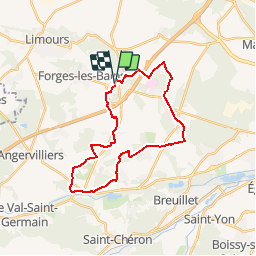
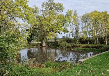
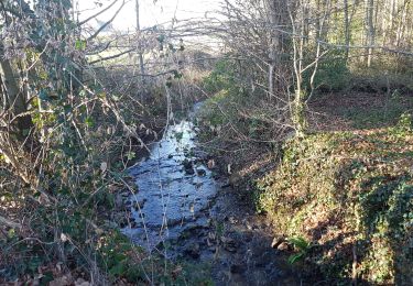
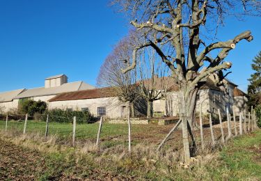
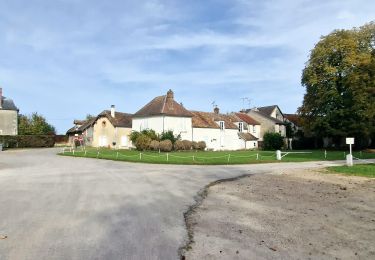
Trail Walking of 24 km to be discovered at Ile-de-France, Essonne, Briis-sous-Forges. This trail is proposed by tracegps.

Description

Parking départ : Briis sous Forges parking de l’église. Descriptif : PR, Briis sous Forges, le Moulin de Béchereau, Vaugrigneuse ... GR11div, ferme Launay-Courson, les Bruyères, GR11, la pate d'oie, les Beaux Sablons, GR111... GR111 PR GRP, le petit bois, Saint-Maurice-Montcouronne, Bois Bourguignette ... PR, bois des Bouleaux, Monteloup (14 km), la Charmoise, les Hameaux ... GR111, ferme Launay-Jacquet, Butte de Graffard cote 108 ... PR, Soucy, Fontenay-les-Briis, Mulleron ... GRP, Plaine de Bligny cote 163 ... PR, Briis sous Forge (24). Des sentiers ont pu être modifiés depuis la dernière validation et les itinéraires proposés n’engagent pas la responsabilité du Comité. Signalez-nous les modifications rencontrées pour mise à jour de la randothèque.

Elevation profile

Photos

Positioning

Country:
France
Region :
Ile-de-France
Department/Province :
Essonne
Municipality :
Briis-sous-Forges
Location:
Unknown
Start:(UTM)
435396 ; 5386189 (31U) N.

Comments

Please log in to post a review or rate the element


rando les 3 pignons Fontainebleau


Parfait


Trails nearby

Trail Walking Limours - Essonne_Tour_des_Fermes_de_la_Prédecelle - Photo
Walking
BMorin91470

Walking

Very easy
(1)
Limours, Ile-de-France, Essonne, France
12.9 km | 14.3 km-effort
3h 43min
Yes
Trail Walking Limours - Essonne_RD_Limours=>Viaduc=>Prédecelle=>Chaumusson - Photo
Walking
BMorin91470

Walking

Easy
(1)
Limours, Ile-de-France, Essonne, France
7.4 km | 8.4 km-effort
2h 30min
Yes
Trail Walking Limours - 20210319_Limours_Viaduc_Prédecelle_Amont - Photo
Walking
BMorin91470

Walking

Easy
(1)
Limours, Ile-de-France, Essonne, France
8.7 km | 9.9 km-effort
2h 30min
Yes
Trail Mountain bike Limours - St Arnoult 33km-2h30 - Photo
Mountain bike
delalex

Mountain bike

Difficult
(1)
Limours, Ile-de-France, Essonne, France
34 km | 39 km-effort
2h 33min
Yes
Trail Mountain bike Fontenay-lès-Briis - Soucy / Le Marais - Photo
Mountain bike
Bora431

Mountain bike

Medium
(2)
Fontenay-lès-Briis, Ile-de-France, Essonne, France
25 km | 30 km-effort
1h 52min
Yes
Trail Walking Limours - Essonne_Limours=>Chaumusson=>Pecqueuse=>Villevert=>Limours - Photo
Walking
BMorin91470

Walking

Medium
Limours, Ile-de-France, Essonne, France
11.5 km | 13.3 km-effort
3h 1min
Yes
Trail Walking Bruyères-le-Châtel - Boucle Fontenay les Briis - Photo
Walking
chessyca

Walking

Very easy
Bruyères-le-Châtel, Ile-de-France, Essonne, France
22 km | 26 km-effort
5h 4min
Yes
Trail Walking Saint-Maurice-Montcouronne - Boucle St Maurice Montcouronne - Brigitte - Photo
Walking
chessyca

Walking

Very easy
Saint-Maurice-Montcouronne, Ile-de-France, Essonne, France
21 km | 24 km-effort
4h 19min
Yes
Trail Walking Gometz-la-Ville - Rumba et l'aérotrain  - Photo
Walking
philou91

Walking

Easy
Gometz-la-Ville, Ile-de-France, Essonne, France
6.5 km | 6.9 km-effort
2h 10min
Yes


Close
My subscriptions