Trail Mountain bike Dabo - Circuit VTT du Kempel - Dabo - Photo

Circuit VTT du Kempel - Dabo

 tracegps
tracegps

User

© OpenStreetMap contributors
Length
Length
32 km
Max alt
Max alt
719 m
Uphill gradient
Uphill gradient
836 m
Km-Effort
Km-Effort  
43 km
Min alt
Min alt
244 m
Downhill gradient
Downhill gradient
837 m
Boucle
Boucle
Yes
Creation date :
2014-12-10 00:00:00.0
Updated on :
2014-12-10 00:00:00.0

(0 Reviews)

Mountain bike
Mountain bike
4h00
Difficulty : Very difficult

Scan this QR Code to open this trail in the SityTrail application

FREE GPS app for hiking

Logo SityTrail SityTrail

IGN / Geographical institutes

Download SityTrail from the App Store Download SityTrail from Google Play

Logo SityTrail SityTrail World

The world is yours!

Download SityTrail from the App Store Download SityTrail from Google Play Download SityTrail on Huawei AppGallery

About

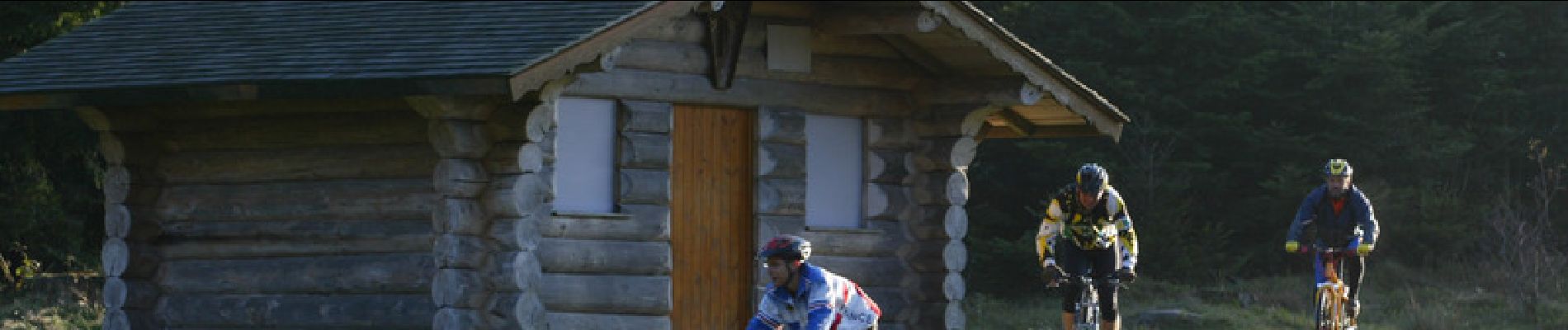
Trail Mountain bike of 32 km to be discovered at Grand Est, Moselle, Dabo. This trail is proposed by tracegps.

Description

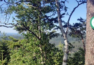
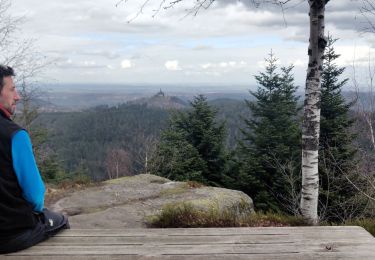
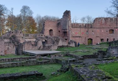
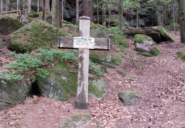
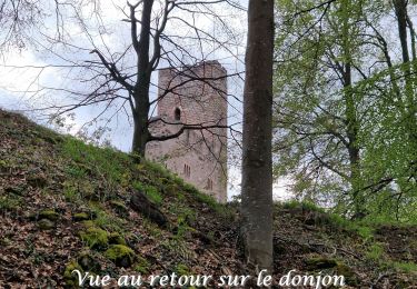
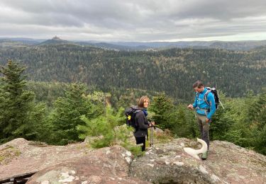
Le circuit part du Col de la Schleif et emprunte un chemin forestier en direction du Col du Valsberg où il traverse la route départementale 143. Il rejoint ensuite le Zollstock et traverse le hameau de La Hoube avant de descendre vers la Borne Saint-Martin. Un agréable sentier, surplombé par un long rocher supportant le village de Hellert, mène en aval de Kuhberg. L’itinéraire se poursuit vers le Falkenberg, passe aux pieds du rocher du Falkenfels, rocher remarquable équipé de nombreuses voies d’escalade et aux pieds duquel on peut visiter des maisons troglodytiques avant de rejoindre Neustadtmuhle en fond de vallée. Il se poursuit par une route forestière en direction du stade où il enjambe la Zorn avant de la longer sur plusieurs kilomètres. Le circuit remonte ensuite en direction de la Maison Forestière du Jaegerhof avec une belle vue sur le village et sur le rocher de Dabo. L’itinéraire se poursuit via le village de Dabo puis rejoint le camping avant de remonter vers le Col de la Schleif.

Elevation profile

Photos

Positioning

Country:
France
Region :
Grand Est
Department/Province :
Moselle
Municipality :
Dabo
Location:
Unknown
Start:(UTM)
371807 ; 5387851 (32U) N.

Trails nearby

Trail Walking Dabo - 2020-06-01 Marche Hengst - Photo
Walking
GUIDE
holtzv

Walking

Very easy
Dabo, Grand Est, Moselle, France
13.8 km | 18.7 km-effort
4h 18min
Yes
Trail Walking Wangenbourg-Engenthal - 2020-03-14 Marche Engenthal le bas - Photo
Walking
GUIDE
holtzv

Walking

Very easy
Wangenbourg-Engenthal, Grand Est, Bas-Rhin, France
14.3 km | 22 km-effort
4h 27min
Yes
Trail Walking Wangenbourg-Engenthal - 2019-11-16 Marche Wangenbourg Castelberg - Photo
Walking
GUIDE
holtzv

Walking

Very easy
Wangenbourg-Engenthal, Grand Est, Bas-Rhin, France
19.8 km | 31 km-effort
4h 51min
Yes
Trail Walking Wangenbourg-Engenthal - 2017-02-24 Marche Schneeberg - Photo
Walking
GUIDE
holtzv

Walking

Very easy
(1)
Wangenbourg-Engenthal, Grand Est, Bas-Rhin, France
12.8 km | 19.9 km-effort
Unknown
Yes
Trail Mountain bike Dabo - Balcon de Dabo 2010 - Photo
Mountain bike
tracegps

Mountain bike

Very difficult
(1)
Dabo, Grand Est, Moselle, France
39 km | 54 km-effort
4h 30min
Yes
Trail Walking Dabo - Windsbourg Dabo - Photo
Walking
oscar1

Walking

Easy
Dabo, Grand Est, Moselle, France
14.3 km | 19.7 km-effort
3h 6min
Yes
Trail Walking Wangenbourg-Engenthal - 2023-04-28_17h34m45_2023-04-26_10-35(2) - Photo
Walking
nfranche

Walking

Medium
Wangenbourg-Engenthal, Grand Est, Bas-Rhin, France
14.1 km | 22 km-effort
4h 56min
Yes
Trail Walking Dabo - 2022-11-01 Marche Dabo et ses Rochers - Photo
Walking
GUIDE
holtzv

Walking

Very difficult
Dabo, Grand Est, Moselle, France
26 km | 38 km-effort
7h 8min
Yes
Trail Nordic walking Wangenbourg-Engenthal - Engenthal  - Photo
Nordic walking
Michel 67

Nordic walking

Very easy
Wangenbourg-Engenthal, Grand Est, Bas-Rhin, France
9.9 km | 14 km-effort
2h 31min
Yes


Close
My subscriptions