Trail Walking Nieurlet - Circuit de Booneghem -Nieurlet - Photo

Circuit de Booneghem -Nieurlet

 tracegps
tracegps

User

© OpenStreetMap contributors
Length
Length
9.6 km
Max alt
Max alt
14 m
Uphill gradient
Uphill gradient
39 m
Km-Effort
Km-Effort  
10.1 km
Min alt
Min alt
-3 m
Downhill gradient
Downhill gradient
37 m
Boucle
Boucle
Yes
Creation date :
2014-12-10 00:00:00.0
Updated on :
2014-12-10 00:00:00.0

(1 Reviews)

Walking
Walking
2h30
Difficulty : Medium

Scan this QR Code to open this trail in the SityTrail application

FREE GPS app for hiking

Logo SityTrail SityTrail

IGN / Geographical institutes

Download SityTrail from the App Store Download SityTrail from Google Play

Logo SityTrail SityTrail World

The world is yours!

Download SityTrail from the App Store Download SityTrail from Google Play Download SityTrail on Huawei AppGallery

About

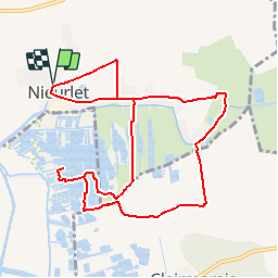
Trail Walking of 9.6 km to be discovered at Hauts-de-France, Nord, Nieurlet. This trail is proposed by tracegps.

Description

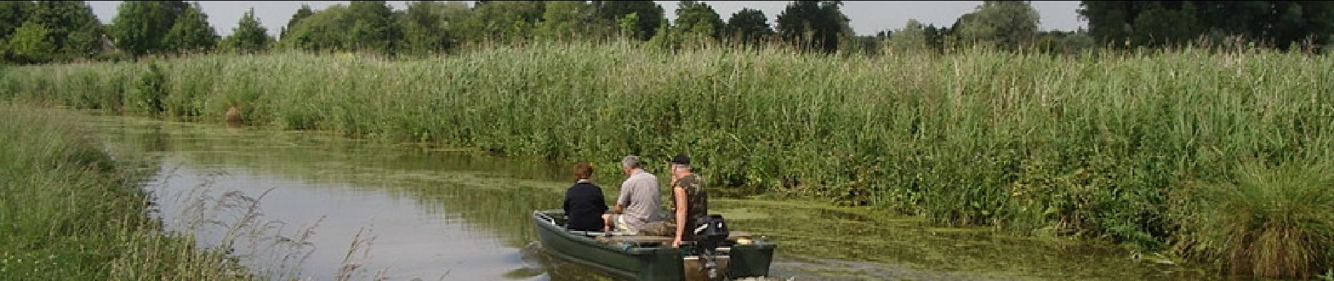
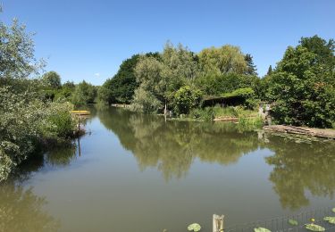
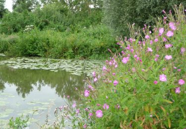
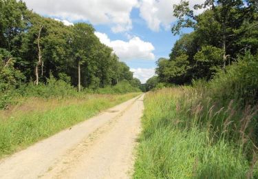
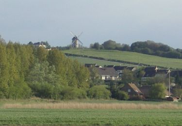
Circuit proposé par le Comité Départemental du Tourisme du Nord. Fiche n° 15 de la pochette « Bocage Flamand et marais Audomarois, au fil de l’Yser»". Départ de l’église de Nieurlet. Circuit familial à découvrir toute l'année. Chaque période apporte sont lot de découverte (faune, flore, production maraîchère). Une halte à la "grange nature" s'impose pour comprendre les différents aspects de l'Audomarois. N'oubliez pas votre paire de jumelles et, en saison humide, votre paire de bottes. Respectez le site du marais et ses hôtes ainsi que les réglementations dans les zones protégées. La trace GPS prend en compte le circuit dans la réserve naturelle du Romelaëre. Retrouvez cette randonnée sur le site du Comité Départemental du Tourisme du Nord.

Elevation profile

Photos

Positioning

Country:
France
Region :
Hauts-de-France
Department/Province :
Nord
Municipality :
Nieurlet
Location:
Unknown
Start:(UTM)
449359 ; 5626639 (31U) N.

Comments

Please log in to post a review or rate the element


Trails nearby

Trail Walking Clairmarais - Clairmarai - Photo
Walking
yves62410

Walking

Difficult
(1)
Clairmarais, Hauts-de-France, Pas-de-Calais, France
19.6 km | 21 km-effort
5h 8min
No
Trail Walking Buysscheure - Vers le paradis - Photo
Walking

Walking

Very easy
(1)
Buysscheure, Hauts-de-France, Nord, France
7.1 km | 7.8 km-effort
Unknown
Yes
Trail sport Clairmarais - À la découverte du marais audomarois - Photo
sport
tenace

sport

Very easy
(1)
Clairmarais, Hauts-de-France, Pas-de-Calais, France
6.8 km | 7.2 km-effort
Unknown
Yes
Trail On foot Clairmarais - activity_1282864488 - Photo
On foot
GUIDE
Peter.vdbergh

On foot

Medium
Clairmarais, Hauts-de-France, Pas-de-Calais, France
14.9 km | 16.1 km-effort
3h 59min
Yes
Trail Walking Arques - Balade en forêt de Rihoult-Clairmarais  -  Arques - Photo
Walking
tracegps

Walking

Medium
Arques, Hauts-de-France, Pas-de-Calais, France
13.5 km | 15.7 km-effort
3h 30min
Yes
Trail Walking Nieurlet - Circuit de Booneghem - Photo
Walking

Walking

Very easy
Nieurlet, Hauts-de-France, Nord, France
8.6 km | 9.1 km-effort
Unknown
Yes
Trail Walking Clairmarais - copie - Photo
Walking
Bernard.voyageur

Walking

Easy
Clairmarais, Hauts-de-France, Pas-de-Calais, France
8.1 km | 8.5 km-effort
2h 4min
Yes
Trail Cycle Watten - De Watten au talus côtier       - Photo
Cycle
tracegps

Cycle

Medium
Watten, Hauts-de-France, Nord, France
29 km | 33 km-effort
2h 0min
Yes
Trail Walking Buysscheure - Vers le Paradis - Buysscheure - Photo
Walking
tracegps

Walking

Medium
Buysscheure, Hauts-de-France, Nord, France
7.8 km | 8.6 km-effort
2h 0min
Yes


Close
My subscriptions