Trail Walking Rubrouck - Circuit des mares - Rubrouck - Photo

Circuit des mares - Rubrouck

 tracegps
tracegps

User

© OpenStreetMap contributors
Length
Length
10 km
Max alt
Max alt
42 m
Uphill gradient
Uphill gradient
37 m
Km-Effort
Km-Effort  
10.4 km
Min alt
Min alt
21 m
Downhill gradient
Downhill gradient
36 m
Boucle
Boucle
Yes
Creation date :
2014-12-10 00:00:00.0
Updated on :
2014-12-10 00:00:00.0

(0 Reviews)

Walking
Walking
2h30
Difficulty : Medium

Scan this QR Code to open this trail in the SityTrail application

FREE GPS app for hiking

Logo SityTrail SityTrail

IGN / Geographical institutes

Download SityTrail from the App Store Download SityTrail from Google Play

Logo SityTrail SityTrail World

The world is yours!

Download SityTrail from the App Store Download SityTrail from Google Play Download SityTrail on Huawei AppGallery

About

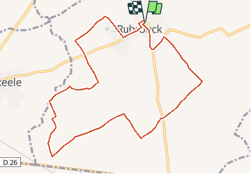
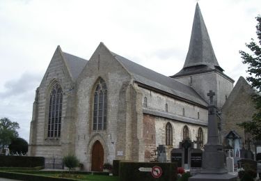
Trail Walking of 10 km to be discovered at Hauts-de-France, Nord, Rubrouck. This trail is proposed by tracegps.

Description

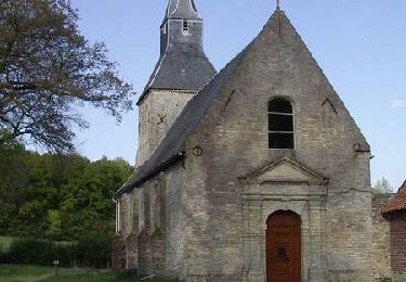
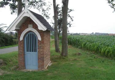
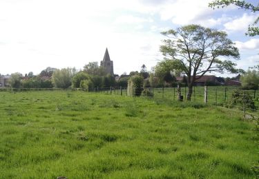
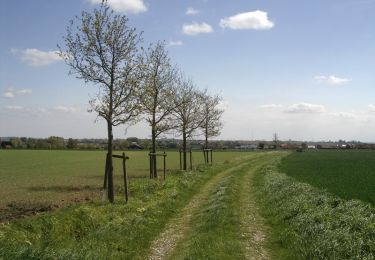
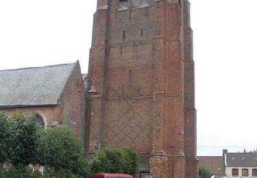
Circuit proposé par le Comité Départemental du Tourisme du Nord. Fiche n° 9 de la pochette « Bocage Flamand et marais Audomarois, au fil de l’Yser». Départ du parking de l’église de Rubrouck, derrière la maison de guillaume de Rubrouck. Circuit à découvrir toute l'année; il permet de découvrir un secteur traditionnel de la Flandre et de la vallée de l'Yser : mares, saules têtards, reliquats de bocage, maisons flamandes, signes runiques. Retrouvez cette randonnée sur le site du Comité Départemental du Tourisme du Nord.

Elevation profile

Photos

Positioning

Country:
France
Region :
Hauts-de-France
Department/Province :
Nord
Municipality :
Rubrouck
Location:
Unknown
Start:(UTM)
454607 ; 5632147 (31U) N.

Trails nearby

Trail Walking Buysscheure - Vers le paradis - Photo
Walking

Walking

Very easy
(1)
Buysscheure, Hauts-de-France, Nord, France
7.1 km | 7.8 km-effort
Unknown
Yes
Trail Cycle Merckeghem - Boucle de Merckeghem - Photo
Cycle
tracegps

Cycle

Medium
Merckeghem, Hauts-de-France, Nord, France
29 km | 31 km-effort
2h 0min
Yes
Trail Cycle Volckerinckhove - Boucle de Volckerinckhove - Photo
Cycle
tracegps

Cycle

Easy
Volckerinckhove, Hauts-de-France, Nord, France
29 km | 31 km-effort
1h 30min
Yes
Trail Walking Arnèke - Circuit des 7 planètes 18 km - Arnèke - Photo
Walking
tracegps

Walking

Very difficult
Arnèke, Hauts-de-France, Nord, France
17.7 km | 19 km-effort
4h 30min
Yes
Trail Walking Buysscheure - Vers le Paradis - Buysscheure - Photo
Walking
tracegps

Walking

Medium
Buysscheure, Hauts-de-France, Nord, France
7.8 km | 8.6 km-effort
2h 0min
Yes
Trail Walking Buysscheure - Du bocage au Marais - Buysscheure - Photo
Walking
tracegps

Walking

Difficult
Buysscheure, Hauts-de-France, Nord, France
13.8 km | 14.9 km-effort
3h 30min
Yes
Trail Walking Bollezeele - Circuit du Pantgat - Bollezeele - Photo
Walking
tracegps

Walking

Easy
Bollezeele, Hauts-de-France, Nord, France
6.4 km | 7.1 km-effort
1h 40min
Yes
Trail Walking Arnèke - Circuit des 7 planètes (Arnéke) - Photo
Walking
tracegps

Walking

Medium
Arnèke, Hauts-de-France, Nord, France
10.6 km | 11.6 km-effort
2h 40min
Yes
Trail Walking Volckerinckhove - Volckerinckhove - Village Patrimoine - Photo
Walking
tracegps

Walking

Easy
Volckerinckhove, Hauts-de-France, Nord, France
6.2 km | 6.9 km-effort
1h 30min
Yes


Close
My subscriptions