Trail Walking Boulogne-sur-Gesse - Tour du lac de la Gimone - Photo
 tracegps
tracegps

User

© OpenStreetMap contributors
Length
Length
18.2 km
Max alt
Max alt
294 m
Uphill gradient
Uphill gradient
195 m
Km-Effort
Km-Effort  
21 km
Min alt
Min alt
267 m
Downhill gradient
Downhill gradient
195 m
Boucle
Boucle
Yes
Creation date :
2014-12-10 00:00:00.0
Updated on :
2014-12-10 00:00:00.0

(1 Reviews)

Walking
Walking
6h00
Difficulty : Difficult

Scan this QR Code to open this trail in the SityTrail application

FREE GPS app for hiking

Logo SityTrail SityTrail

IGN / Geographical institutes

Download SityTrail from the App Store Download SityTrail from Google Play

Logo SityTrail SityTrail World

The world is yours!

Download SityTrail from the App Store Download SityTrail from Google Play Download SityTrail on Huawei AppGallery

About

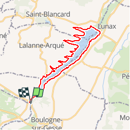
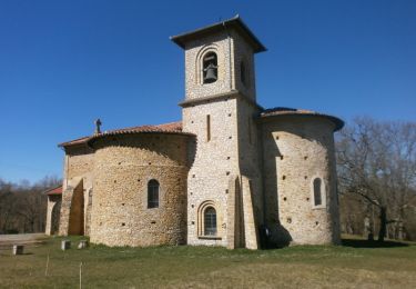
Trail Walking of 18.2 km to be discovered at Occitania, Haute-Garonne, Boulogne-sur-Gesse. This trail is proposed by tracegps.

Description

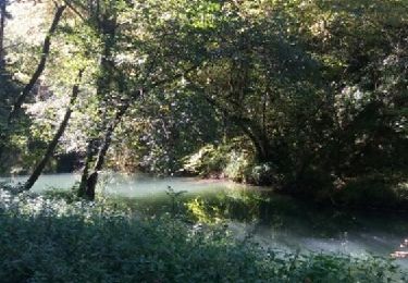
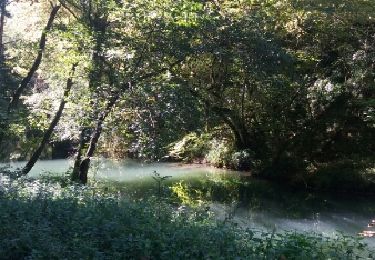
Longue balade autour du Lac de la Gimone à cheval entre la Haute Garonne et le Gers. Un barrage-poids a été construit sur la Gimone entre Lalanne-Arqué et Lunax, créant un lac de retenue d'une longueur d'environ six kilomètres. (source Wikipédia)

Elevation profile

Photos

Positioning

Country:
France
Region :
Occitania
Department/Province :
Haute-Garonne
Municipality :
Boulogne-sur-Gesse
Location:
Unknown
Start:(UTM)
308289 ; 4796934 (31T) N.

Comments

Please log in to post a review or rate the element


génial et facile à utiliser merci je recommande


Trails nearby

Trail Walking Lagarde-Hachan - Le sentier du Bois du Cerf - Lagarde-Hachan - Photo
Walking
tracegps

Walking

Medium
(1)
Lagarde-Hachan, Occitania, Gers, France
12.7 km | 15 km-effort
3h 10min
Yes
Trail Walking Cardeilhac - Boucle à Cardeilhac - Photo
Walking
tracegps

Walking

Medium
(1)
Cardeilhac, Occitania, Haute-Garonne, France
17.5 km | 21 km-effort
4h 30min
Yes
Trail Walking Aurignac - 31_Aurignac - Photo
Walking
jab31

Walking

Difficult
(1)
Aurignac, Occitania, Haute-Garonne, France
15.5 km | 21 km-effort
3h 16min
Yes
Trail Walking L'Isle-en-Dodon - De l'Isle en Dodon à Puymaurin - Photo
Walking
tracegps

Walking

Medium
(1)
L'Isle-en-Dodon, Occitania, Haute-Garonne, France
15.7 km | 20 km-effort
4h 0min
Yes
Trail Walking Cardeilhac - arboretum de cardeilhac  - Photo
Walking
GUIDE
lhomme.ph

Walking

Very easy
Cardeilhac, Occitania, Haute-Garonne, France
6.6 km | 7.6 km-effort
1h 46min
Yes
Trail Walking Charlas - Charlas: gorges de la Save - Photo
Walking
patricklecetre

Walking

Easy
(1)
Charlas, Occitania, Haute-Garonne, France
16.7 km | 21 km-effort
4h 33min
Yes
Trail Walking Charlas - Charlas: gorges de la Save - Photo
Walking
pidjam

Walking

Easy
Charlas, Occitania, Haute-Garonne, France
16.7 km | 21 km-effort
4h 33min
Yes
Trail Walking Aurignac - Chapelle St-Bernard - Aurignac - Photo
Walking
tracegps

Walking

Medium
Aurignac, Occitania, Haute-Garonne, France
10.5 km | 15 km-effort
3h 0min
Yes
Trail Mountain bike Lagarde-Hachan - Le sentier du Bois du Cerf - Lagarde-Hachan - Photo
Mountain bike
tracegps

Mountain bike

Medium
Lagarde-Hachan, Occitania, Gers, France
12.7 km | 15 km-effort
1h 15min
Yes


Close
My subscriptions