Trail Walking Coaraze - Rocca Spavierra - Photo
 franquen
franquen

User

© OpenStreetMap contributors
Length
Length
11.6 km
Max alt
Max alt
1096 m
Uphill gradient
Uphill gradient
595 m
Km-Effort
Km-Effort  
19.6 km
Min alt
Min alt
614 m
Downhill gradient
Downhill gradient
597 m
Boucle
Boucle
Yes
Creation date :
2019-05-06 11:07:28.857
Updated on :
2019-05-06 11:07:28.857

(1 Reviews)

Walking
Walking
4h06
Difficulty : Medium

Scan this QR Code to open this trail in the SityTrail application

FREE GPS app for hiking

Logo SityTrail SityTrail

IGN / Geographical institutes

Download SityTrail from the App Store Download SityTrail from Google Play

Logo SityTrail SityTrail World

The world is yours!

Download SityTrail from the App Store Download SityTrail from Google Play Download SityTrail on Huawei AppGallery

About

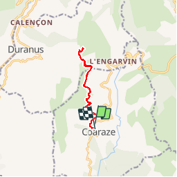
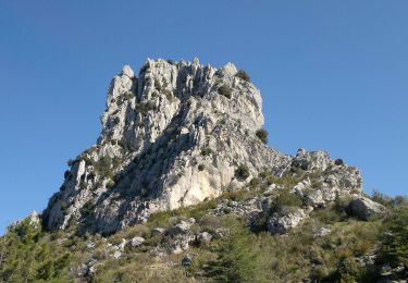
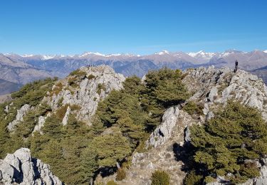
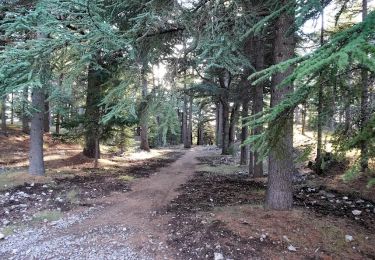
Trail Walking of 11.6 km to be discovered at Provence-Alpes-Côte d'Azur, Maritime Alps, Coaraze. This trail is proposed by franquen.

Description

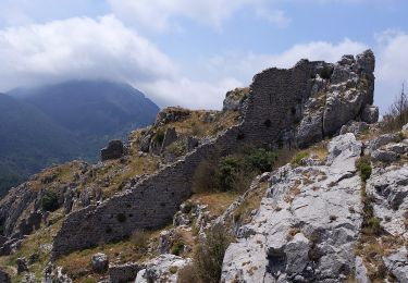
Magnifique rando avec un super point de vue. bâtons conseillés. Possibilité de faire une boucle par la pointe de Serena

Elevation profile

Positioning

Country:
France
Region :
Provence-Alpes-Côte d'Azur
Department/Province :
Maritime Alps
Municipality :
Coaraze
Location:
Unknown
Start:(UTM)
362843 ; 4858309 (32T) N.

Comments

Please log in to post a review or rate the element


Trails nearby

Trail On foot Coaraze - Rocca Sparvièra - Photo
On foot
PRO

On foot

Easy
Coaraze, Provence-Alpes-Côte d'Azur, Maritime Alps, France
10.5 km | 17.6 km-effort
3h 59min
Yes
Trail On foot Utelle - Gorges de la Vésubie - Photo
On foot
PRO

On foot

Medium
(1)
Utelle, Provence-Alpes-Côte d'Azur, Maritime Alps, France
14.6 km | 27 km-effort
6h 11min
Yes
Trail Walking L'Escarène - L’Escarene - Photo
Walking
Renefrt

Walking

Easy
L'Escarène, Provence-Alpes-Côte d'Azur, Maritime Alps, France
10.1 km | 13.9 km-effort
4h 39min
Yes
Trail Walking Utelle - Cros d Utelle chapelle St Antoine - Photo
Walking
56jj

Walking

Difficult
Utelle, Provence-Alpes-Côte d'Azur, Maritime Alps, France
7.5 km | 13.7 km-effort
4h 6min
Yes
Trail Walking L'Escarène - L'Escarène - Baisse de Bussia - Col de Savel - Chapelle Bon Coeur - Lucéram - Photo
Walking
LtZIP

Walking

Medium
L'Escarène, Provence-Alpes-Côte d'Azur, Maritime Alps, France
18.7 km | 28 km-effort
5h 16min
No
Trail On foot Levens - Crête du Férion - Photo
On foot
PRO

On foot

Medium
Levens, Provence-Alpes-Côte d'Azur, Maritime Alps, France
13 km | 24 km-effort
5h 26min
Yes
Trail On foot Duranus - Mine de l'Eguisse - Photo
On foot
PRO

On foot

Easy
Duranus, Provence-Alpes-Côte d'Azur, Maritime Alps, France
6.8 km | 14.5 km-effort
3h 17min
Yes
Trail Walking Duranus - Cime de Rocassiera depuis l'Engarvin - Photo
Walking
patsure

Walking

Medium
Duranus, Provence-Alpes-Côte d'Azur, Maritime Alps, France
15.4 km | 27 km-effort
4h 40min
Yes
Trail Walking Levens - Crête du Ferion par Levens  - Photo
Walking
GrouGary

Walking

Medium
Levens, Provence-Alpes-Côte d'Azur, Maritime Alps, France
11.9 km | 22 km-effort
3h 40min
Yes


Close
My subscriptions