Trail Walking Chamblac - Circuit de Bonneville  -  Chamblac - Photo

Circuit de Bonneville - Chamblac

 tracegps
tracegps

User

© OpenStreetMap contributors
Length
Length
11.2 km
Max alt
Max alt
201 m
Uphill gradient
Uphill gradient
61 m
Km-Effort
Km-Effort  
12 km
Min alt
Min alt
182 m
Downhill gradient
Downhill gradient
61 m
Boucle
Boucle
Yes
Creation date :
2014-12-10 00:00:00.0
Updated on :
2014-12-10 00:00:00.0

(0 Reviews)

Walking
Walking
2h45
Difficulty : Medium

Scan this QR Code to open this trail in the SityTrail application

FREE GPS app for hiking

Logo SityTrail SityTrail

IGN / Geographical institutes

Download SityTrail from the App Store Download SityTrail from Google Play

Logo SityTrail SityTrail World

The world is yours!

Download SityTrail from the App Store Download SityTrail from Google Play Download SityTrail on Huawei AppGallery

About

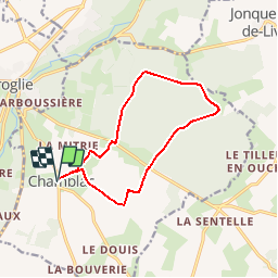
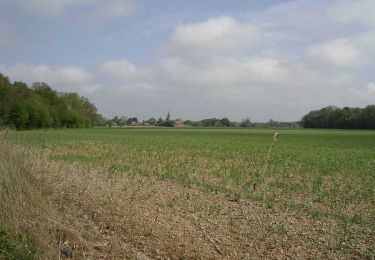
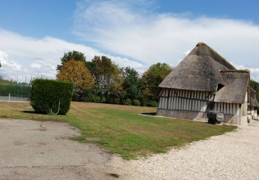
Trail Walking of 11.2 km to be discovered at Normandy, Eure, Chamblac. This trail is proposed by tracegps.

Description

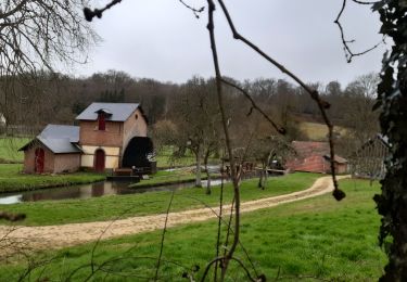
Circuit proposé par la Communauté de Communes du canton de Broglie. Départ de la mairie de Chamblac. A découvrir : l’église Notre-Dame 16e siécle, château de Bonneville, forêt de Broglie, la Pierre l’Ormée, le chemin Perrey (ancienne voie romaine). Ce circuit a été numérisé par les randonneurs du CODEPEM. Merci à Jean-Marie.

Elevation profile

Photos

Positioning

Country:
France
Region :
Normandy
Department/Province :
Eure
Municipality :
Chamblac
Location:
Unknown
Start:(UTM)
320302 ; 5429067 (31U) N.

Trails nearby

Trail Walking Ferrières-Saint-Hilaire - Ferrières St Hilaire - Photo
Walking
FROIDMONT

Walking

Very easy
(1)
Ferrières-Saint-Hilaire, Normandy, Eure, France
9.4 km | 11.3 km-effort
2h 25min
Yes
Trail Cycle Broglie - Boucle des 3 Maréchaux  -  Broglie - Photo
Cycle
tracegps

Cycle

Medium
Broglie, Normandy, Eure, France
18.5 km | 20 km-effort
1h 15min
Yes
Trail Walking Broglie - Circuit du Prieuré - Broglie - Photo
Walking
tracegps

Walking

Difficult
(1)
Broglie, Normandy, Eure, France
13.2 km | 14.9 km-effort
3h 19min
Yes
Trail Mountain bike Mesnil-en-Ouche - Circuit du Bois des Hautcaires - Jonquerets de Livet - Photo
Mountain bike
tracegps

Mountain bike

Medium
Mesnil-en-Ouche, Normandy, Eure, France
8.5 km | 9.2 km-effort
1h 10min
Yes
Trail Walking Mesnil-en-Ouche - Circuit du Bois des Hautcaires - Jonquerets de Livet - Photo
Walking
tracegps

Walking

Medium
(1)
Mesnil-en-Ouche, Normandy, Eure, France
8.5 km | 9.2 km-effort
2h 4min
Yes
Trail Walking Saint-Aubin-du-Thenney - boucle de St Aubin  - Photo
Walking
ymarvin

Walking

Easy
Saint-Aubin-du-Thenney, Normandy, Eure, France
5.2 km | 5.7 km-effort
1h 1min
Yes
Trail Walking Chamblac - Le Chamblac - Photo
Walking
ymarvin

Walking

Easy
Chamblac, Normandy, Eure, France
9.1 km | 9.7 km-effort
1h 52min
Yes
Trail Walking Broglie - Broglie - Photo
Walking
werth

Walking

Medium
Broglie, Normandy, Eure, France
10.1 km | 11.8 km-effort
2h 50min
Yes
Trail Walking Mesnil-en-Ouche - Les jonquerets de livet - Photo
Walking
ymarvin

Walking

Very easy
Mesnil-en-Ouche, Normandy, Eure, France
8.9 km | 9.6 km-effort
1h 46min
Yes


Close
My subscriptions