Trail Mountain bike Miramont-de-Guyenne - Miramont-de-Guyenne vers Roumagne et Saint-Pardoux-Issac - Pays du Dropt - Photo

Miramont-de-Guyenne vers Roumagne et Saint-Pardoux-Issac - Pays du Dropt

 tracegps
tracegps

User

© OpenStreetMap contributors
Length
Length
15.4 km
Max alt
Max alt
107 m
Uphill gradient
Uphill gradient
233 m
Km-Effort
Km-Effort  
18.5 km
Min alt
Min alt
44 m
Downhill gradient
Downhill gradient
235 m
Boucle
Boucle
Yes
Creation date :
2014-12-10 00:00:00.0
Updated on :
2014-12-10 00:00:00.0

(0 Reviews)

Mountain bike
Mountain bike
1h49
Difficulty : Difficult

Scan this QR Code to open this trail in the SityTrail application

FREE GPS app for hiking

Logo SityTrail SityTrail

IGN / Geographical institutes

Download SityTrail from the App Store Download SityTrail from Google Play

Logo SityTrail SityTrail World

The world is yours!

Download SityTrail from the App Store Download SityTrail from Google Play Download SityTrail on Huawei AppGallery

About

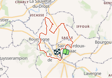
Trail Mountain bike of 15.4 km to be discovered at New Aquitaine, Lot-et-Garonne, Miramont-de-Guyenne. This trail is proposed by tracegps.

Description

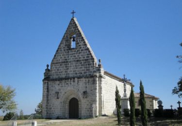
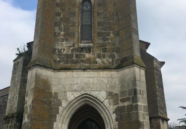
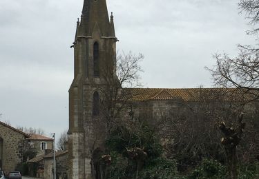
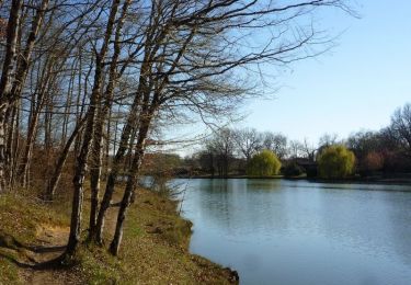
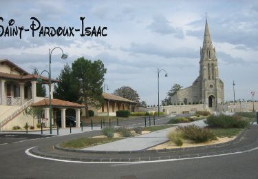
Miramont de Guyenne / Roumagne / St Pardoux Isaac C. C. Pays de Lauzun. Tracé dans la vallée de la Dourdenne, affluent de la rivière Dropt, ce circuit relie trois villages et trois églises aux clochers pointus. Classé difficile par sa longueur, il ne l’est pas par son relief peu marqué. Téléchargez la fiche de cette randonnée sur le site du Tourisme du Lot et Garonne.

Elevation profile

Photos

Positioning

Country:
France
Region :
New Aquitaine
Department/Province :
Lot-et-Garonne
Municipality :
Miramont-de-Guyenne
Location:
Unknown
Start:(UTM)
290690 ; 4942245 (31T) N.

Trails nearby

Trail Walking Peyrière - Peyrières, la boucle du Bouyssou - Pays du Dropt - Photo
Walking
tracegps

Walking

Easy
(2)
Peyrière, New Aquitaine, Lot-et-Garonne, France
4.9 km | 6 km-effort
1h 45min
Yes
Trail Mountain bike Saint-Pardoux-Isaac - Vers l'église de Saint-Laurent - Saint-Pardoux-Isaac - Photo
Mountain bike
tracegps

Mountain bike

Easy
Saint-Pardoux-Isaac, New Aquitaine, Lot-et-Garonne, France
11.2 km | 13.3 km-effort
1h 25min
Yes
Trail Walking Saint-Pardoux-Isaac - Vers l'église de Saint-Laurent - Saint-Pardoux-Isaac - Photo
Walking
tracegps

Walking

Medium
(1)
Saint-Pardoux-Isaac, New Aquitaine, Lot-et-Garonne, France
11.2 km | 13.3 km-effort
2h 49min
Yes
Trail Walking Bourgougnague - Bourgougnague 2 - Photo
Walking
Briarwood

Walking

Easy
Bourgougnague, New Aquitaine, Lot-et-Garonne, France
49 km | 55 km-effort
1h 45min
No
Trail Walking Bourgougnague - Bourgougnague - Photo
Walking
Briarwood

Walking

Medium
Bourgougnague, New Aquitaine, Lot-et-Garonne, France
7.5 km | 8.6 km-effort
2h 27min
Yes
Trail Mountain bike Miramont-de-Guyenne - Tour de Miramont de Guyenne - Photo
Mountain bike
tracegps

Mountain bike

Medium
Miramont-de-Guyenne, New Aquitaine, Lot-et-Garonne, France
12.6 km | 15 km-effort
49min
Yes
Trail Mountain bike Saint-Pardoux-Isaac - Balade semi-urbaine à Saint Pardoux Isaac - Photo
Mountain bike
tracegps

Mountain bike

Easy
Saint-Pardoux-Isaac, New Aquitaine, Lot-et-Garonne, France
6.2 km | 7.5 km-effort
45min
Yes
Trail Walking Saint-Pardoux-Isaac - Balade semi-urbaine à Saint Pardoux Isaac - Photo
Walking
tracegps

Walking

Easy
Saint-Pardoux-Isaac, New Aquitaine, Lot-et-Garonne, France
6.2 km | 7.5 km-effort
2h 19min
Yes
Trail Running Agnac - Iffour, randonnée en Guyenne - Agnac - Photo
Running
tracegps

Running

Easy
Agnac, New Aquitaine, Lot-et-Garonne, France
10.2 km | 12.5 km-effort
1h 49min
Yes


Close
My subscriptions