Trail Walking Tourliac - Un sentier découverte autour du lac du Brayssou - Pays du Dropt - Photo

Un sentier découverte autour du lac du Brayssou - Pays du Dropt

 tracegps
tracegps

User

© OpenStreetMap contributors
Length
Length
5.9 km
Max alt
Max alt
136 m
Uphill gradient
Uphill gradient
68 m
Km-Effort
Km-Effort  
6.8 km
Min alt
Min alt
102 m
Downhill gradient
Downhill gradient
73 m
Boucle
Boucle
Yes
Creation date :
2014-12-10 00:00:00.0
Updated on :
2014-12-10 00:00:00.0

(0 Reviews)

Walking
Walking
2h10
Difficulty : Easy

Scan this QR Code to open this trail in the SityTrail application

FREE GPS app for hiking

Logo SityTrail SityTrail

IGN / Geographical institutes

Download SityTrail from the App Store Download SityTrail from Google Play

Logo SityTrail SityTrail World

The world is yours!

Download SityTrail from the App Store Download SityTrail from Google Play Download SityTrail on Huawei AppGallery

About

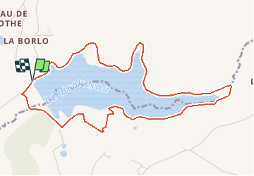
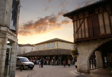
Trail Walking of 5.9 km to be discovered at New Aquitaine, Lot-et-Garonne, Tourliac. This trail is proposed by tracegps.

Description

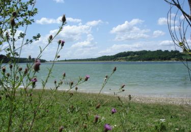
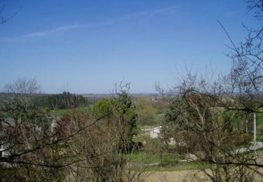
Lac du Brayssou communes de Parranquet et Tourliac. N’oubliez pas vos jumelles pour cette balade sur les berges du Brayssou, où vous pourrez observer colverts, sarcelles ou canards siffleurs depuis un abri mis en place par la fédération des chasseurs. Téléchargez la fiche de cette randonnée sur le site du Tourisme du Lot et Garonne.

Elevation profile

Photos

Positioning

Country:
France
Region :
New Aquitaine
Department/Province :
Lot-et-Garonne
Municipality :
Tourliac
Location:
Unknown
Start:(UTM)
325335 ; 4948904 (31T) N.

Trails nearby

Trail Walking Rayet - Un sentier de découverte autour de la retenue de la Ganne - Rayet   - Photo
Walking
tracegps

Walking

Easy
Rayet, New Aquitaine, Lot-et-Garonne, France
5.6 km | 6.6 km-effort
2h 0min
Yes
Trail Walking Vergt-de-Biron - Biron 18km - Photo
Walking
amelie14

Walking

Medium
Vergt-de-Biron, New Aquitaine, Dordogne, France
18 km | 23 km-effort
3h 11min
Yes
Trail Cycle Villeréal - Circuit de la Bastide Royale - Villeréal - Pays du Dropt  - Photo
Cycle
tracegps

Cycle

Medium
Villeréal, New Aquitaine, Lot-et-Garonne, France
73 km | 87 km-effort
3h 45min
Yes
Trail Equestrian Villeréal - Villeréal, de la Bastide à l'église de Parisot - Pays du Dropt - Photo
Equestrian
tracegps

Equestrian

Medium
Villeréal, New Aquitaine, Lot-et-Garonne, France
8.3 km | 9.5 km-effort
1h 25min
Yes
Trail Mountain bike Villeréal - Villeréal, de la Bastide à l'église de Parisot - Pays du Dropt - Photo
Mountain bike
tracegps

Mountain bike

Medium
Villeréal, New Aquitaine, Lot-et-Garonne, France
8.3 km | 9.5 km-effort
1h 0min
Yes
Trail Walking Villeréal - Villeréal, de la Bastide à l'église de Parisot - Pays du Dropt - Photo
Walking
tracegps

Walking

Medium
(1)
Villeréal, New Aquitaine, Lot-et-Garonne, France
8.3 km | 9.5 km-effort
3h 0min
Yes
Trail Equestrian Villeréal - Villeréal, le circuit de la bastide royale - Pays du Dropt - Photo
Equestrian
tracegps

Equestrian

Medium
Villeréal, New Aquitaine, Lot-et-Garonne, France
9.5 km | 11 km-effort
1h 34min
Yes
Trail Mountain bike Villeréal - Villeréal, le circuit de la bastide royale - Pays du Dropt - Photo
Mountain bike
tracegps

Mountain bike

Medium
Villeréal, New Aquitaine, Lot-et-Garonne, France
9.5 km | 11 km-effort
1h 10min
Yes
Trail Walking Villeréal - Villeréal, le circuit de la bastide royale - Pays du Dropt - Photo
Walking
tracegps

Walking

Medium
Villeréal, New Aquitaine, Lot-et-Garonne, France
9.5 km | 11 km-effort
2h 30min
Yes


Close
My subscriptions