Trail Walking Doville - Le Mont de Doville - Photo

Le Mont de Doville

 tracegps
tracegps

User

© OpenStreetMap contributors
Length
Length
11.3 km
Max alt
Max alt
126 m
Uphill gradient
Uphill gradient
200 m
Km-Effort
Km-Effort  
14 km
Min alt
Min alt
6 m
Downhill gradient
Downhill gradient
200 m
Boucle
Boucle
Yes
Creation date :
2014-12-10 00:00:00.0
Updated on :
2014-12-10 00:00:00.0

(0 Reviews)

Walking
Walking
4h00
Difficulty : Medium

Scan this QR Code to open this trail in the SityTrail application

FREE GPS app for hiking

Logo SityTrail SityTrail

IGN / Geographical institutes

Download SityTrail from the App Store Download SityTrail from Google Play

Logo SityTrail SityTrail World

The world is yours!

Download SityTrail from the App Store Download SityTrail from Google Play Download SityTrail on Huawei AppGallery

About

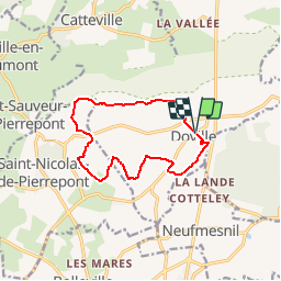
Trail Walking of 11.3 km to be discovered at Normandy, Manche, Doville. This trail is proposed by tracegps.

Description

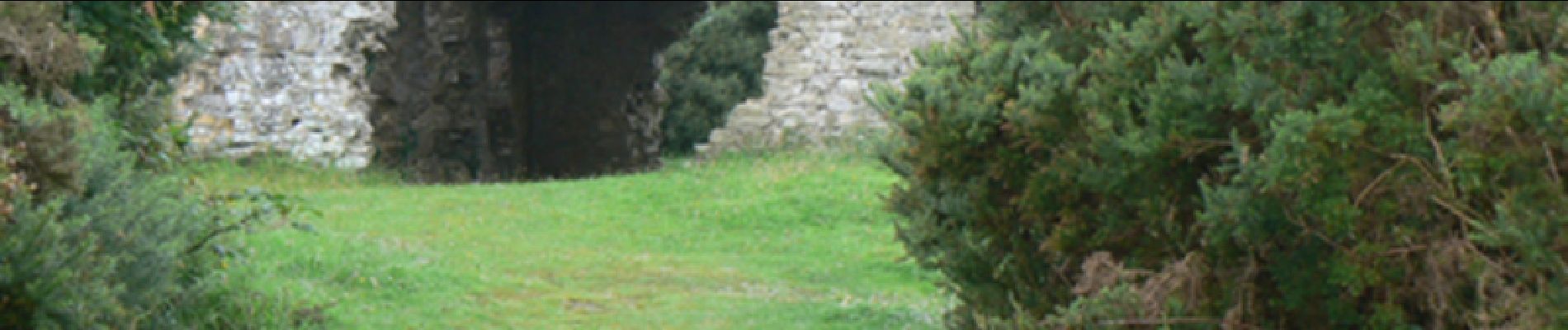
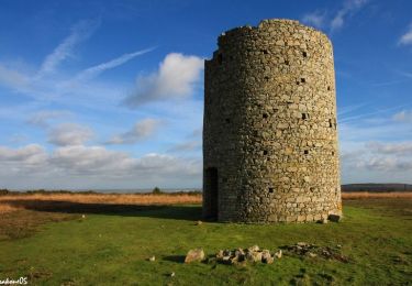
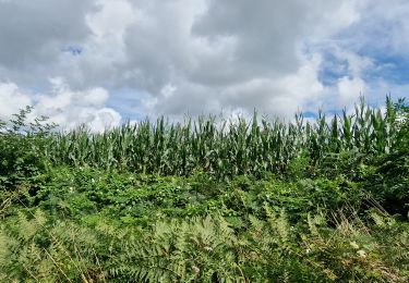
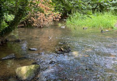
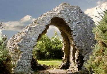
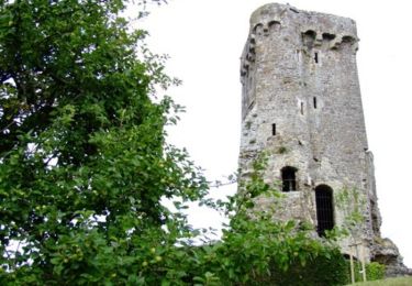
Le Mont de Doville On parle de sorcières et de sabbats dans la région… Laissez vous pénétrer par la magie des lieux et la singularité du Mont de Doville, ses tapis de bruyères et ses ruines pittoresques. Au sommet, affûtez votre regard aux 4 points cardinaux pour repérer les marais, les sommets, les grands bois et les Îles anglo-normandes par temps clair. Plus de détails sur le circuit (balisage, difficulté…), les points remarquables à proximité et téléchargements sur Manche Tourisme – Loisirs Randonnée GPS.

Elevation profile

Photos

Points of interest

Point of interest Doville - 01_GUE - Photo
tracegps
DOVILLE 
Point of interest Doville - 02_CHEMIN_CREUX - Photo
tracegps
Point of interest Doville - 03_3_BIOTOPES - Photo
tracegps
DOVILLE 
Point of interest Doville - 04_PANORAMA_ET_VARIANTE - Photo
tracegps
Point of interest Doville - 05_ANCIEN_MOULIN - Photo
tracegps
Point of interest Saint-Nicolas-de-Pierrepont - 06_PANORAMA_SUR_LES_MARAIS - Photo
tracegps
SAINT-NICOLAS-DE-PIERREPONT 

Positioning

Country:
France
Region :
Normandy
Department/Province :
Manche
Municipality :
Doville
Location:
Unknown
Start:(UTM)
606096 ; 5465372 (30U) N.

Trails nearby

Trail Walking Doville - Boucle du Mont de Doville - Photo
Walking
prv

Walking

Very easy
(1)
Doville, Normandy, Manche, France
12.1 km | 14.7 km-effort
2h 32min
Yes
Trail Walking Doville - doville le 21 /09/2019 - Photo
Walking
jmp76700

Walking

Very easy
(1)
Doville, Normandy, Manche, France
10.8 km | 13.4 km-effort
3h 20min
No
Trail Mountain bike La Haye - Autour du Mont Doville - Lahaye-du-Puits - Photo
Mountain bike
tracegps

Mountain bike

Difficult
La Haye, Normandy, Manche, France
38 km | 46 km-effort
3h 0min
Yes
Trail Walking Saint-Sauveur-le-Vicomte - St Sauveur Besneville boucle - Photo
Walking
chessyca

Walking

Easy
Saint-Sauveur-le-Vicomte, Normandy, Manche, France
13.2 km | 15.5 km-effort
3h 21min
Yes
Trail Walking Doville - Mont doville  - Photo
Walking
joelinou

Walking

Difficult
Doville, Normandy, Manche, France
12.5 km | 15.1 km-effort
3h 37min
No
Trail Walking Doville - Pédestre - Promenade et Randonnée Le Mont de Doville - Photo
Walking
neoroll44

Walking

Medium
Doville, Normandy, Manche, France
11.3 km | 14 km-effort
3h 10min
Yes
Trail Mountain bike La Haye - Le Mont Castre - La Haye du Puits - Photo
Mountain bike
tracegps

Mountain bike

Medium
La Haye, Normandy, Manche, France
13.4 km | 15.8 km-effort
1h 30min
Yes
Trail On foot Doville - Le Mont de Doville et les marais de la Sangsurière - Photo
On foot

On foot

Medium
Doville, Normandy, Manche, France
11.7 km | 14.4 km-effort
Unknown
Yes
Trail On foot Doville - Le Mont de Doville - Photo
On foot

On foot

Easy
Doville, Normandy, Manche, France
6.5 km | 7.3 km-effort
2h 0min
Yes


Close
My subscriptions