Trail Walking Bailleul - Itinéraire du patrimoine de Bailleul.      - Photo

Itinéraire du patrimoine de Bailleul.

 tracegps
tracegps

User

© OpenStreetMap contributors
Length
Length
1.9 km
Max alt
Max alt
48 m
Uphill gradient
Uphill gradient
14 m
Km-Effort
Km-Effort  
2.1 km
Min alt
Min alt
36 m
Downhill gradient
Downhill gradient
15 m
Boucle
Boucle
Yes
Creation date :
2014-12-10 00:00:00.0
Updated on :
2014-12-10 00:00:00.0

(0 Reviews)

Walking
Walking
1h30
Difficulty : Easy

Scan this QR Code to open this trail in the SityTrail application

FREE GPS app for hiking

Logo SityTrail SityTrail

IGN / Geographical institutes

Download SityTrail from the App Store Download SityTrail from Google Play

Logo SityTrail SityTrail World

The world is yours!

Download SityTrail from the App Store Download SityTrail from Google Play Download SityTrail on Huawei AppGallery

About

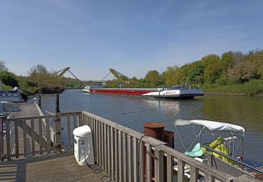
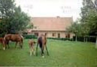
Trail Walking of 1.9 km to be discovered at Hauts-de-France, Nord, Bailleul. This trail is proposed by tracegps.

Description

Ce circuit vous est proposé par le comité départemental du Nord et l’ Office de Tourisme des Monts de Flandre de Bailleul. Départ de l'Office de Tourisme, Grand Place. Parcours en 17 étapes à la découverte de Bailleul. Le dépliant avec plan et explications est disponible à l’Office de Tourisme ou retrouvez cette randonnée sur le site du Comité Départemental du Tourisme du Nord. Ce circuit a été numérisé par les randonneurs du CODEPEM.

Elevation profile

Photos

Positioning

Country:
France
Region :
Hauts-de-France
Department/Province :
Nord
Municipality :
Bailleul
Location:
Unknown
Start:(Dec)
Start:(UTM)
481313 ; 5620859 (31U) N.

Trails nearby

Trail Motor Bailleul - 104 - Photo
Motor
abalcerek

Motor

Very easy
(3)
Bailleul, Hauts-de-France, Nord, France
127 km | 140 km-effort
3h 49min
No
Trail Walking Saint-Jans-Cappel - sentier des jacynthes - Photo
Walking
Bernard.voyageur

Walking

Medium
(1)
Saint-Jans-Cappel, Hauts-de-France, Nord, France
7.3 km | 9.2 km-effort
2h 1min
Yes
Trail Walking Bailleul - camping de la Ferme des Saules à côté de Bailleul, arrivée Deulemont - Photo
Walking
jeff2

Walking

Medium
Bailleul, Hauts-de-France, Nord, France
32 km | 34 km-effort
9h 10min
No
Trail Walking Heuvelland - Dranouter 12,3 km - Photo
Walking
GUIDE
rvapeldo

Walking

Easy
Heuvelland, Flanders, West Flanders, Belgium
12.4 km | 14.5 km-effort
3h 32min
Yes
Trail Walking Heuvelland - Loker 18,2 km - Photo
Walking
GUIDE
rvapeldo

Walking

Medium
Heuvelland, Flanders, West Flanders, Belgium
18.3 km | 23 km-effort
5h 14min
Yes
Trail Walking Boeschepe - Week-end des estaminets CAF1 - Photo
Walking
reneperrin

Walking

Easy
Boeschepe, Hauts-de-France, Nord, France
16.7 km | 21 km-effort
4h 32min
Yes
Trail Running Saint-Jans-Cappel - st jans - mont des cats - mont noir - Photo
Running
jamboxland

Running

Easy
Saint-Jans-Cappel, Hauts-de-France, Nord, France
16.8 km | 21 km-effort
1h 43min
Yes
Trail Walking Saint-Jans-Cappel - Sentier des jacinthes - Photo
Walking

Walking

Very easy
(1)
Saint-Jans-Cappel, Hauts-de-France, Nord, France
6.3 km | 8.1 km-effort
Unknown
Yes
Trail Running Berthen - mont des cats - Photo
Running
jamboxland

Running

Medium
Berthen, Hauts-de-France, Nord, France
11 km | 14.5 km-effort
1h 10min
Yes


Close
My subscriptions