Trail Mountain bike Quettehou - Les balcons du Val de Saire - Quettehou - Photo

Les balcons du Val de Saire - Quettehou

 tracegps
tracegps

User

© OpenStreetMap contributors
Length
Length
27 km
Max alt
Max alt
104 m
Uphill gradient
Uphill gradient
462 m
Km-Effort
Km-Effort  
34 km
Min alt
Min alt
12 m
Downhill gradient
Downhill gradient
462 m
Boucle
Boucle
Yes
Creation date :
2014-12-10 00:00:00.0
Updated on :
2014-12-10 00:00:00.0

(0 Reviews)

Mountain bike
Mountain bike
4h00
Difficulty : Medium

Scan this QR Code to open this trail in the SityTrail application

FREE GPS app for hiking

Logo SityTrail SityTrail

IGN / Geographical institutes

Download SityTrail from the App Store Download SityTrail from Google Play

Logo SityTrail SityTrail World

The world is yours!

Download SityTrail from the App Store Download SityTrail from Google Play Download SityTrail on Huawei AppGallery

About

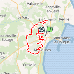
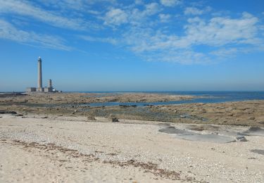
Trail Mountain bike of 27 km to be discovered at Normandy, Manche, Quettehou. This trail is proposed by tracegps.

Description

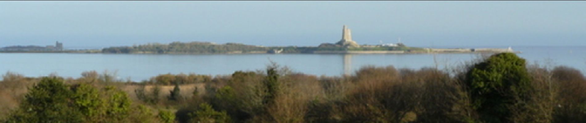
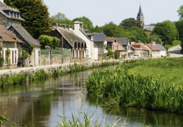
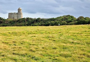
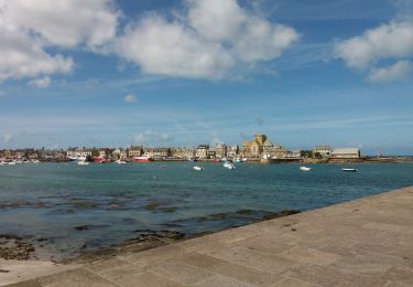
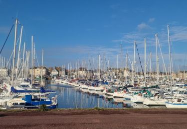
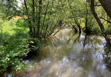
Partirez-vous à la recherche de l’arbre à la Fée pour être couvert d’or ? N’y perdez pas trop de forces, l’enchantement du paysage n’est pas fini et pour avoir de belles vues, il vous faudra encore gravir quelques pentes ! Entre mer et bocage, une grande variété architecturale se love dans des paysages enchanteurs. Dénichez-les ! Plus de détails sur le circuit (balisage, difficulté…), les points remarquables à proximité et téléchargements sur Manche Tourisme – Loisirs Randonnée GPS.

Elevation profile

Photos

Points of interest

Point of interest La Pernelle - 01_LA_PERNELLE - Photo
tracegps
LA PERNELLE 
Point of interest La Pernelle - 02_MANOIR_D'OURVILLE - Photo
tracegps
Point of interest La Pernelle - 03_TOUR_DU_VAL-DE-SAIRE - Photo
tracegps
Point of interest Teurthéville-Bocage - 04_BOIS_DU_RABEY - Photo
tracegps
TEURTHÉVILLE-BOCAGE 
Point of interest Quettehou - 05_ARBRE_A_LA_FEE - Photo
tracegps
Point of interest Quettehou - 06_BLOCKHAUS - Photo
tracegps
QUETTEHOU 
Point of interest Quettehou - 07_PHARE_DE_BEAUVAIS - Photo
tracegps
Point of interest Quettehou - 08_EGLISE_QUETTEHOU - Photo
tracegps
Point of interest Quettehou - 09_MANOIR_DU_VALVACHET - Photo
tracegps

Positioning

Country:
France
Region :
Normandy
Department/Province :
Manche
Municipality :
Quettehou
Location:
Quettehou
Start:(UTM)
622571 ; 5494848 (30U) N.

Trails nearby

Trail Walking Le Vast - Le long de la Saire - Le Vast - Photo
Walking
tracegps

Walking

Medium
(4)
Le Vast, Normandy, Manche, France
9.7 km | 12.4 km-effort
3h 0min
Yes
Trail Walking Quettehou - Morsalines ( Boucle ) - Photo
Walking
neitag61

Walking

Easy
(1)
Quettehou, Normandy, Manche, France
4.3 km | 5.1 km-effort
1h 15min
Yes
Trail Walking  - Tatihou - Photo
Walking
chessyca

Walking

Medium
, , , France
6.7 km | 7.1 km-effort
1h 44min
Yes
Trail Electric bike Saint-Vaast-la-Hougue - Boucle Saint Vast - Barfleur - Photo
Electric bike
EricVIBERT

Electric bike

Easy
Saint-Vaast-la-Hougue, Normandy, Manche, France
33 km | 35 km-effort
2h 18min
Yes
Trail Mountain bike Saint-Vaast-la-Hougue - Raid VTT Tatihou - Le Mont St Michel - Photo
Mountain bike
tracegps

Mountain bike

Difficult
Saint-Vaast-la-Hougue, Normandy, Manche, France
313 km | 369 km-effort
0h 0min
No
Trail Walking Saint-Vaast-la-Hougue - St Vaast la Hougue tourisme - Photo
Walking
chessyca

Walking

Very easy
Saint-Vaast-la-Hougue, Normandy, Manche, France
8.3 km | 8.6 km-effort
2h 0min
Yes
Trail Walking Le Vast - Le long de la vallée de la Sairre - Photo
Walking
yago1404

Walking

Medium
Le Vast, Normandy, Manche, France
10 km | 12.6 km-effort
2h 40min
Yes
Trail Walking Saint-Vaast-la-Hougue - 29 mai 2021 - Photo
Walking
thierry91

Walking

Very easy
Saint-Vaast-la-Hougue, Normandy, Manche, France
19.8 km | 21 km-effort
5h 53min
No
Trail Walking Réville - barfleur - Photo
Walking
raypat

Walking

Very easy
Réville, Normandy, Manche, France
21 km | 22 km-effort
4h 49min
Yes


Close
My subscriptions