Trail Cycle Carpentras - Circuit Vélo - Au fil du Comtat - Carpentras  - Photo

Circuit Vélo - Au fil du Comtat - Carpentras

 tracegps
tracegps

User

© OpenStreetMap contributors
Length
Length
35 km
Max alt
Max alt
205 m
Uphill gradient
Uphill gradient
335 m
Km-Effort
Km-Effort  
39 km
Min alt
Min alt
80 m
Downhill gradient
Downhill gradient
335 m
Boucle
Boucle
Yes
Creation date :
2014-12-10 00:00:00.0
Updated on :
2014-12-10 00:00:00.0

(0 Reviews)

Cycle
Cycle
2h15
Difficulty : Medium

Scan this QR Code to open this trail in the SityTrail application

FREE GPS app for hiking

Logo SityTrail SityTrail

IGN / Geographical institutes

Download SityTrail from the App Store Download SityTrail from Google Play

Logo SityTrail SityTrail World

The world is yours!

Download SityTrail from the App Store Download SityTrail from Google Play Download SityTrail on Huawei AppGallery

About

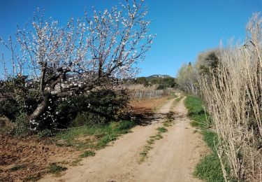
Trail Cycle of 35 km to be discovered at Provence-Alpes-Côte d'Azur, Vaucluse, Carpentras. This trail is proposed by tracegps.

Description

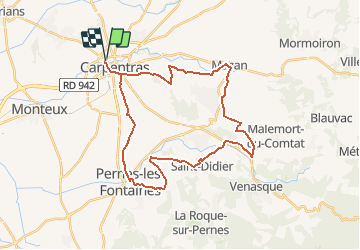
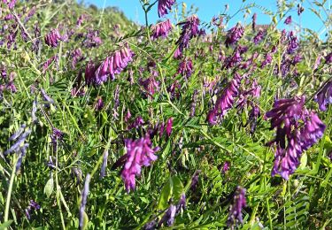
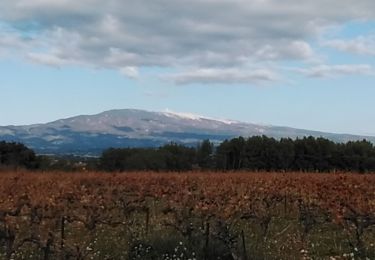
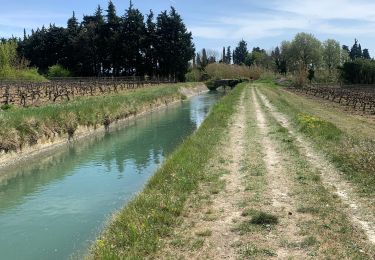
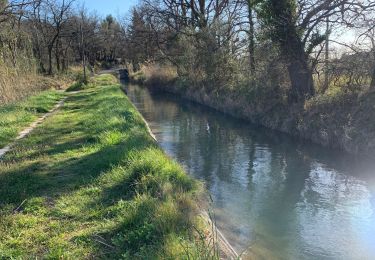
Circuit Vélo - Au fil du Comtat - Carpentras Cet itinéraire traverse la plaine du Comtat et ses paysages de cultures variées : fraises, asperges, vignes… Sans oublier une petite virée dans les deux cités historiques du Comtat Venaissin, Pernes-les-Fontaines et Carpentras, qui permettront aux cyclistes de découvrir des monuments incontournables de ce territoire : synagogue, portes, chapelles, hôtels particuliers... Circuit créé par la Communauté d'agglomération Ventoux Comtat Venaissin Retrouvez plus d’informations et téléchargez la fiche du circuit sur le site de la Provence en vélo. Tous les circuits vélo du Vaucluse sur le site www.provence-a-velo.fr.

Elevation profile

Photos

Positioning

Country:
France
Region :
Provence-Alpes-Côte d'Azur
Department/Province :
Vaucluse
Municipality :
Carpentras
Location:
Unknown
Start:(UTM)
663654 ; 4880380 (31T) N.

Trails nearby

Trail Walking Loriol-du-Comtat - loriol - Photo
Walking
aupi

Walking

Very easy
Loriol-du-Comtat, Provence-Alpes-Côte d'Azur, Vaucluse, France
7.1 km | 8.1 km-effort
1h 54min
Yes
Trail Walking Carpentras - PF-Canal de Carpentras - Photo
Walking
MicDul

Walking

Very easy
Carpentras, Provence-Alpes-Côte d'Azur, Vaucluse, France
17.1 km | 18.7 km-effort
3h 56min
Yes
Trail Mountain bike Aubignan - beaumes - Photo
Mountain bike
gero2b

Mountain bike

Medium
Aubignan, Provence-Alpes-Côte d'Azur, Vaucluse, France
21 km | 28 km-effort
2h 28min
Yes
Trail Road bike Aubignan - Aubignan - Les Murs - Aubignan - Photo
Road bike
sebcastella

Road bike

Very difficult
Aubignan, Provence-Alpes-Côte d'Azur, Vaucluse, France
73 km | 88 km-effort
5h 21min
Yes
Trail Walking Carpentras - Carpentras . la Lègue . Le Canal - Photo
Walking
stef789

Walking

Easy
Carpentras, Provence-Alpes-Côte d'Azur, Vaucluse, France
7.8 km | 9.5 km-effort
2h 20min
Yes
Trail Walking Carpentras - carpentras la lègue et le canal - Photo
Walking
aupi

Walking

Easy
Carpentras, Provence-Alpes-Côte d'Azur, Vaucluse, France
9.2 km | 11.3 km-effort
2h 26min
Yes
Trail Walking Aubignan - Le canal  - Photo
Walking
Lionel DAVIN

Walking

Easy
(1)
Aubignan, Provence-Alpes-Côte d'Azur, Vaucluse, France
5.5 km | 6 km-effort
1h 1min
Yes
Trail Walking Aubignan - Rocalinaud - Photo
Walking
Lionel DAVIN

Walking

Easy
Aubignan, Provence-Alpes-Côte d'Azur, Vaucluse, France
13.1 km | 16.6 km-effort
2h 43min
Yes
Trail Walking Aubignan - les côtes de st Hippolyte 84 - Photo
Walking
aupi

Walking

Very easy
Aubignan, Provence-Alpes-Côte d'Azur, Vaucluse, France
6.2 km | 7.6 km-effort
2h 11min
Yes


Close
My subscriptions