Trail Walking Saint-Paul-de-Jarrat - Le Mont Fourcat - Croquié - Photo

Le Mont Fourcat - Croquié

 tracegps
tracegps

User

© OpenStreetMap contributors
Length
Length
10.5 km
Max alt
Max alt
1999 m
Uphill gradient
Uphill gradient
745 m
Km-Effort
Km-Effort  
20 km
Min alt
Min alt
1254 m
Downhill gradient
Downhill gradient
745 m
Boucle
Boucle
Yes
Creation date :
2014-12-10 00:00:00.0
Updated on :
2014-12-10 00:00:00.0

(2 Reviews)

Walking
Walking
4h15
Difficulty : Difficult

Scan this QR Code to open this trail in the SityTrail application

FREE GPS app for hiking

Logo SityTrail SityTrail

IGN / Geographical institutes

Download SityTrail from the App Store Download SityTrail from Google Play

Logo SityTrail SityTrail World

The world is yours!

Download SityTrail from the App Store Download SityTrail from Google Play Download SityTrail on Huawei AppGallery

About

Trail Walking of 10.5 km to be discovered at Occitania, Ariège, Saint-Paul-de-Jarrat. This trail is proposed by tracegps.

Description

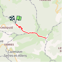
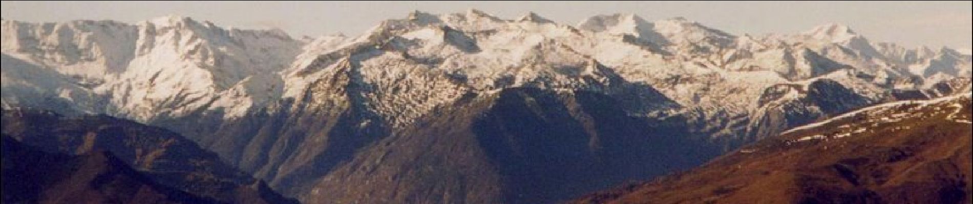
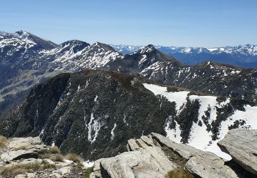
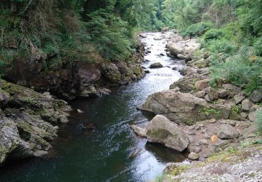
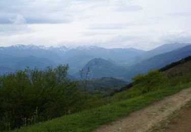
Circuit proposé par l’Office de Tourisme de Tarascon & du Vicdessos. Départ : A l’entrée du village de Croquié, au grand châtaignier, prenez la piste à gauche jusqu’au parking des Brouges. Le Mont Fourcat est un classique des randonnées Tarasconnaises à ne pas confondre avec le Pic de l’étang Fourcat dans le Vicdessos au dessus d’Artiès. Situé sur le majestueux massif de Tabe, son ascension aérée vous amène à 2000 mètres pour un panorama, grandiose et rarement égalé. Vous pouvez vous procurer le topoguide auprès de l’Office de Tourisme de Tarscon & du Vicdessos.

Elevation profile

Photos

Positioning

Country:
France
Region :
Occitania
Department/Province :
Ariège
Municipality :
Saint-Paul-de-Jarrat
Location:
Unknown
Start:(UTM)
391645 ; 4747378 (31T) N.

Comments

Please log in to post a review or rate the element


superbe


Très bon sentier qui monte régulièrement. Paysage superbe


Trails nearby

Trail Running Mercus-Garrabet - mercus1 - Photo
Running
gilbertcaujolle

Running

Very easy
(1)
Mercus-Garrabet, Occitania, Ariège, France
20 km | 37 km-effort
5h 6min
Yes
Trail Walking Mercus-Garrabet - Mont Fourcat en A/R - Photo
Walking
chrisgps

Walking

Easy
Mercus-Garrabet, Occitania, Ariège, France
10 km | 21 km-effort
4h 42min
Yes
Trail On foot Arnave - Le Tour de la Pique - Photo
On foot
PRO

On foot

Easy
Arnave, Occitania, Ariège, France
9.9 km | 17.3 km-effort
3h 55min
Yes
Trail Walking Montoulieu - MONTOULIEU - GINABAT - Photo
Walking
RonanDAGORN

Walking

Medium
Montoulieu, Occitania, Ariège, France
7.1 km | 10.3 km-effort
1h 53min
Yes
Trail On foot Montoulieu - La cabane des gardes - Photo
On foot
c.chehere

On foot

Medium
Montoulieu, Occitania, Ariège, France
15.5 km | 25 km-effort
Unknown
Yes
Trail Walking Mercus-Garrabet - Mercus-Garabet - Photo
Walking
c.chehere

Walking

Easy
Mercus-Garrabet, Occitania, Ariège, France
15.5 km | 25 km-effort
7h 45min
No
Trail Walking Saint-Paul-de-Jarrat - De Saint-Paul à Montgailhard - Photo
Walking
tracegps

Walking

Medium
Saint-Paul-de-Jarrat, Occitania, Ariège, France
9.9 km | 11.7 km-effort
2h 30min
Yes
Trail Mountain bike Arnave - Mont Fourcat - Arnave - Photo
Mountain bike
tracegps

Mountain bike

Difficult
Arnave, Occitania, Ariège, France
31 km | 52 km-effort
5h 0min
Yes
Trail Walking Saint-Paul-de-Jarrat - De St Paul de Jarrat aux Brougues - Photo
Walking
tracegps

Walking

Very difficult
Saint-Paul-de-Jarrat, Occitania, Ariège, France
21 km | 35 km-effort
5h 0min
Yes


Close
My subscriptions