Trail Walking Montaignac-Saint-Hippolyte - Les Etangs de la Doustre - Montaignac St Hippolyte - Pays d'Egletons - Photo

Les Etangs de la Doustre - Montaignac St Hippolyte - Pays d'Egletons

 tracegps
tracegps

User

© OpenStreetMap contributors
Length
Length
16.7 km
Max alt
Max alt
636 m
Uphill gradient
Uphill gradient
323 m
Km-Effort
Km-Effort  
21 km
Min alt
Min alt
538 m
Downhill gradient
Downhill gradient
322 m
Boucle
Boucle
Yes
Creation date :
2014-12-10 00:00:00.0
Updated on :
2014-12-10 00:00:00.0

(0 Reviews)

Walking
Walking
4h30
Difficulty : Medium

Scan this QR Code to open this trail in the SityTrail application

FREE GPS app for hiking

Logo SityTrail SityTrail

IGN / Geographical institutes

Download SityTrail from the App Store Download SityTrail from Google Play

Logo SityTrail SityTrail World

The world is yours!

Download SityTrail from the App Store Download SityTrail from Google Play Download SityTrail on Huawei AppGallery

About

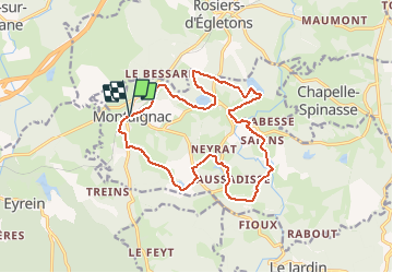
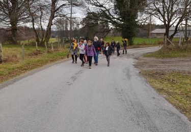
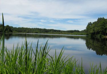
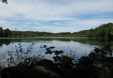
Trail Walking of 16.7 km to be discovered at New Aquitaine, Corrèze, Montaignac-Saint-Hippolyte. This trail is proposed by tracegps.

Description

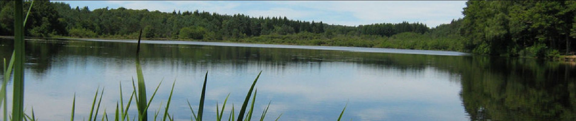
Les Etangs de la Doustre - Montaignac St Hippolyte - Pays d'Egletons La commune de Montaignac - St Hippolyte recèle dans ses fonds tourbeux un nombre important d’étangs, ceux- ci alimentent en partie le Doustre. Site de nidification ou halte migratoire pour les oiseaux sauvages, réserve alimentaire pour la loutre ou plaisir de la pêche pour petits et grands amateurs de gaule, les étangs du Doustre vous invitent au bord de l’eau. Téléchargez la fiche du circuit sur le site du Conseil Général de la Corrèze. Renseignements : Communauté de Communes de Ventadour 05.55.27.69.26

Elevation profile

Photos

Positioning

Country:
France
Region :
New Aquitaine
Department/Province :
Corrèze
Municipality :
Montaignac-Saint-Hippolyte
Location:
Unknown
Start:(UTM)
420039 ; 5022830 (31T) N.

Trails nearby

Trail Walking Montaignac-Saint-Hippolyte - Les Etangs du Doustre - Photo
Walking
tracegps

Walking

Difficult
(1)
Montaignac-Saint-Hippolyte, New Aquitaine, Corrèze, France
16.4 km | 21 km-effort
4h 30min
Yes
Trail Walking Eyrein - Etang de la chéze - Photo
Walking
gerard1222

Walking

Easy
(1)
Eyrein, New Aquitaine, Corrèze, France
4 km | 4.9 km-effort
1h 7min
Yes
Trail On foot Le Jardin - Le Jardin Bourg - Photo
On foot
PRO

On foot

Easy
Le Jardin, New Aquitaine, Corrèze, France
4.4 km | 5.5 km-effort
1h 15min
Yes
Trail On foot Rosiers-d'Égletons - Le Puy des Places - Photo
On foot
chanac les mines

On foot

Easy
Rosiers-d'Égletons, New Aquitaine, Corrèze, France
13.2 km | 17.2 km-effort
3h 56min
Yes
Trail Walking Le Jardin - balade le jardin avec Viviane  - Photo
Walking
Nicole Cridel

Walking

Very easy
Le Jardin, New Aquitaine, Corrèze, France
4.3 km | 5.3 km-effort
1h 29min
Yes
Trail Walking Le Jardin - Le Jardin Bourg - Pays d'Égletons  - Photo
Walking
tracegps

Walking

Easy
Le Jardin, New Aquitaine, Corrèze, France
4.2 km | 5.2 km-effort
1h 10min
Yes
Trail Mountain bike Montaignac-Saint-Hippolyte - Les Etangs de la Doustre - Montaignac St Hippolyte - Pays d'Egletons - Photo
Mountain bike
tracegps

Mountain bike

Medium
(1)
Montaignac-Saint-Hippolyte, New Aquitaine, Corrèze, France
16.7 km | 21 km-effort
1h 10min
Yes
Trail Mountain bike Rosiers-d'Égletons - Par les Puys - Rosiers d'Egletons - Pays d'Egletons  - Photo
Mountain bike
tracegps

Mountain bike

Medium
Rosiers-d'Égletons, New Aquitaine, Corrèze, France
11.5 km | 14.5 km-effort
49min
Yes
Trail Walking Rosiers-d'Égletons - Par les Puys - Rosiers d'Egletons - Pays d'Egletons  - Photo
Walking
tracegps

Walking

Medium
Rosiers-d'Égletons, New Aquitaine, Corrèze, France
11.5 km | 14.5 km-effort
3h 0min
Yes


Close
My subscriptions