


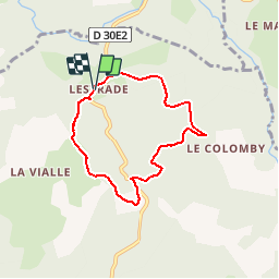

9.4 km | 12.7 km-effort


User


FREE GPS app for hiking
 SityTrail
IGN / Geographical institutes
SityTrail World
The world is yours!
Trail Walking of 6.1 km to be discovered at New Aquitaine, Corrèze, Meymac. This trail is proposed by tracegps.
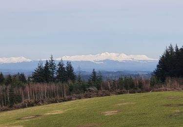
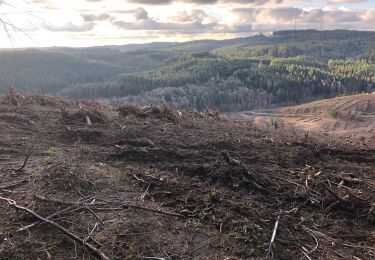
Métamorphoses paysagères 6 km - Meymac - Pays de Haute Corrèze Découverte de paysages traditionnels de landes et bruyères autrefois prédominants sur le plateau de Millevaches et aujourd’hui en voie de disparition. Paysages liés à une agriculture agro-pastorale et à une organisation sociale autarcique propres aux habitants des hauts plateaux. Téléchargez la fiche du circuit sur le site du Conseil Général de la Corrèze. Renseignements : Office de Tourisme de Meymac 05.55.95.18.43

Walking
Walking
Walking
Walking
Walking

Walking

Mountain bike
Walking
Mountain bike